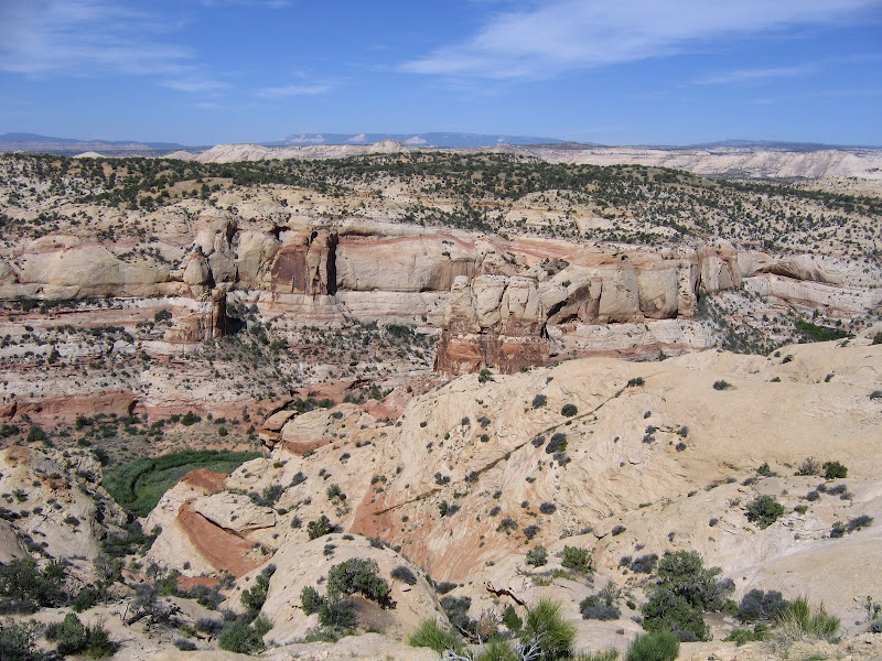
Penetrating the interior of Box - Death Hollow was high on my list of priorities, especially after driving the incredibly scenic stretch of Highway 12 between the southern Utah towns of Boulder and Escalante.
As seen from the road the complex and convoluted landscape appears as a wonderland of sloping domes and benches, with fascinating patterns of swirling cross-bedded sandstone. At first glance the undulating terrain seems benign and relatively easy to navigate, but steep walled canyons hidden in pleats and folds await the uninitiated. In my case the view from outside is irresistible, and the lure of the unknown draws me in.
 |  |  |


I chose to explore the heart of the stone sea on a route known as the Boulder Mail Trail. Until Highway 12 was constructed this path was the primary corridor for mail and other supplies to reach the isolated community of Boulder. Traveling 16 miles over and through the canyons of Escalante River tributaries, the trip was a challenge even when weather was favorable. Long since abandoned as a conduit between the towns, Boulder Mail Trail offers the hiker a perfect opportunity to experience the wild and rugged character of the wilderness.
I began the journey with this post, having reached the first benchmark of Sand Creek located approximately two miles from the eastern trailhead. Continuing on to Death Hollow is another 2.5 miles further in - this utterly beautiful and sublime canyon being the destination for my out and back visit to the area.
After dropping into the shallow bowl of the Sand Creek Drainage, the trail approaches and crosses the creek. Dense willow thickets and other riparian vegetation crowd the narrow course of the creek, and some minor bushwhacking is needed to get across the narrow but energetic stream.
The route continues along the creek bottom for a short distance before climbing up the western slope. If recent flooding has occurred it may be a slight challenge to locate the precise spot where the trail makes a sudden ascent, but if you've gone too far you'll know it - the canyon continues to narrow downstream and is filled with dense brush, making forward progress increasingly difficult.

Once you've climbed up and out the trail begins a long scenic trek across the bench. The path alternates at first between short sandy stretches with widely scattered vegetation consisting mainly of waxleaf currant, manzanita, pinyon, and ponderosa pine and broad shelves of naked whitish-yellow slickrock.


The trail is marked by periodic cairns, and careful observation is required to keep moving in the right direction. Another landmark is shown in the pictures below - an old telephone line which still crosses the canyon in places. This link between Boulder and Escalante was a patched up affair, strung along trees and subject to frequent disruption. Notice the baling wire repair on this section.


The parallel grooves in the rock show where the line sagged along the ground, allowing the steel to cut into the softer sandstone as wind in the trees created a "seesaw" action.

As the trail takes you deeper into the wilderness, the more you can appreciate what a unique environment surrounds you. The shapes and patterns of the cross-bedded sandstone combine with sparse vegetation to create a surreal and starkly beautiful landscape.


The entire region of Box - Death Hollow is composed of sand in one form or another. The strikingly beautiful Navajo sandstone forms the underlying structure of the canyons and plateaus, and as it loses cohesion it turns to, well, sand. There is a lot of very fine, loose sand on the bench between Sand Creek and Death Hollow, and the trail has to cross extended segments of it. If it's dry, walking these sections is arduous, especially if you are wearing a heavy pack.


Fortunately there is a great deal of fantastic scenery along the way to help keep the hiker focused and motivated.


The final approach to Death Hollow crosses a particularly long segment of deep sand, but when it's finally over and you get the first glimpse of what lies ahead, you'll know it's been worth it.


The trail begins to drop steadily over 800 feet from the rim on sloping benches, and it is easy to imagine how the canyon earned the name. When dry, the surface of the rock offers some friction, although in places it's loose and crumbly and needs to be negotiated carefully. When the sandstone becomes wet, you can appreciate how the term "slickrock" came to be. Although the descent is not inherently dangerous, it does need to be respected.


Year-round water flows through Death Hollow, and the bottom of the canyon has accumulated enough eroded material so that plants and trees have a place to take root. Ponderosa trees and riparian species are abundant, and there are some good albeit sandy places to camp along the creek.

The sheer walls of the hollow are impressive, and during storms many small, ephemeral waterfalls can be seen cascading down from above. Water here does not seep into soil, as precious little exists. Nearly every drop that falls from the sky winds up carving its way through countless channels and cracks to the larger creeks, and thence into the Escalante River.


Making this trip allowed me to discover some of the long held secrets of the Box - Death Hollow Wilderness. Like many of the places I've been fortunate enough to visit, I know I've only seen a fraction of what exists. But it's enough to know that coming back here has to be included on my very long list of "musts". When I do return, I'll let you in on it too.


How long did this hike take you? Did you go out to highway 12 near calf creek? Do you remember the miles?? THANKS! You're photos are amazing!
ReplyDelete