Thursday, September 27, 2012

On Foot Part XIV - Making the Connection: Dry Lake Hills Loop No. 1

Elden Trail System Map
Quality of life is certainly a very subjective concept, and it varies widely from person to person. In my case what makes the difference is the environment that surrounds me. I am fortunate indeed that the community I call home is located in a beautiful natural setting, and more importantly that many opportunities for recreation exist just beyond my front door.

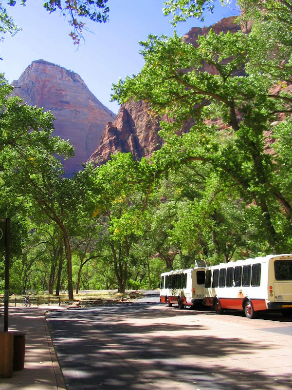
In previous posts I have documented some of the many hiking trails found within a short distance of Flagstaff, and the area that offers the closest and most varied catalog is known as the Dry Lake Hills. This self contained region lies to the south of the larger San Francisco Peaks, creating somewhat of a buffer zone between the high alpine mountain and the bustling city below. Here you'll find long ridgelines and steep escarpments where trails criss-cross pine clad hills rising 1000 feet and more over the surrounding terrain.

Many trails in the Dry Lake Hills work well as stand alone hikes and are rewarding enough to be experienced as "out and back" adventures. For those seeking to cover additional ground or for more variety, the proliferation of routes makes it possible to create a wide array of loop hikes. In this post I'm detailing one of the many options available, and in the future I'll present a couple more.

 The Mt. Elden - Sunset - Heart - Christmas Tree Loop

This particular loop uses 4 different trails that together constitute a trip just over 8 miles in total. Hikers completing this circuit will encounter a surprisingly diverse range of environments, with a mixture of high desert plants, ponderosa pine, aspen, and spruce inhabiting microclimates that reflect not only elevation but orientation to the sun.

Through it all the geology is composed of dacitic lava, with a few remnant sections of the sedimentary rock that was lifted and shunted aside when the upwelling of volcanic material occurred. The steep relief of much of the topography is a testament to both the erosion resistant qualities of dacite and the relatively short time period it took to create the mountain.

Loop hikes start with a choice: which direction should you go? In my case I am rather fond of steep rocky trails, so I elect to begin with the hard part, taking a clockwise direction with an immediate ascent of the Mt. Elden Lookout Trail. This 2.6 mile calf buster climbs the southern aspect of Mt. Elden in a more or less zig-zag fashion, attaining over 2300 feet in elevation gain along the way.

Mt. Elden trailhead

Although certainly challenging from a physical standpoint, once you reach the trail junction just below the lookout the hike becomes much less arduous, and with the exception of a 2 mile descent down a different rocky trail the remainder of the route is a pleasant and scenic ramble.


Sunset - Mt. Elden trail junction

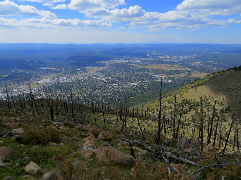
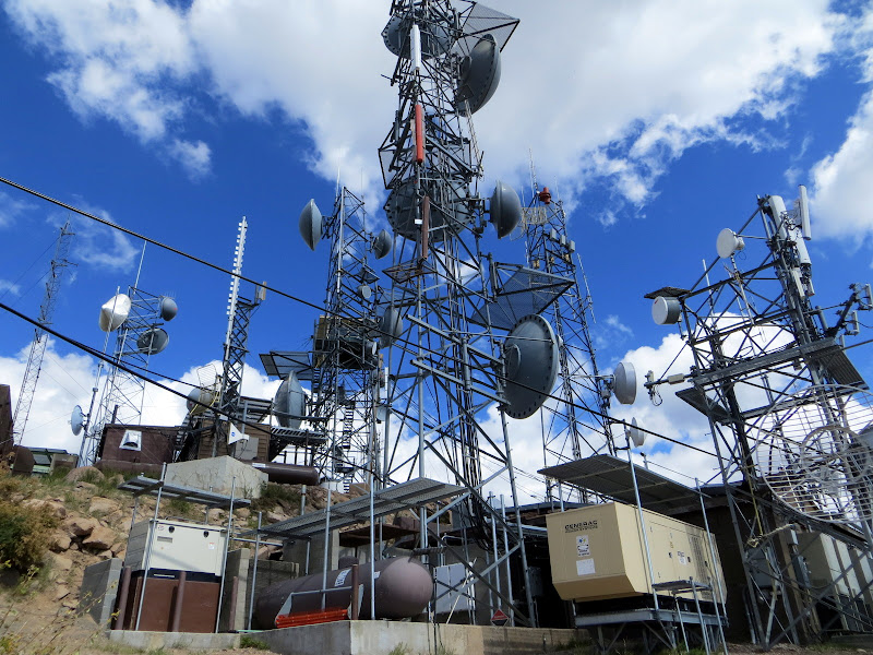
Of course if you've still got some juice left in your legs upon reaching the junction, it's not too much of a detour to make the .2 miles to the lookout for some great views over the city and a closer look at the man-made forest of communications equipment installed on this lofty perch.


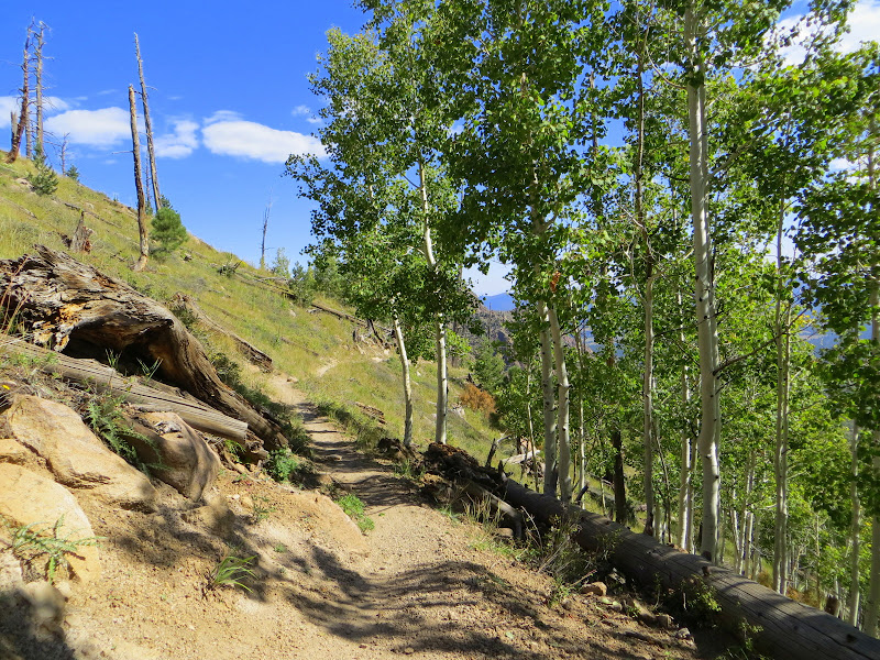
The Elden trail portion is located on the south facing side of the mountain, and as such receives full sunlight. This makes for a generally warmer and drier climate, and is reflected in the types of vegetation that populates the slope. When you make the transition to the north aspected Sunset Trail, the difference is dramatic and sudden.


In 1977 the human caused Radio Fire swept much of this area completely, denuding the slopes of trees. Despite the initial devastation the healing power of time has allowed for some recovery. At this elevation and latitude the first trees to reappear were the aspens, which along with other shrubby plants have begun the long process of rehabilitation.

The Sunset trail begins with a long, somewhat level traverse on the north side of Mt. Elden, eventually emerging onto a slender ridge connecting the main body of the mountain with the rest of the Dry Lake Hills. I really enjoy the Sunset trail for many different reasons, but particularly for the beautiful and vibrant color splashed across the mountain in fall.


Looking back on the Sunset trail towards Mt. Elden

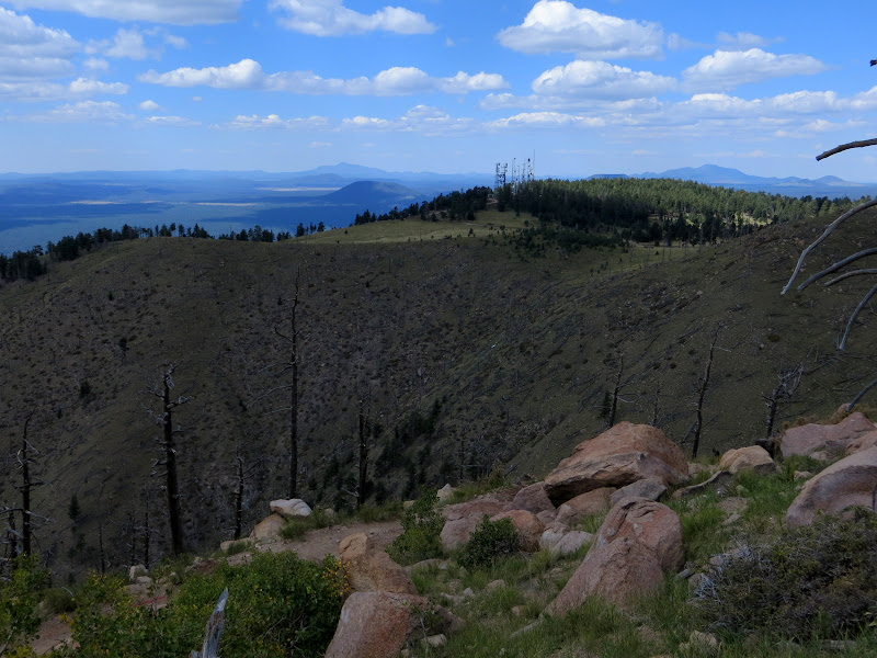
Once on the airy, open ridge views to north include the tallest mountain in Arizona, the San Francisco Peaks.


The ridge served as a natural firebreak during the Radio blaze, and many of the trees at the top were spared. Here the path follows along the spine, dropping slightly in elevation as it nears the next waypoint.


After an easy mile of walking, the Sunset trail meets up with the junction of the Upper Oldham trail.


The intersection represents just one of the many loop possibilities found throughout the Dry Lake Hills trail system. For now we continue straight ahead, at first staying near the crest before dropping just below on the eastern face.


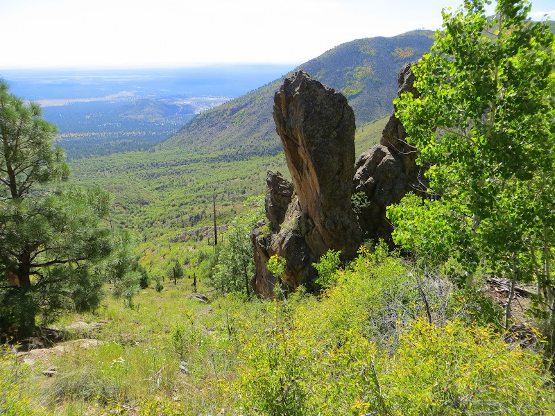
This scenic half mile segment offers the best view east over the outlying communities of Doney Park and Timberline, and beyond into the hazy brown and pink of the Painted Desert on the horizon. While enjoying the scenery, hikers should be aware that mountain bikes are permitted on the Sunset trail, and this downhill section has become fairly popular with riders.

As the Sunset trail makes a sudden turn to the west and downhill, the next section in this loop portfolio appears on the east side - the Heart Trail
.


Dropping quickly below the level of Sunset, the descent on the Heart Trail appears loose and rocky - which it is for at least the first few hundred yards. Soon however the path levels out enough to allow for looking up instead of carefully negotiating the steep, debris filled pitch.

One result of the 1977 fire was the removal of trees and shrubs which masked some of the more unusual rock pillars and outcroppings on this face of the mountain. Although the extent of revegetation is not as extensive in other places, enough has grown in to soften the contours of the jagged and harsh foundation that lies underneath.


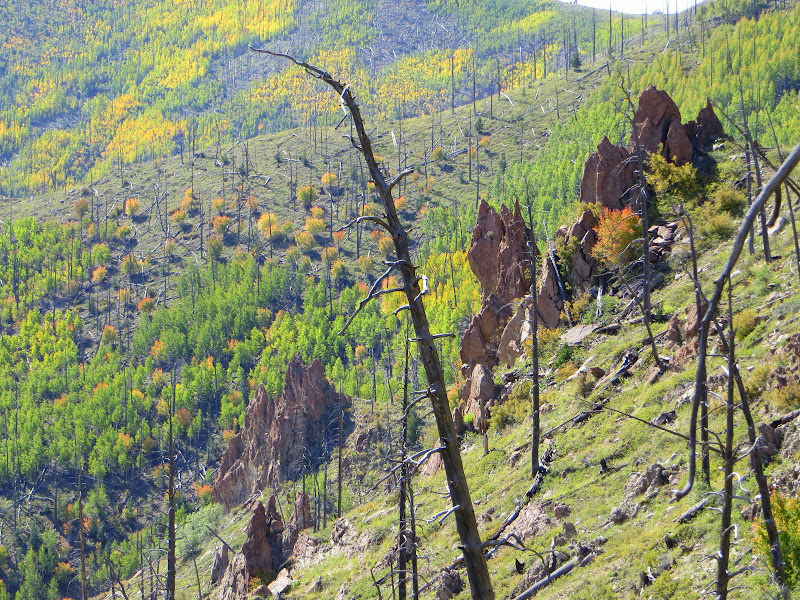
Heart trail follows a descending ridge for the most part, making long graceful switchbacks through open air. Although the grade is moderate overall, a few places on this upper section feature enough of an incline with lots of rocks to warrant special attention.  Even so hikers have ample opportunity to take in expansive views as they make their way to the valley below.


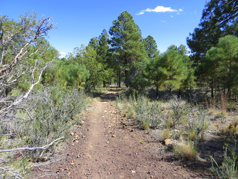
The lower sections of Heart trail are characterized by frequent stands of Gambel or scrub oak, growing in family clusters.


The further down you go the more rocky the path becomes, requiring more attention to placement of the feet.


Much of the rubble is metamorphic in origin, but some of it springs from the few visible surface layers of sedimentary rock that once covered the entire region. Here is a rare outcropping of red sandstone seen along the way.


Nearing the base of the mountain the route becomes more brushy as it levels out, and isolated stands of ponderosa pine appear. Gradually the chunky red rock underfoot disappears to be replaced by sandy, white soil.


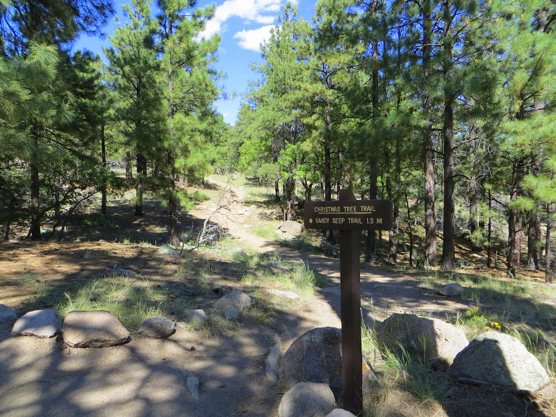
My only complaint about this otherwise excellent hike is that at the point where the Heart trail meets the Sandy Seep and Christmas Tree trails no signs exist to mark the junction. Anyone unfamiliar with the territory could easily take an errant turn and wind up heading the wrong direction. Just so you know - the correct answer is turn right onto the Christmas Tree trail.

The not-so-obvious and unmarked trail junction

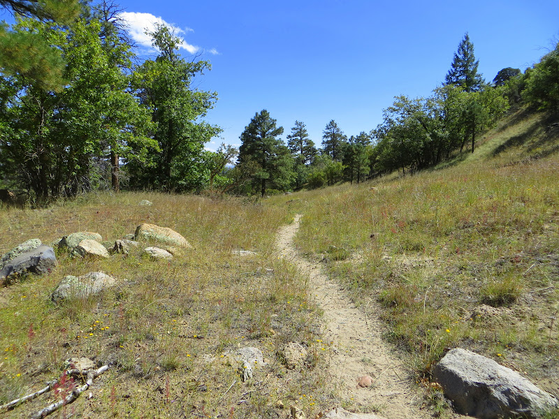
At this point you should be heading generally west, contouring around the base of Mt. Elden. The path itself shows a fair amount of traffic and is easy to follow.


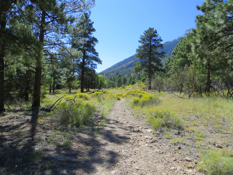
Soon the sounds of traffic along the always busy Route 66/U.S. Highway 89 fill the air, and despite the screen of trees it's hard to maintain the illusion of being deep in the forest far away from the trappings of civilization. I suppose this what it feels like to walk in Central Park in downtown Manhattan.

After about 1.5 miles, the Christmas Tree trail we've been traveling meets the easternmost extension of Fat Man's Loop, a circular route which is incorporated into the Elden Lookout trail.


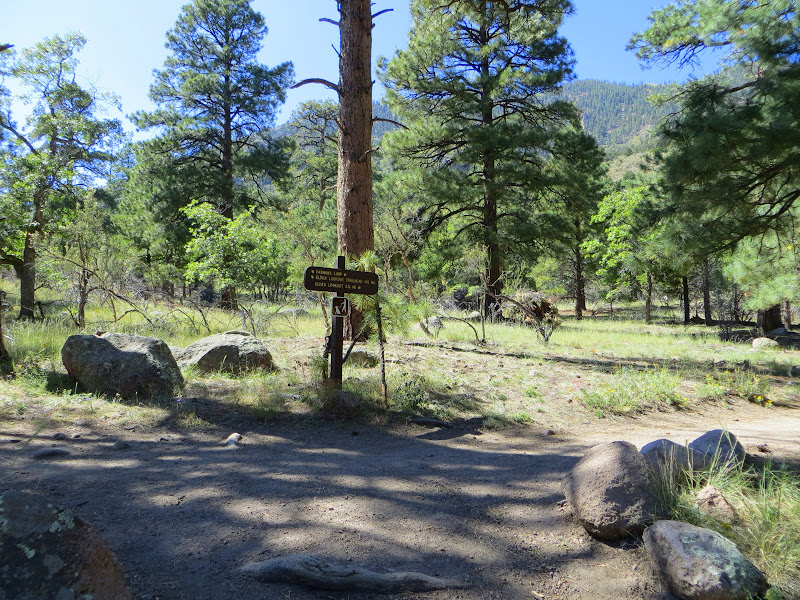
From here it's only a short walk to the junction with Fat Man's Loop and the Mt. Elden Lookout trail, followed by the previously traveled .2 mile back to the trailhead and parking area.


By now you've covered over 8 miles (more if you took any detours like a trip to the lookout) and seen how varied and scenic the country is just on the other side of the hill, so to speak. You've gained and lost nearly a vertical mile in elevation, and probably lost a pound or two in sweat.

What you get in return is up to you, but from my perspective I can tell you the gift of a day in the natural world is one without price - especially if you are fortunate enough to see the sunrise over Mt. Elden like I have.

Sunrise from Mt. Elden


Sunday, September 16, 2012

Zion - High and Mighty

As any reader of this blog already knows, I am in awe of the majesty and beauty found throughout the Four Corners region. With such an abundance of grandeur it is easy to run short of superlatives, especially when trying to describe a place like Zion National Park, which transcends the merely sublime with landscapes dwarfing all but the grandest spectacles found in the region.

Showcasing soaring canyons of the Virgin River and the surrounding watershed, Zion features sheer sandstone cliffs and monoliths among the tallest in the world.  With elevations ranging from 3600 feet to well over 8000 feet, the Park features an astounding range of habitats and environments, including lush riparian corridors along perennial rivers and creeks.  There are incredibly deep and narrow canyons, soaring towers, and broad high altitude plateaus that beckon the backcountry explorer both on established trails and unmarked cross-country routes.


In General

The Park is large, encompassing 229 square miles. Much of that is designated as wilderness, and the areas that most visitors see represent a fraction of the total. Like the South Rim of Grand Canyon and Bryce National Parks, Zion is rightfully popular with tourists.  Considered one of the "big three" must see destinations in the southwest, the Park Service has instituted a number of practices to manage crowds requiring advance planning and knowledge in order to get the most out of your visit.


This post serves as an introduction to the Park and provides basic information about visitation. In subsequent entries I'll detail some of the more interesting front country hiking trails found in the heavily visited Virgin River Canyon section.

History

Humans have called the area around Zion home for thousands of years, beginning with Paleo peoples in small nomadic groups wandering the land in search of game and plants. Little evidence remains of their earliest time here, and it's not until about 2000 years ago that organized groups developed a lifestyle that included farming and semi-permanent settlements. This period is referred to as the Archaic, with significant artifacts and ruins left behind to document their presence in the canyons and mesas.

Later evolution led to a culture similar to that of the Puebloan peoples found throughout the Four Corners regions, more specifically referred to here as the Basketmakers and Parowan Fremont groups. Like their counterparts to the east, it appears that most of the population abandoned the area around 1300 A.D., possibly due to climactic changes or conflict with others. The next occupants to seek life in the region were primarily from the Ute and Paiute groups of southern Utah, who made seasonal forays into the valleys for game and edible plants.

The late 1700's saw the entrance of the first anglos to the area, with Spanish explorers seeking an overland route from Santa Fe to Monterrey. In the early 1800's mountain men began trapping beaver along the creeks and rivers, and their first hand knowledge of the country enabled the initial wave of emigrant pioneers trekking westward in search of new opportunities. Of this category the group who had the greatest and most lasting human impact are the Mormon settlers sent south by Brigham Young to colonize and settle the land.

Upon arrival to the valleys of the Virgin River and its tributaries they found lush canyon bottoms with year-round water, and in the lower elevation temperate climates favorable to a longer growing season. Unfortunately they also discovered generally poor soils and canyons that were subject to frequent flash flooding. Difficult conditions eventually led most families to settle outside the current boundaries of the Park in communities like Springdale, with only a few hardy souls persisting in the main canyon.

The overall beauty of the place was not lost on those who were sent to make their homes here, and the religious fervor that inspired members of the LDS church also led to the naming of many geographical features, including the indelible and appropriate label of Zion, mentioned in the Bible as a place of peace.

By the early 1900's, recognition of spectacular and relatively pristine natural areas in the west was promoted heavily by artists, geographers, and early travelers who had the wherewithal to visit these remote and rugged areas. In particular artist Frederick Dellenbaugh created a series of portraits that helped establish the beauty of the region with the general public in the east, and in 1909 President William Howard Taft created Mukuntuweap National Monument.

1903 painting of Zion Canyon by Frederick Dellenbaugh

The name was changed to the more palatable Zion National Park in 1919 when Congress added additional acreage. In the first years the Park was rarely visited as the remote location and lack of good roads prevented all but the most determined from getting there. It wasn't until 1930 when work was completed on the Zion - Mt. Carmel road and tunnel that automobiles could reliably reach the area. In 1937 a separate unit of the Park was established that included the Kolob Canyons, which subsequently was incorporated into the larger Park in 1956.

Zion is one of the more popular National Parks in the country today, with annual visitation in excess of 3 millions people. In 2009 President Barack Obama signed legislation that designated and preserved much of the Park as wilderness, preventing further development and preserving the unique character of the landscape.

Getting There

Zion is located in the southwestern corner of Utah, and has two primary units.  The northwestern extension of the Park is known as the Kolob Canyons and is reached from Interstate 15 near Cedar City.  This more remote area is an extension of the Park added in 1937, and is less heavily trafficked than the main canyon.  The 10 mile roundtrip along the scenic drive allows views and access into the rugged wilderness that comprises this part of the Park.  Be aware that winter driving conditions may force the temporary closure of the road.

The more well known Zion Canyon area is accessible from either east or west on Utah Highway 9.  If traveling from the east the turnoff is found at Mt. Carmel Junction located on U.S. Highway 89 north of Kanab.  Please note that oversize vehicles using this route will need an escort through the Zion - Mt. Carmel Tunnel.  The tunnel is an amazing feat of engineering carved through nearly 1 mile of Navajo sandstone, and is an attraction all its own.  Currently there is a $15.00 fee that allows for 2 trips through the tunnel which must be paid at the time of entrance to the Park.  For more information and vehicle size restrictions, click here.

To avoid delays and fees associated with passing through the tunnel visitors may want to use the westside entry point.  This route also utilizes Highway 9 and can be found from one of two exits on Interstate 15 - Use Exit 27 if heading south, and Exit 16 if traveling northbound.  Both converge in the town of La Verkin and provides a direct approach to the south entrance gate through Springdale.

Springdale

Springdale is the gateway community found immediately south of the main Park entrance, and offers the widest array of services found adjacent to Zion.  Hotels, restaurants, galleries, and mercantiles provide visitors with many options for lodging, dining, and shopping.  Be advised that prices here are significantly higher due to the monopolistic position of the town.  Wise travelers will fill gas tanks and grocery carts in Hurricane, Cedar City, or Kanab to minimize the expense.

Springdale also serves as auxiliary parking when Zion lots are full, which commonly occurs by 10:00 a.m. nearly every day in season.  A free shuttle bus offers transportation into the Park and connections to the designated Zion shuttle system, making for a relatively hassle free entrance to the main canyon area (Park entrance fees still apply).

Lodging/Camping

As mentioned in the previous passage, Springdale has a variety of accommodations for those who desire to spend the night under a roof with all the amenities.  Inside the Park the only lodging option is the Zion Lodge, open year-round and operated by a concessionaire.  Zion Lodge is located in the main canyon and offers the convenience of being closest to the attractions found here, as well as the "wow' factor of having million dollar views just outside your room.

For those who travel more simply or have the self contained options offered by an RV, two campgrounds are located just beyond the south Park entrance.  These are Watchmen and South campgrounds, and although they are located adjacent to each other there are a few important differences.

For starters, space at Watchmen is available on a reservation only basis from mid-March to mid-November, with bookings available up to 6 months in advance.  If you are planning a trip during peak season (spring through fall) I strongly advise planning ahead and securing a spot.  In addition Watchmen bans generators but offers electrical hookups (no water or sewer connections) for those who want to run A/C and other appliances.

South campground is more modest in that it allows generators during specified hours, but has no hookups and operates as a first-come, first-served venue.  It fills completely by mid-day during peak season, so don't count on a space if you will arrive late in the day.  Additionally South campground closes in late November, at which time Watchmen becomes open on a space available basis.  Both campgrounds are in close proximity to the Virgin River, although only a few select sites offer riverside camping.

Weather

All developed facilities for visitors at Zion exist at lower elevations than those found at Grand Canyon and Bryce, and as a result summers can be shockingly hot for the unprepared.  The canyon bottom routinely exceeds the 100 degree mark in summer, and even higher elevations can reach temperatures of 90 or more.  This makes hiking in many locations hazardous as heat exhaustion and dehydration takes a toll on unwary hikers.

In addition the summer thunderstorm season which occurs generally from mid-July through early September can produce localized flooding in many canyons, making popular hiking destinations like the Narrows and the Subway literal death traps.  The uncertainty of flash flooding combined with high temperatures can make visiting some areas of the Park somewhat challenging during the warmer months.


Spring and fall are generally better times to experience Zion, although snowmelt after wet winters can add an extra dimension of unnecessary danger to canyon hiking in March and April.  Winter brings the fewest number of people to the Park, but snow at the highest elevations can close many trails, and freezing cold water temperatures limit exploration of routes like the Narrows.  In addition, snow can fall at even the lowest points in Zion, although it usually won't last long or accumulate to any depth where the sun can reach.

Of all seasons, the consensus seems to be that the period from October to early December offers the best chance at milder weather with generally sunny days.  Even so given the range of topographic and environmental diversity, it's best to arrive prepared for just about anything.

The Park Shuttle
Photo courtesy of  Zion National Park

To decrease traffic congestion and improve visitor experience the Park Service has closed the Main Canyon Road to private vehicles from April through October.  To facilitate the movement of people to trailheads and points of interest in the canyon a free shuttle system operates daily.  Round trip travel time with no exits from the shuttle require about 80 minutes.

During the ride an informative narrative is broadcast over the shuttle speakers, providing guests with a mixture of history, services, and details about each stop along the way. This also allows people to focus on the scenery around them and practically eliminates distracted driving.

Shuttle hours vary with the season - check the current Park newspaper for details.

Hiking

Both Zion Canyon and Kolob Canyons provide a range of front country trails suitable for first-time visitors.  These trails range in general from relatively easy strolls with minimal elevation gain to leg and lung busting hikes from the valley to the highest plateaus.  In subsequent posts I will detail some of these options for your consideration.

There are two hikes of note that should be addressed in regards to their respective challenges. The first is probably the most popular and well known route in Zion - the Narrows.

The Narrows is a 16 mile stretch of Virgin River that cuts through some incredibly deep and spectacular canyon walls. As the name implies, there are a few sections where the walls are close together and nearly 2000 feet high, and almost the entire route is the river. This means walking in the stream on slick algae covered rocks for long periods of time, in a channel that for at least a few miles offers no chance at escape in the event of a flash flood.  The water can be swift and cold, and in some cases may require swimming.  This is definitely not a hike for the first timer or the unprepared.

The entrance to the Narrows at the Temple of Sinawava

There are many rules and regulations that must be observed when considering a hike through the Narrows, and the Park Service is very strict about when this hike can be attempted. Permits are required, even for day trips, and are not issued until the day before the hike starts. To learn more about the Narrows and other backcountry permit requirements, download the Wilderness Guide

The other front country hike that is popular with visitors is the 5.5 mile round trip climb to Angel's Landing.  This route ascends steeply from the valley floor over 1400 feet in elevation to a narrow ridge of sandstone that offers incredible views up and down canyon.  The last half mile is particularly challenging to those with a fear of heights, as there is a great deal of exposure and a very real risk of falling over a thousand feet to certain death.

The 1400 foot high sandstone monolith known as Angel's Landing

Although the upper section has chains in place to assist in climbing, anyone with vertigo or an established paranoia about high places should avoid this hike.  It should also not be attempted when weather conditions are unfavorable, i.e., during summer thunderstorms, high winds, or in winter when ice can create significant slip and fall hazards.


During peak season Zion is a very busy place, and well known and established front country trails offer few opportunities for solitude and quiet.  Even so, if you get out early enough, or go a little farther than the masses (when possible to do so) peace and tranquility can be found.  Besides, the majestic setting and grand scale of the place makes it easy to forget that you are sharing all that beauty with many others.  At least that's how I see it.