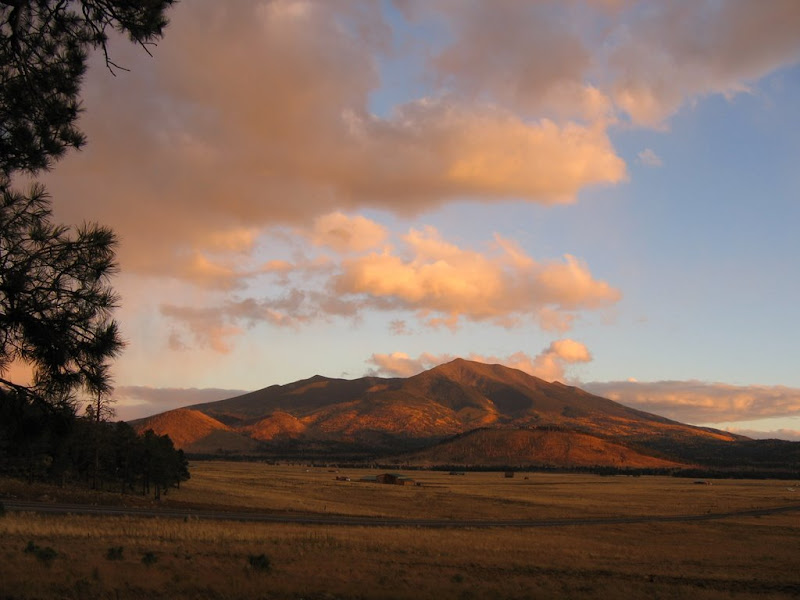
Located in northern Arizona, the Peaks (as they are known to locals) loom over the city of Flagstaff and offer the only true alpine environment in the state. The mountain is a classic example of an ancient stratovolcano that once reached a height of 15,000 feet or more, and is the largest feature of a still active hotspot beneath the Earth's crust known as the San Francisco Volcanic Field.
Geologists speculate that an eruption rivaling that of Mt. St. Helens in the Pacific Northwest removed the entire top of the mountain, with much of the mass ejecting to the east and forming a caldera known today as the Inner Basin. Of course all of this occurred several hundred thousand years ago, and the likelihood of further activity on the mountain itself is nearly non-existent.
Humphreys Peak Trail #51
The trailhead is found at the end of Snowbowl Road, a paved 7 mile route located 7 miles northwest of Flagstaff on U.S. Highway 180. Incidentally Snowbowl Road also leads to the Arizona Snowbowl, one of the state's few ski and snowboard venues.
The combination of its status as Arizona's highest mountain, ease of access, and non-technical nature make this hike very popular, particularly on summer weekends when large numbers of people head north to avoid the oppressive heat of Phoenix.
The trail is 4.5 miles each way, and climbs 3300 feet to reach the summit. Although not especially difficult in grade or terrain at first, the elevation can be a factor for many people, as it starts at around 9300 feet.
The first 3.5 miles is relatively pleasant although not especially scenic, with an extended hike through a spruce-fir forest on a moderate incline. The real challenge and best scenery begins where the trail tops out above treeline on a very rocky slope. It is here that most folks feel the reduced oxygen content in conjunction with some fairly steep grades, and the pace will likely slow somewhat for many.
Another consideration is the weather. Like most high altitude environments, the mountain itself can have a profound effect on climate in the immediate vicinity. This includes the possibility of snowfall at any time of year on the uppermost slopes, high winds caused by pressure differentials and the mechanics of the mountain, and probably the most likely threat summer hikers will face - lightning.
Summer thunderstorms are common from about mid-July through early September, and days that begin with clear blue skies can rapidly deteriorate into a potentially life threatening adventure. Large diameter hail, freezing rain, and frequent lightning strikes above tree line often occur simultaneously, making exposed and unprepared hikers not only miserable, but at risk for hypothermia and electrocution.
Take my advice - the most successful hikers always check the forecast beforehand, get an early start, and are willing to abandon their quest for the top when conditions dictate a retreat.
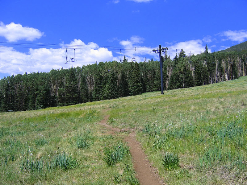
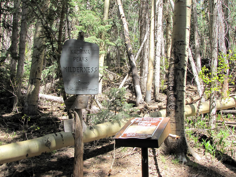
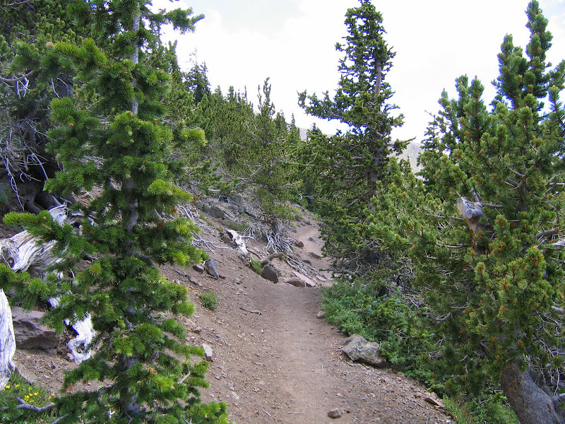
But let's begin at the beginning, shall we? Once the trail leaves the parking area and passes under a ski lift located on Hart Prairie, it plunges into a dense and somewhat overgrown sub-alpine forest. A trail register and sign appears marking the boundary of the Kachina Peaks Wilderness, which covers much of the mountain.
From here the trail initiates a series of long switchbacks along a western facing ridge. One notable characteristic of the path through this section is an abundance of tree roots interlaced like gnarled fingers or extended veins. Lifting ones feet is paramount through here unless you're fond of stumbling.


At the northern most extension of the switchbacks you'll encounter a massive rockslide extending up and down the flanks of the mountain. There is a side hike here that I'll detail at some point leading straight up the slide to the wreckage of a B24 bomber that crashed during a training mission in 1944, killing the entire crew.
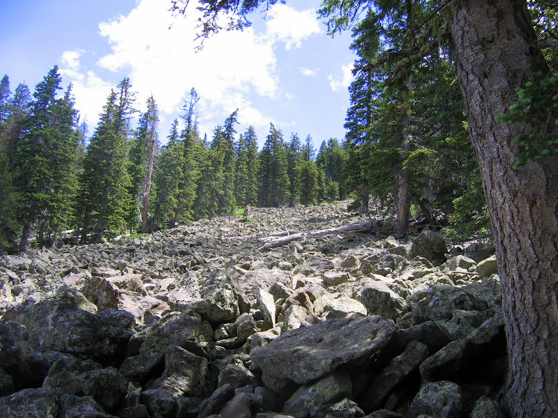
Not unexpectedly the trailbed also becomes increasingly rocky in these areas, again requiring the hiker to pick up their feet and watch their step.

Views are hard to come by in this passage, as dense forest masks the horizon. Here is one of the exceedingly scarce peeks you'll get of the landscape to the west.

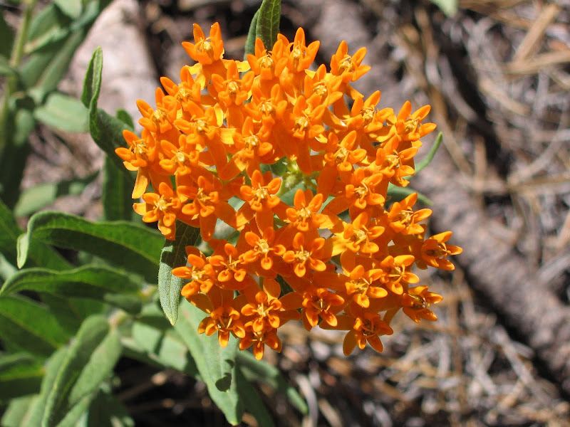
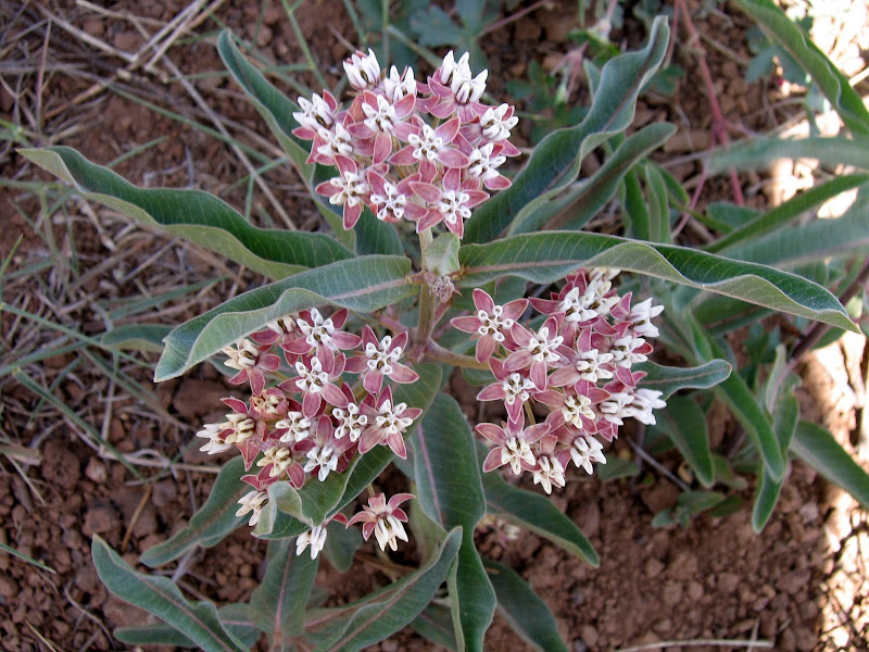
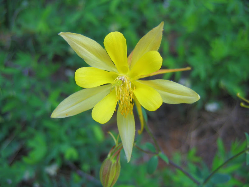
Although not spectacular or grand in terms of views, walking through the forest does have appeal in the form of usually abundant summer wildflowers and aesthetically pleasing surroundings.

 |  |  |
 |  |

The final switchback on the western ridge turns south at first, then east as it ascends along a traverse above a shallow bowl framing the north boundary of the ski area. The trees thin here for better views across the slopes, and it is easy to see how much elevation has been gained - and how much there is yet to climb.

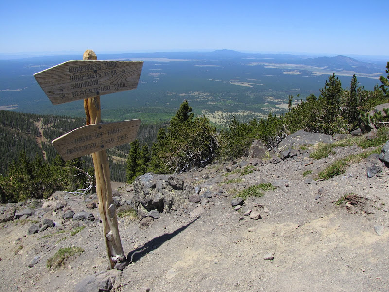
A sign appears just before the trail begins a steep climb towards the saddle between Agassiz and Humphreys Peak. The first part warns that hiking off trail is not permitted. This is due to the existence of an endangered plant, the Senecio Franciscanus also known as flowering yellow groundsel. This inconspicuous forb grows nowhere else in the world except above treeline on the Peaks.
The second mentions that the altitude is 11,500 feet above sea level, and that camping beyond this point is not allowed, for the same reasons as above. Only 1100 feet to go.

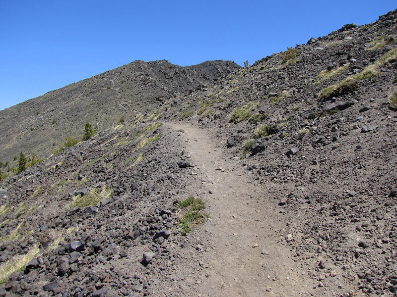
The next section is where most folks realize that the hike will be harder than they thought. That's because a 500 foot climbs begins in earnest beyond this point, and the trail wastes no time as it ramps up the grade. Add the lower level of available oxygen to the equation, and you'll see why most hikers take frequent breaks to catch their breath along the way.

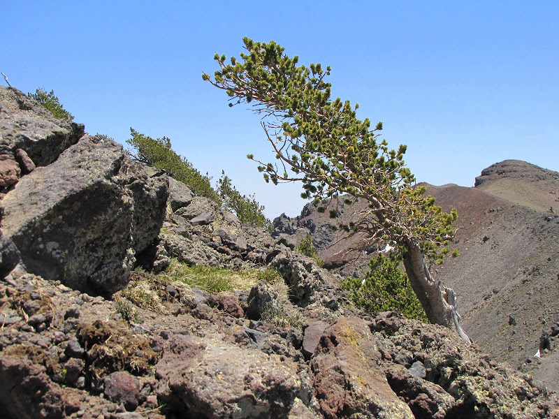
Most of the walk so far has been in a forest dominated by spruce and fir, with some pockets of aspen down lower. At the upper reaches trees more acclimated to the harsh environmental conditions found at higher altitudes appear - Limber Pine and Bristlecone Pine are the prevalent species.
Near the saddle trees become sparse, and those that do survive appear twisted, gnarled, and lower to the ground than their brethren down low. The Germans, who have an abundance of high mountain peaks call these stunted groves krummholz (literally "knee forest"), and they typify the extreme environment found in alpine environments.

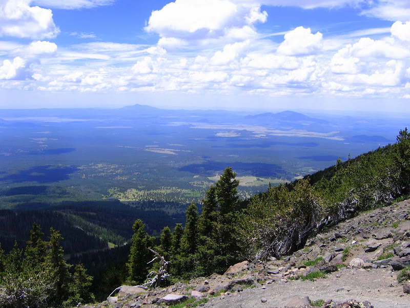
Once the saddle is gained, the views open up in nearly all directions to encompass much of northern Arizona. The elevation here is 12,000 feet, and beyond this point very little grows, let alone thrives. One example is the Senecio below, as well as another hardy shrub unknown to me.
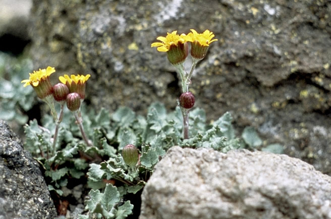 |
| Senecio franciscanus - Photo courtesy of U.S. Forest Service (USDA) |

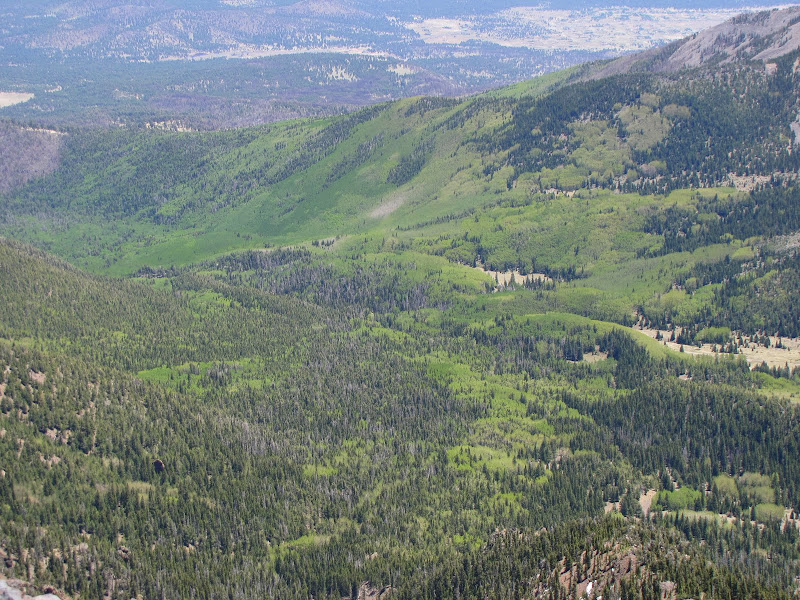
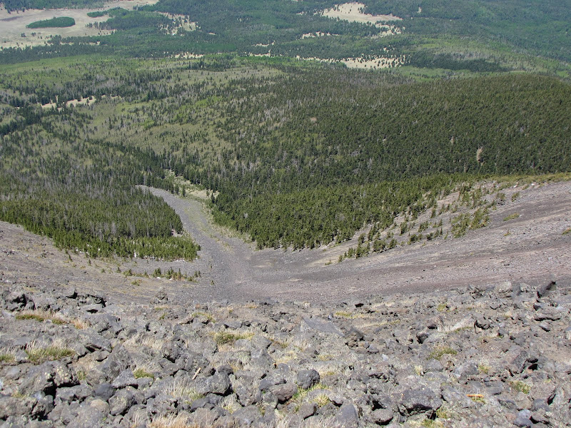
Taking time to admire the views is a good idea, since the last mile will seem both endless and rocky to most people. Looking east reveals the crater at the center of the mountain, aka the Inner Basin. Filled with extensive groves of mature white barked aspen trees, the area is a magnet for photographers both summer and fall.
To the north is seen the final destination - Humphreys Peak, still one mile on and 600 feet higher.
Out west are other volcanic heights like Sitgreaves and Bill Williams Mountains, as well as hundreds of other smaller cinder and splatter cone remnants.
Looking southeast, a curious rock formation atypical of volcanic geology is seen high on a sheer slope above the Inner Basin. What appears at this angle as an arch is likely a juxtaposition of rocks forming a window, although unless I hike up there I'll never know for sure.

The saddle marks a trail junction as well as a good resting spot. At this point the Weatherford Trail arrives from the backside of Agassiz Peak to continue on to Humphreys.
This former "auto tour" road was developed in the early 1900's by a would be entrepreneur who envisaged happy-go-lucky motorists driving their tin lizzies and jalopies to the top of Arizona.
Alas the costs of maintenance and development proved too much, and with the creation of the Kachina Peaks Wilderness the route reverted to the Forest Service to become a hiking and horseback trail.
Once you've managed to get enough air and taken in the views, it's time to continue onwards and upwards.

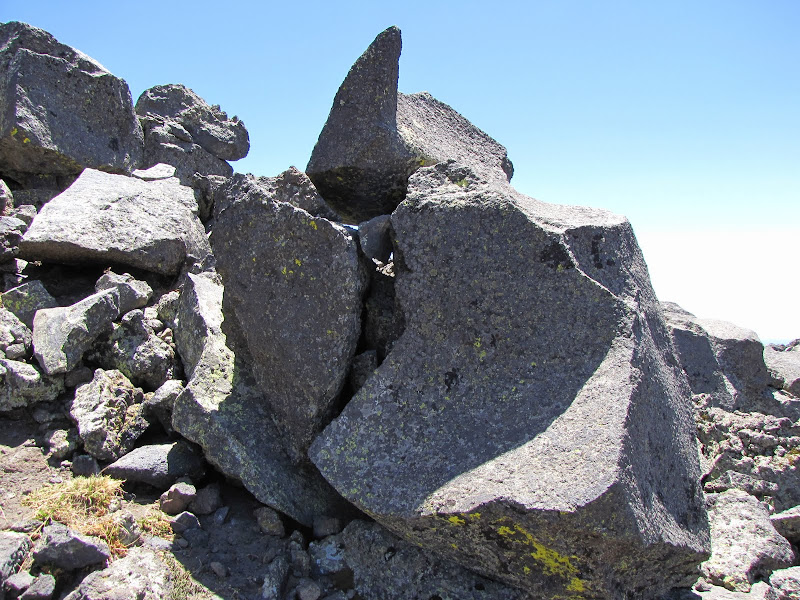
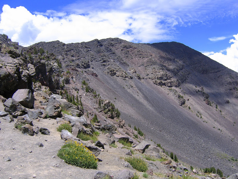
Above treeline the horizon is endless, and so are the rocks. What ensues for the next mile are a series of false summits as the trail clings to a narrow ridge leading to Humphreys. In places the path is relatively level and obstacle free, while in others loose rock and cinders conspire to foil uphill progress on steep pitches.
 |  |

 | 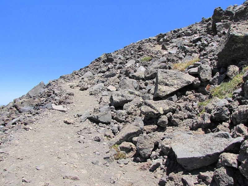 |
Although the exposure is minimal, I doubt anyone would want to lose their balance and tumble down the rocky slopes, especially not in one of these very long avalanche chutes.
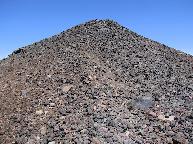
After what seems like interminable walking, the real pinnacle of the mountain appears. One last rocky scramble reveals the prize.
Because high wind is a frequent companion to the highest point, over the years enterprising individuals have labored to build a rudimentary windbreak at the apex. Fortunately there is no shortage of material on hand to work with.
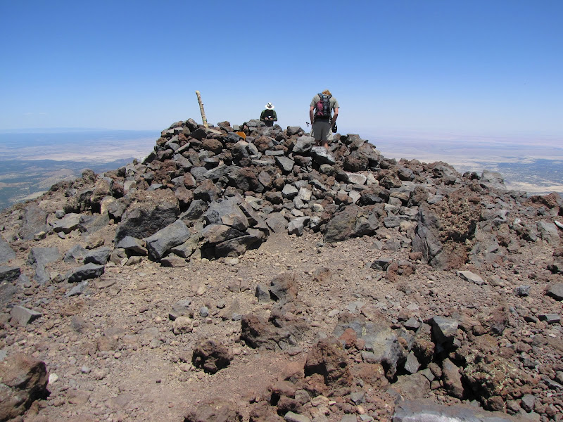
On my last visit I was surprised to see that someone with even more initiative has hauled a wooden bench all the way to the summit. I certainly hope whoever did it took it up in pieces and assembled it in place, otherwise they're made of stronger stuff than I'll ever be.

Of course besides the bragging rights of saying you've been as high as you can be in Arizona, the views are essentially unlimited on a clear day. Looking west is Kendrick Mountain, the next tallest and also volcanic feature in the region at 10,400 feet.

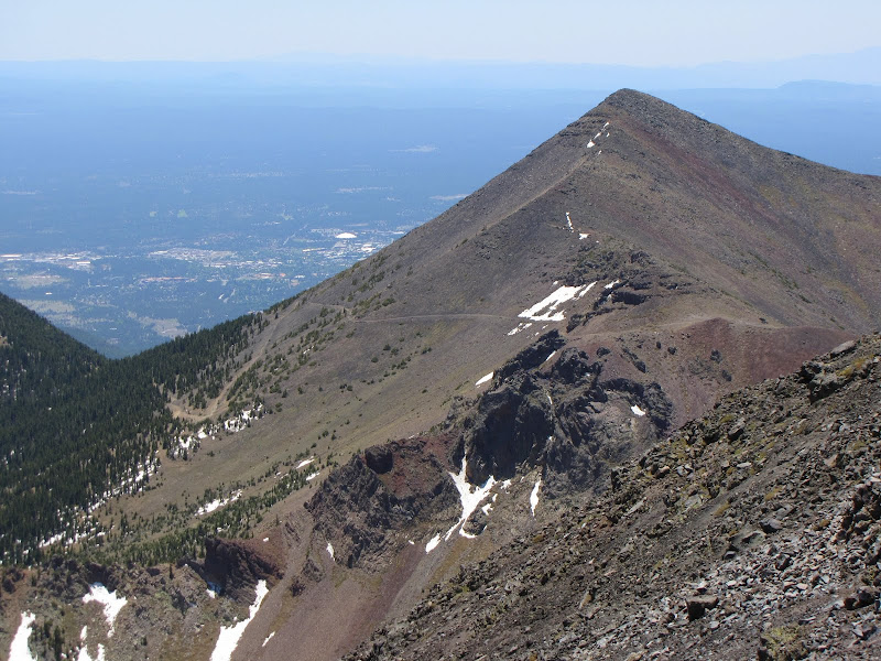
Due south is the second highest peak in the range, Agassiz at 12,356 feet. This image shows the Weatherford Trail snaking up the east flank and headed for the saddle.
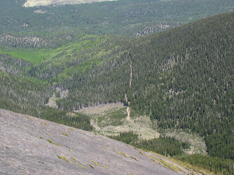
Due north and below Humphreys is the slash of the Waterline Trail contouring around the shoulders where it ultimately connects the Abineau Trail and Bear Jaw Trails in a loop.
The northeastern horizon shades to brown and pinks as the land slopes away towards the vast Navajo and Hopi reservations amid the Painted Desert. And it's true, you can see the Grand Canyon from here, although what you really get is the elevated upper part of the North Rim peeking over the earth-sky line some 70 miles distant.

After enjoying your conquest of Humphreys, the long downhill trip allows plenty of time to savor the achievement. Although it's not a Rocky Mountain High, it is rocky, and it is high, and it all belongs to Arizona. As far as I'm concerned that's good enough.