Confluence. That's the word that best describes what occurred over 800 years ago in this arid, high desert place. Sometime around 1040 and 1100 A.D., nearby
Sunset Crater erupted, spewing forth a layer of insulating volcanic ash. Also around that time people from surrounding areas migrated into the sparsely settled region and began to farm small plots, taking advantage of the moisture retaining properties of loose cinders.
Over time these new populations grew and expanded, building larger structures and dwellings, eventually reaching an estimated population of several thousand people within a days walk. Then for reasons unknown, nearly 150 years after the influx began the region became once again devoid of significant habitation. Today the remnants of this culture are preserved at
Wupatki National Monument just northeast of the modern day enclave of
Flagstaff, Arizona.
The southwestern part of North America contains a wealth of human history that stretches well into the past. I have enjoyed the pleasure of seeing many of the better known sites, such as
Chaco Canyon,
Mesa Verde,
Betatakin, and
Keet Seel to name just a few. I had also visited Wupatki briefly once before long ago, but as the Monument is in my backyard so to speak, I had long overlooked the hidden treasures contained within its borders. Fortunately I recently had a chance to correct my oversight.
Like many National Parks and Monuments, Wupatki focuses the visitor's attention on the highlights. Developed sites are accessed via a loop road which also connects with nearby Sunset Crater National Monument. The main attractions along the road are stabilized and accompanied by interpretive signs, giving nearly all a chance to see and learn more about what is preserved here. I will spend time in a future post providing detailed information about more accessible parts of the Monument, but for this entry I want to share a place where most people will never go.
Crack In The Rock
To protect and preserve the many sites found within the Monument, there are places the general public are not allowed to go without a guide. In an effort to provide access to visitors who want to know more, Monument staff conducts day hikes during the summer to various locations. But in order to see the most extensive collection of sites and petroglyphs found here, you must be willing and able to undertake a rigorous overnight hike deep into the backcountry.
I'm referring to the trip to
Crack In The Rock, a 16 mile (approximately) backpacking trip that takes a small group (no more than 12 people per hike) to visit some amazing petroglyphs and structures far from the comforts of the Visitor Center. Conducted on select weekends in April and October, the hike has become popular enough that in order to participate you must submit your name for a lottery. If chosen, you will accompany a Park Service escort into a wild and scenic landscape to learn more about how people managed to survive in the challenging environment.
The Park Service is rightfully concerned about protecting the resource for the future, and asks participants not to disclose sensitive information regarding the location of the hike, and I will not do so here. GPS units are strictly forbidden, and access is tightly controlled.
The Hike
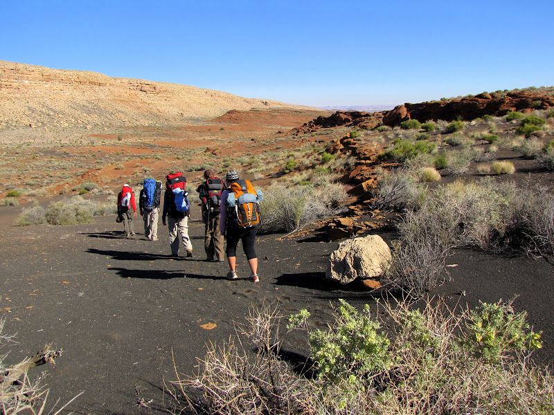
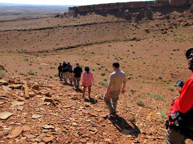
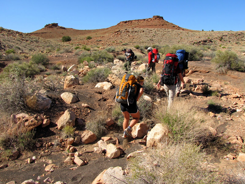
Meeting at the Visitor Center at the designated time, we cover the ground rules (don't touch or take, stay with the group, etc.) and carpool to the starting point, a nondescript clearing several miles off the road. We shoulder packs which are heavier than usual for an overnight hike, because everyone is required to carry a minimum of two gallons of water. The weight is hardly felt however as the surrounding beauty quickly begins to mesmerize.
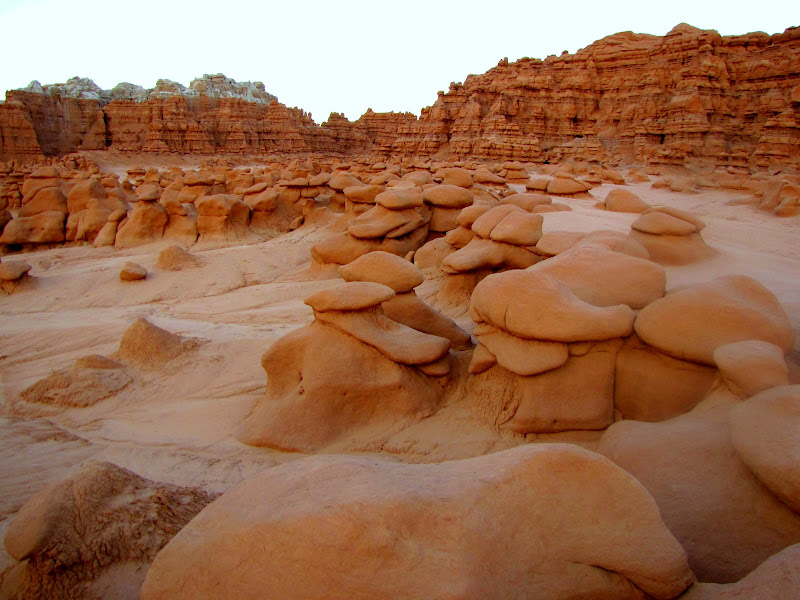
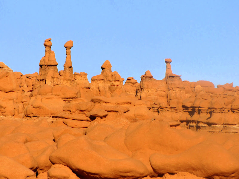
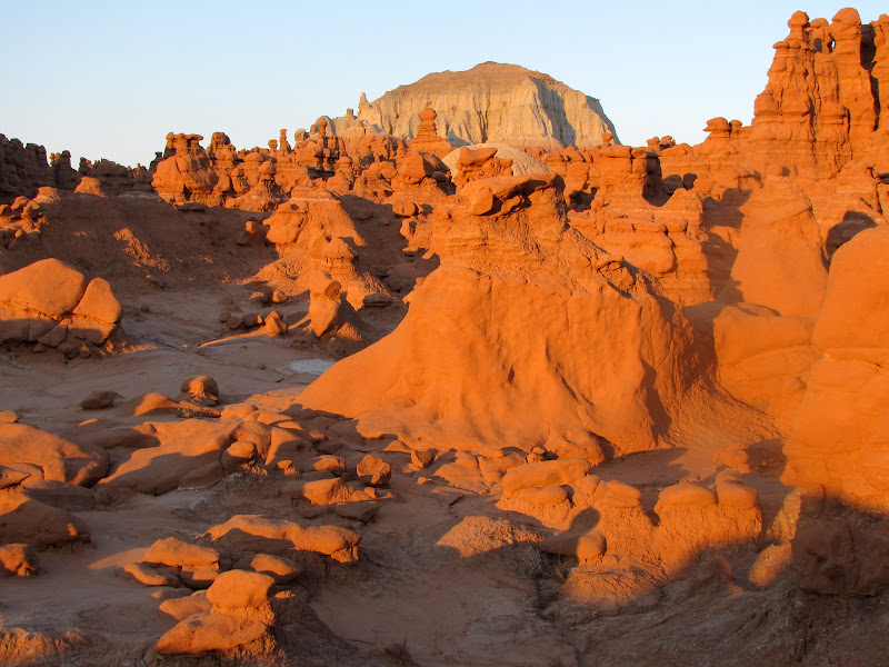
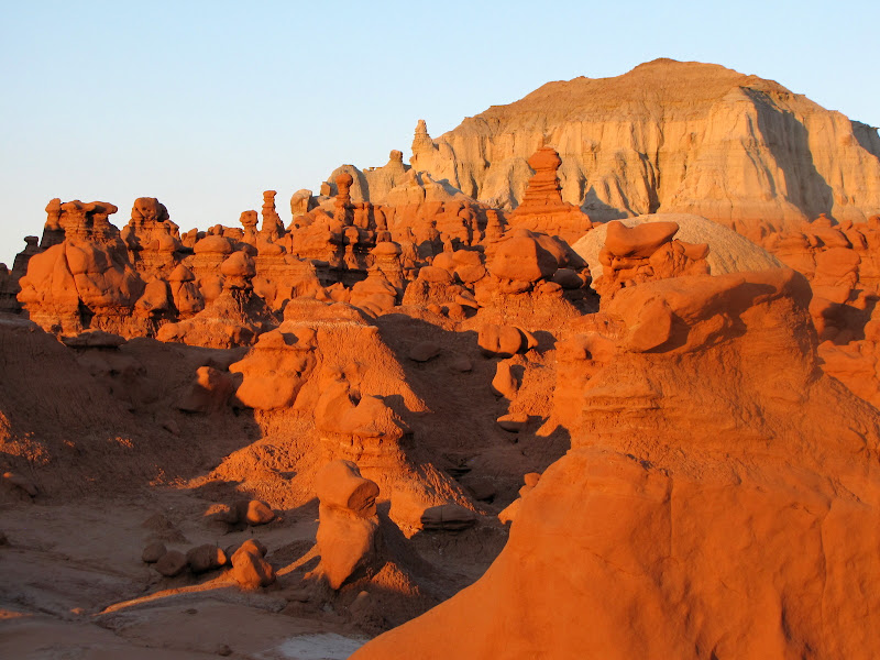
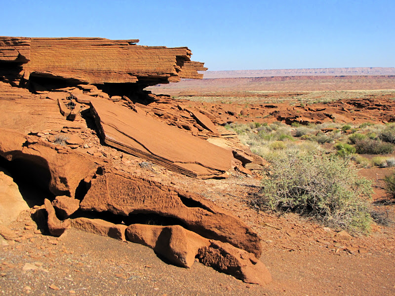
There is no trail, just a long ramble over often rugged terrain. The scene is one of near barren austerity, with scattered shrubs consisting mostly of blackthorn and saltbush. There are widely dispersed juniper trees providing scant shade, but little else. A fine layer of black cinder sand fills the many small washes and drainages that wend a serpentine course between outcrops of
Moenkopi sandstone. The only real topographical relief comes from a nearby monocline, an upthrust ridge of
Kaibab limestone that dominates the horizon.
I did this hike in late October, and the weather was perfect, with daytime highs in the mid-60's and nightime lows in the 30's. But be warned. The climate here is quite variable, and our guide regaled us with stories of 90 degree temperatures under a relentless sun, and blinding snowstorms that required evacuation.
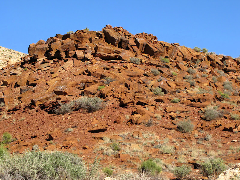
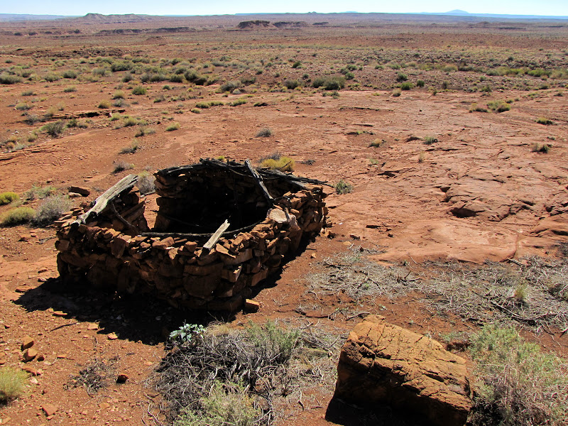
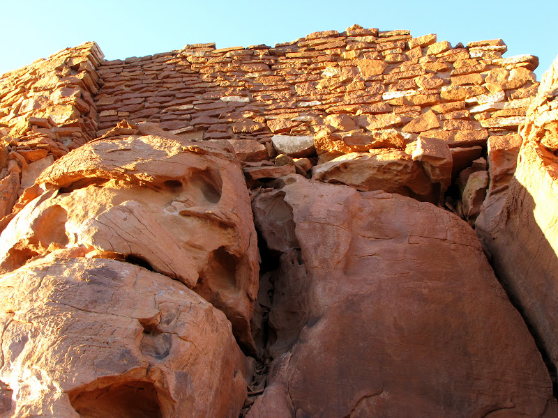
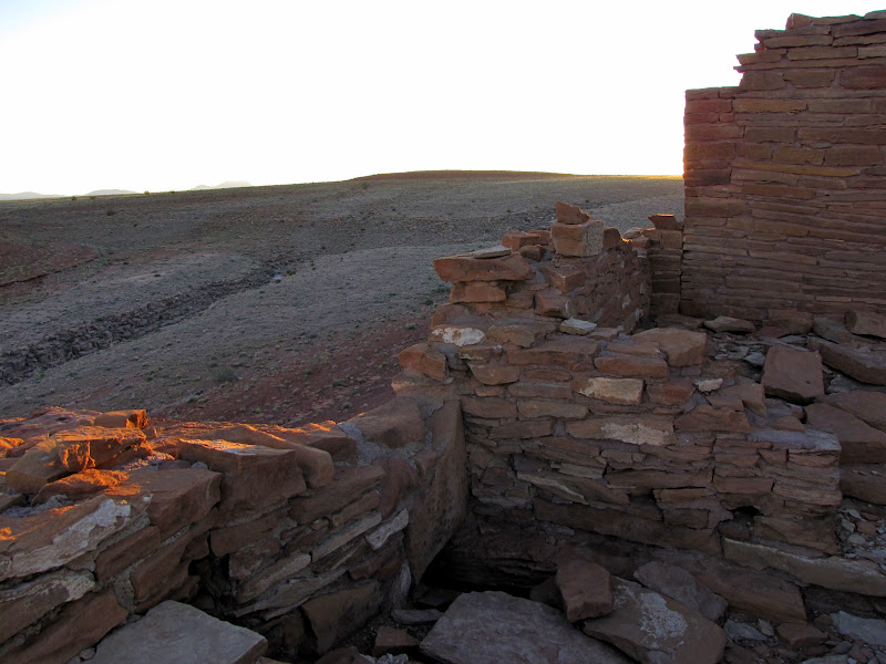
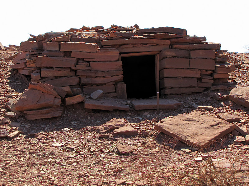
Not long after starting out, we reach the first of many structures found along the way. In nearly all cases these are located on the high point of an exposed formation of Moenkopi sandstone. We will never know why these places were selected, but it's easy to imagine that all-encompassing views of the surrounding area was one reason. That, and the abundance of building materials at hand.
Using stone slabs fractured along one edge in linear fashion, the technique used to make walls is very similar to the "core and veneer" construction found at other sites in the Four Corners area. The walls were once mortared with clay found along the
Little Colorado River some distance away, but time and weather have stripped away the bonds holding the blocks together, and the stones are slowly returning to the state in which they were found.
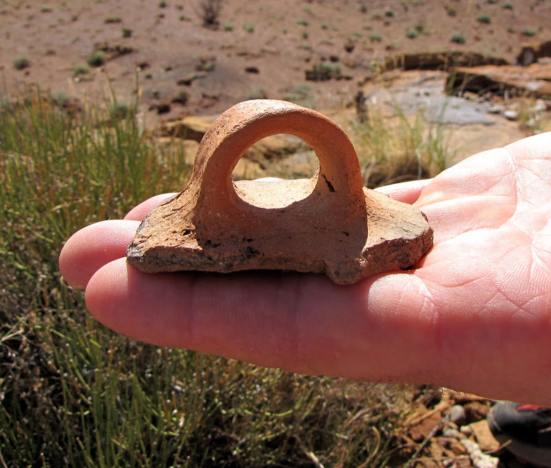
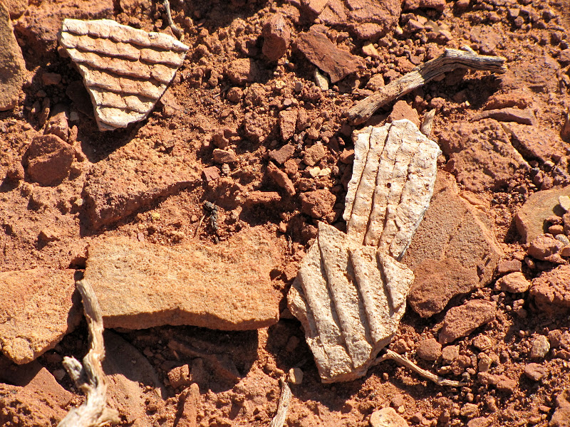
More evidence of domestic life is found scattered amongst the detritus of the hill - pottery sherds from bowls and vessels used to store and prepare food. Many different styles of pottery have been found at Wupatki, and evidence suggests that the people living here were a mixture of several cultures. These are primarily the
Sinagua from the south, the
Cohonina from northwest, and the
Kayenta Anasazi from the north.
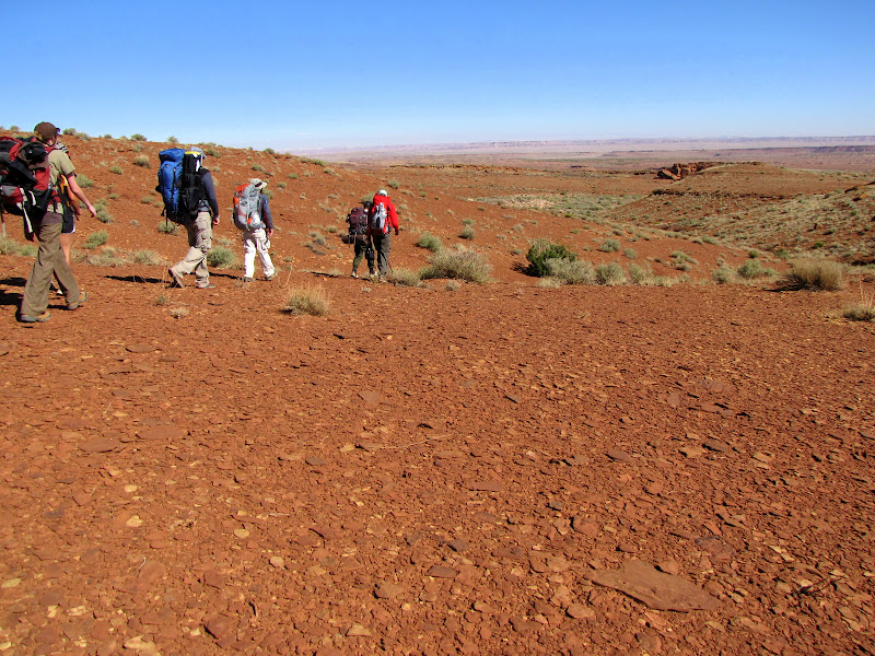
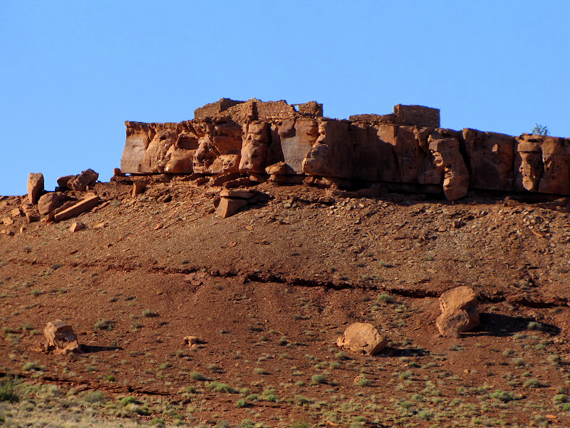
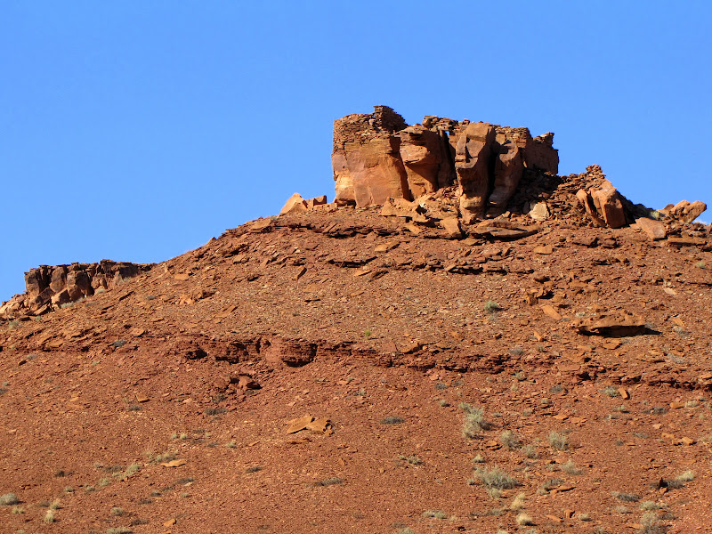
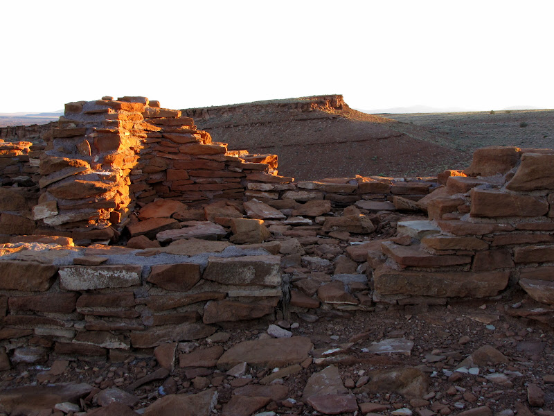
As the group continues on a series of structures appear, each one crowning a broken hill of reddish brown sandstone.
After pausing briefly at each new encounter with the remains of a vanished civilization, we continue making steady progress towards our ultimate destination.
After the ancestral puebloans left the area hundreds of years ago, the land did not remain entirely abandoned.
Navajo families migrated into the Four Corners region beginning sometime in the 15th century, in some case clashing with the descendants of the earlier inhabitants, the
Hopi people. The Navajo (or
Dine as they refer to themselves) were somewhat nomadic, herding sheep, raising crops in canyon bottoms, and hunting game. They too left their mark on this place, in the form of hogans, sheep pens, and sweat lodges.
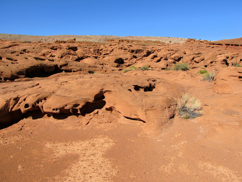
Cultural remains are not the only items of interest out here. This picture shows slabs of Moenkopi sandstone that have captured ripples from a shallow sea, now frozen in stone.
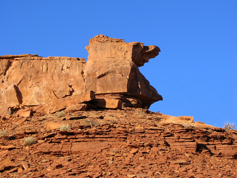
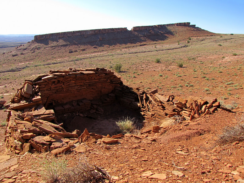
Further on isolated islands of sandstone rise progressively higher, forming elevated mesas. Many of these summits hold stone structures built on the precipice.
Most of the day has passed when the country in front of us opens up, providing sweeping views of the Little Colorado River Valley and badland cliffs of the Hopi Reservation on the opposite side. We are soon heading for the campsite area, where we are given time to settle in before making a late afternoon visit to Crack In The Rock.
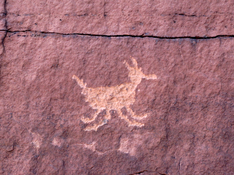
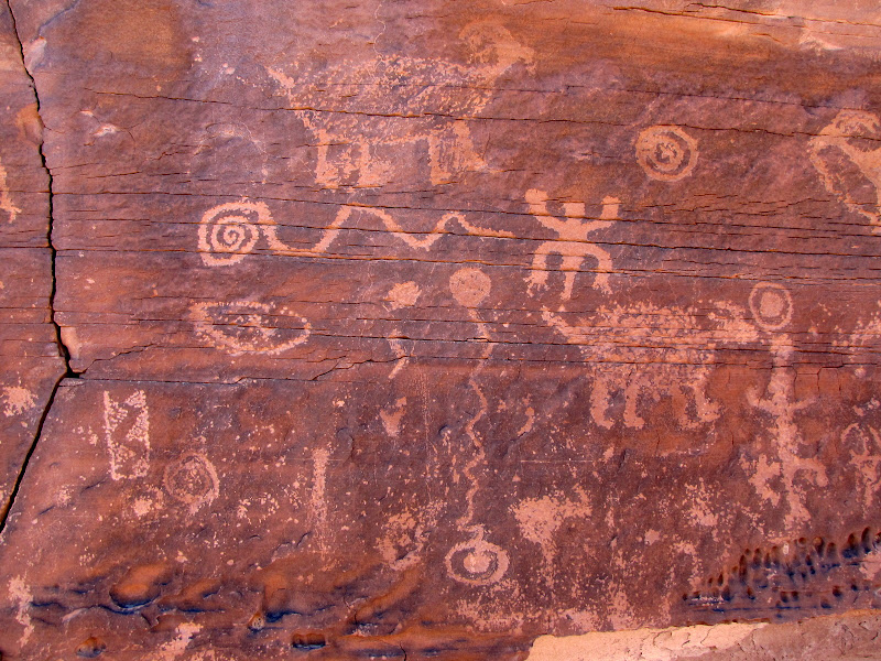
After a short rest we make our way back up the slope of a nearby mesa. At the base of the exposed Moenkopi cliffs we make a circumnavigation of the naked rock, where our Park Service guide begins to point out the first of thousands of works of prehistoric art etched into the stone.
Although we have yet to ascend the mesa top, the views are incredible as the low angle sun casts shadows that define the folds and creases of the land below.
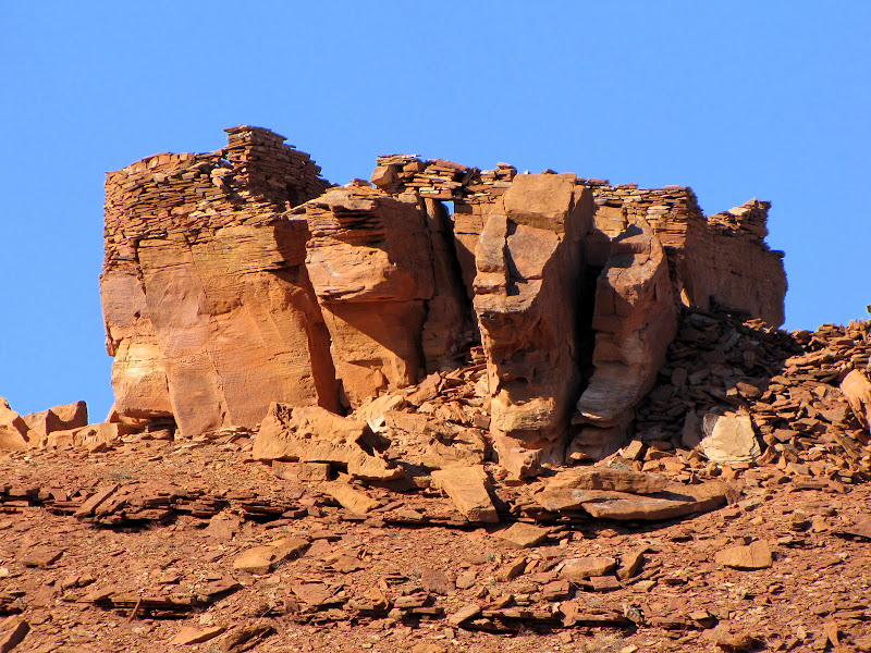
Looking up, the remains of the pueblo rise above, man-made extensions of sheer rock walls.
Before climbing up, there are many panels of petroglyphs to examine.
Crack In The Rock gets its name from the unique method of accessing the pueblo - through a narrow gap which emerges via a doorway onto the plaza. Many of the puebloan peoples in existence today have a creation story which mentions an entrance into this world which is often called a "sipapu". It is possible that this particular method of reaching the mesa top represents a similar idea, and the pueblo was constructed in this way for just that reason. Or not. Remember, we're just guessing here.
Entering the open space of the plaza finally reveals the ruins of the pueblo. All that remains of what was once a living, breathing community of humans are crumbling walls that open to the vault of sky, and endless vistas that must have inspired the occupants even then.
After the sun slips beneath the horizon, darkness chases us from the mesa top and we return to camp, where we share food and fellowship around a thoughtful campfire. The Park Service was gracious enough to haul a portable toilet and firewood to an otherwise spartan location, making for a most welcome evening. The next morning we arise with the return of our companion star and get an early start, for many more petroglyph panels await.
Day Two
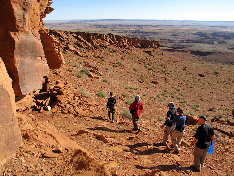
Starting from the previous nights camp, we shoulder our packs and head back towards the mesas. There are three distinct formations, one of which (Crack In The Rock) we visited the night before. Today the arc of our journey is similar, although we will not climb to the summit of any other features. Instead we visit the area where talus slopes meet the sheer face of sandstone which form the upper cliff bands. These smooth, vertical surfaces made ideal palettes for artisans from hundreds of years past, blank canvas on which to etch pictures and images of significance.
When we reach a spot between the mesas, we drop our packs before making the final approach. This is to assure that the extra weight and bulk carried on our backs does no damage to the panels and structures we visit, and it also makes climbing up and down the loose rocky slopes much easier.
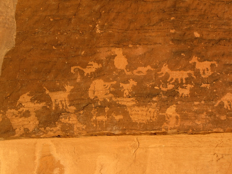
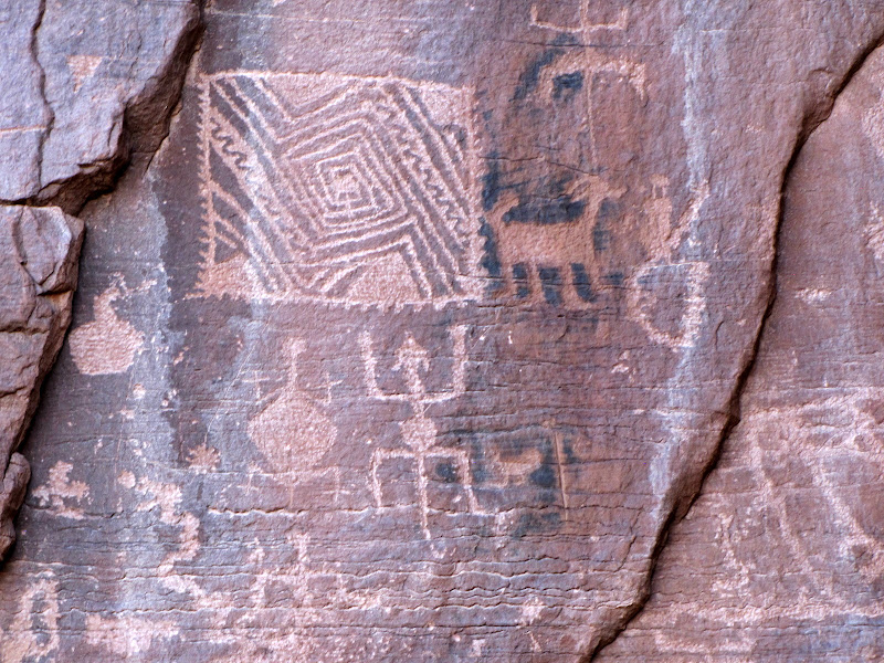
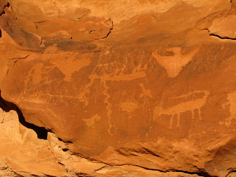
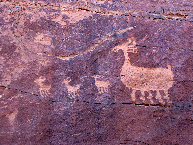
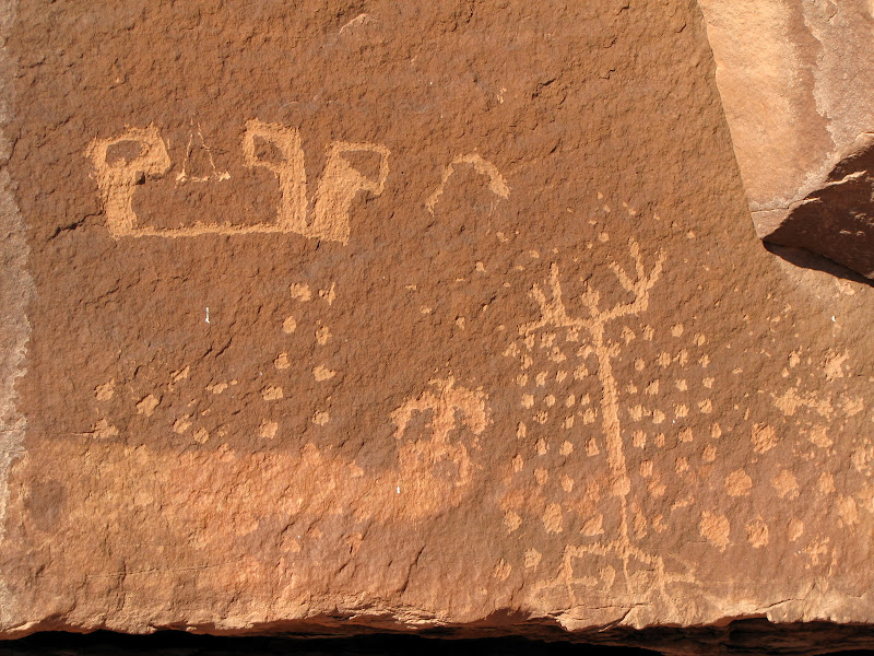
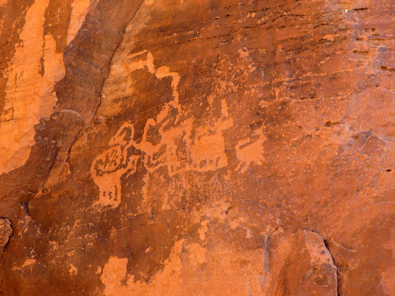
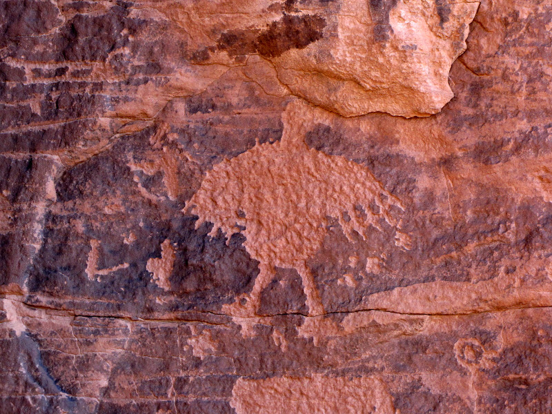
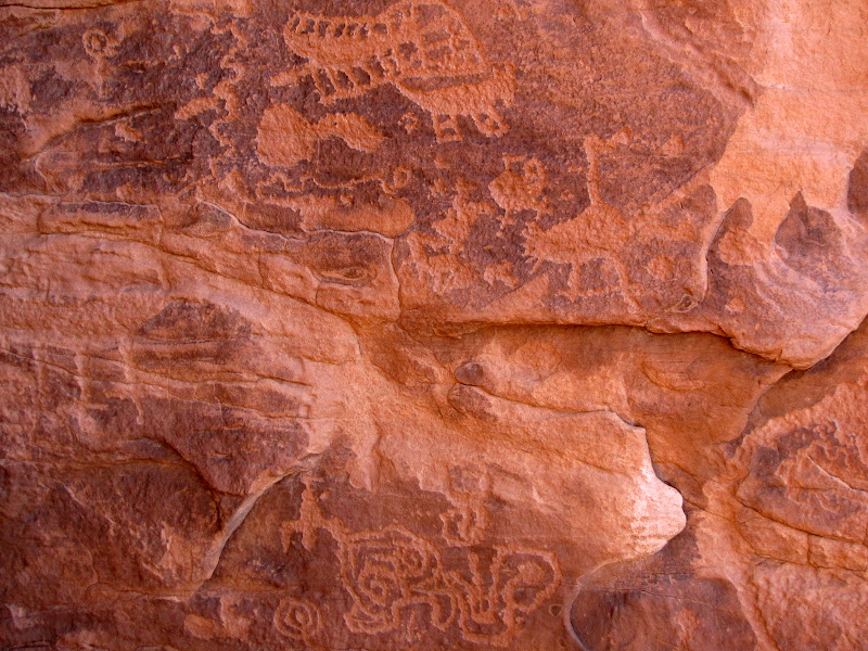
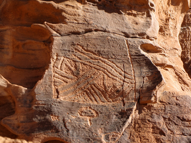
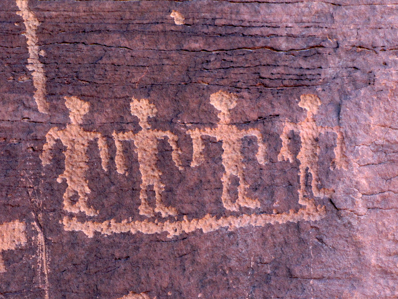
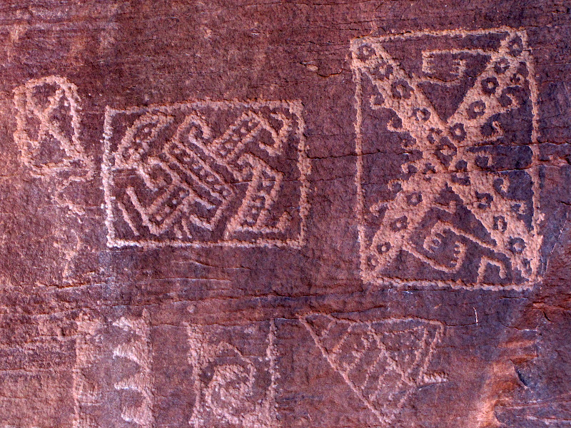
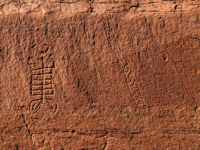
There are so many pictures, and so few answers. Many of the etchings echo themes of the hunt, with animals featured in prominent positions. But others defy easy characterization, and without any written or verifiable oral history to explain the often surreal beings and designs, we can never be sure what meaning the creators assigned to their work, We can attempt interpretations, but I prefer to let the images speak for themselves.
Three mesas in this area hold the majority of structures and petroglyphs. We visited Crack In The Rock on the previous day, leaving two for discovery on the return trip. We walk along the talus slope of each mesa, where it seems every rock face holds a wealth of visual images from the past. There are far too many pictures to post here, so here is a sampling of what we saw.
One obvious landmark on the horizon are the
San Francisco Peaks. These are the tallest mountains in Arizona, reaching 12,633 feet above sea level at the highest point, and are visible for many miles across the relatively flat high desert. The Peaks figure prominently in Native American culture, forming one of four cardinal points in Navajo theology, and are considered to be the home of spiritual beings known as
Katsinas (also spelled
Kachina) by the Hopi.
Our Park Service guide did an excellent job at providing information about the geography and culture of the region. She managed to find the perfect balance between allowing us the greatest possible access while still protecting the integrity of sites. Her knowledge, competence, and professionalism helped to make the experience very worthwhile.
We continued to explore along the base of the cliffs, viewing panel after panel. When we reach the end of the line, we drop back to the ravine between mesas and take a short break in this scenic drainage before climbing back up to the second outcropping.
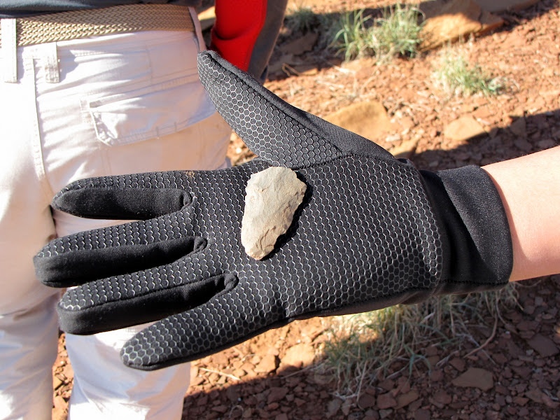
The valley floor is littered with artifacts including pottery sherds and this stone fragment, possibly broken off a larger spear tip.
When we reach the face of the third mesa the wealth of rock art continues.
Eventually we reach the end of the cliff face, and head back down to the packs, our heads full of strange images and ideas. There is plenty to think about on the return trip to civilization.
Even though the highlight of our visit is behind us, there is still much to see as we make our way back to the vehicles. There are more Navajo structures, interesting many-headed barrel cactus, several vividly colored collared lizards, and the beauty of the landscape itself.
When we stop for lunch, our guide shows us even more petroglyphs and pottery sherds nearby.
The remainder of the hike passes quickly, and we are soon parting company. The trip has been memorable for me, and I've tried to summarize the experience as best I can. Still, there are feelings and ideas that occurred along the way that words and pictures cannot convey.
Living in the modern world ill prepares me to understand how these early inhabitants felt about the landscape they called home. But after viewing the images they created and the places they chose to live, I think they must have appreciated beauty as much as I do.