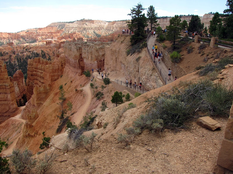
 Summer is officially over and fall now holds sway over the land. Although snow is a possibility in northern Arizona anytime after September, in general the weather offers clear, cool days and sharply cold nights. In short, perfect hiking weather. In this post I share another great outing from the many trails found in and around Flagstaff, this time from the north side of the San Francisco Peaks - the Abineau-Bear Jaw loop.
Although Abineau and Bear Jaw are located in the same general area on the flanks of the Peaks, in character they are very different. Abineau follows the bed of a canyon nearly arrow straight up the mountain, while Bear Jaw meanders along the shoulder, mainly staying high on the ridge. The trail up Abineau climbs steadily in a heavily treed ravine for the entire route, and Bear Jaw initially offers long traverses with a moderate grade, with the last stretch being a steep ascent through open aspen groves. Both trails reach above the 10,000 foot mark and are connected at the apex by the Waterline Trail.
The easiest access point is from U.S. Highway 180, which leads north to the South Rim of Grand Canyon. At 19.5 miles from Flagstaff the turnoff for Forest Service Road 151 appears on the east side.
 |  |
This reasonably well maintained dirt road leads east through mixed ponderosa and aspen forest for 1.6 miles to Forest Road 418. Take 418 another 5.6 miles to the junction of FR 9123J, where you turn south for an additional 1.2 miles to the trail head parking area. Both Bear Jaw and Abineau trails begin here.

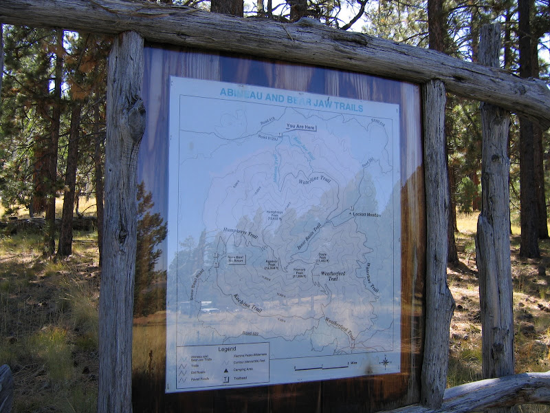
For the first .4 of a mile the trails share a common path. At the junction, a trail register is available for hikers to sign in. Left takes you 2.4 miles up Bear Jaw, a right turn leads 1.9 miles to the upper end of Abineau. Either hike is worthwhile as a days' outing, although a loop also makes for a good choice and adds 2.1 miles to the trip total - 7.2 miles altogether.


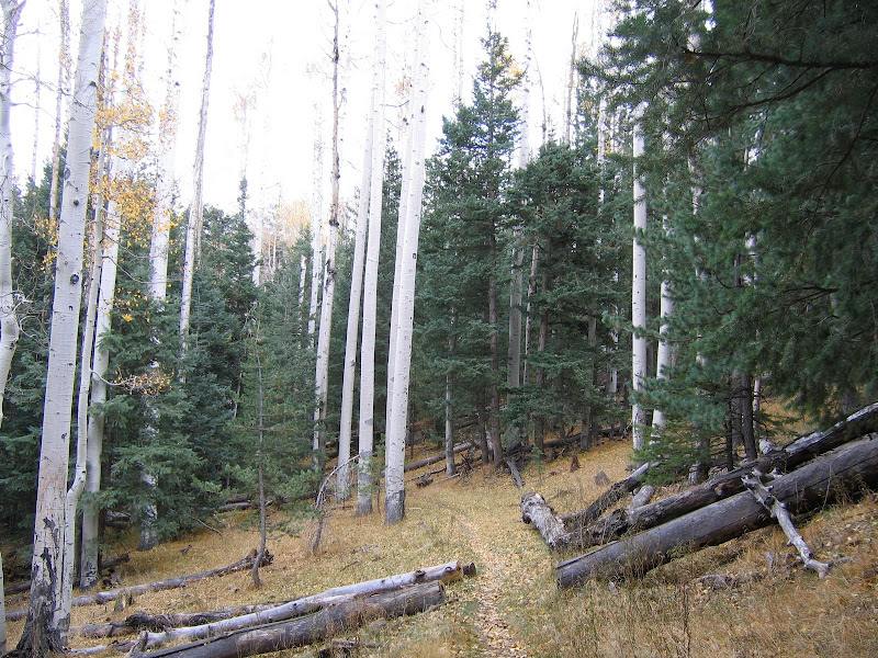
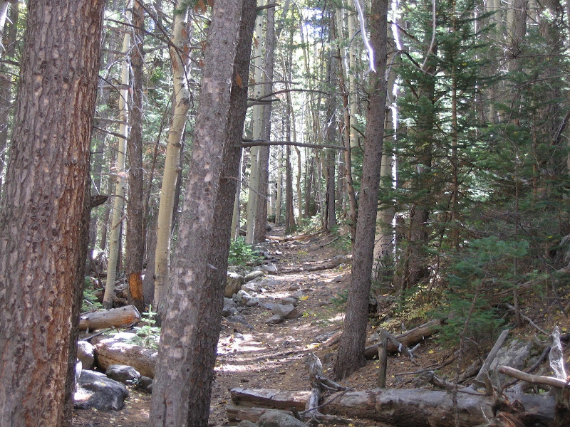
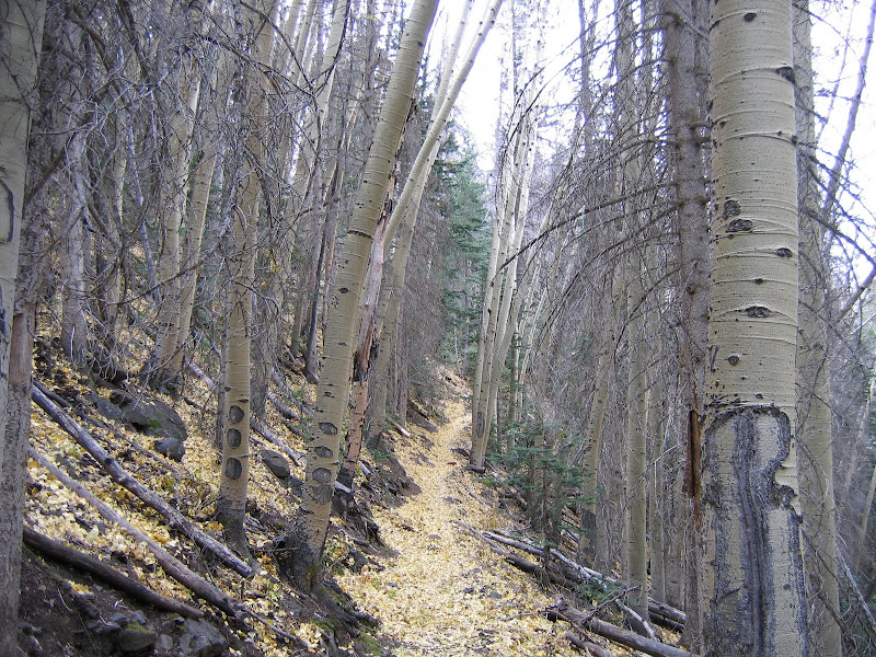
For this post I'll cover the loop starting with Abineau. As mentioned earlier this trail follows the bottom of Abineau Canyon, and soon after leaving the junction begins a moderate climb that continues the rest of the way. The path is heavily treed, with aspen and other mixed high elevation conifers screening out much of the available light. The trail bed is rocky but well defined, and views are limited to the way ahead.
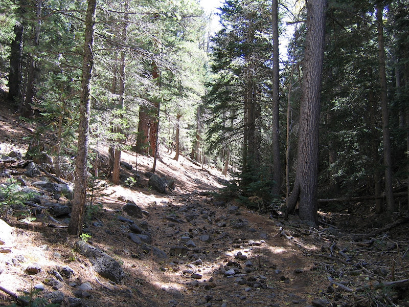 |  |
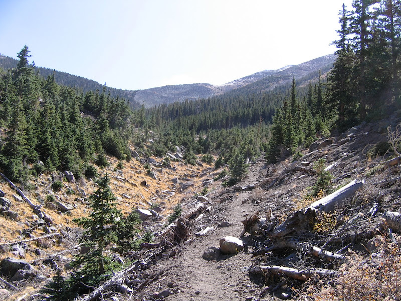
The trail gradually increases in steepness ensuring steady progress. After a little over a mile of climbing, a maze of choked timber appears ahead in the canyon bottom, the result of a major avalanche in 2005. This significant natural event wiped out the upper third of the trail, and filled the ravine with fallen timber and debris, forcing a reroute of the path up and onto the west flank.
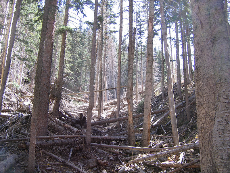
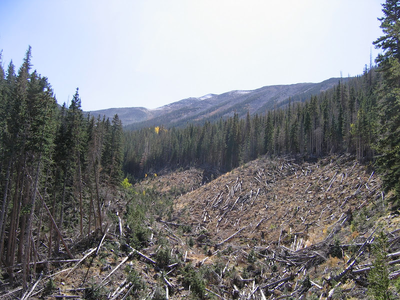
The awesome power of the snowslide is revealed in the sheer mass of large trees and boulders ripped from the surrounding slopes and left in a jumbled heap. It is also worth noting that the phrase "nature abhors a vacuum" is apparent here - small firs and aspen shoots are beginning to recolonize the stripped area. Thanks to the avalanche the trail climbs out into the open, and the looming summit of Humphrey's Peak appears ahead.
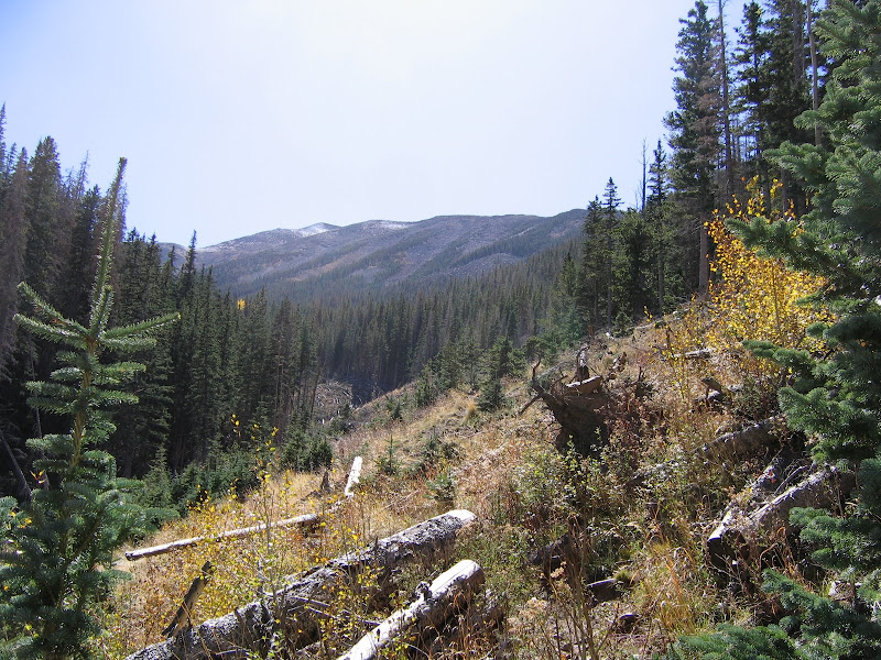
For a moment the trail drops back into the ravine, wending its way through debris before resuming the uphill climb. The soil here is loose and a good deal of scrambling is required in places to regain the high ground. For the first time since starting out looking back reveals views north of the volcanic fields and the horizon. On clear days the edge of Grand Canyon is visible in the distance.

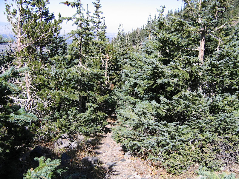
The trail continues climbing to near the head of the canyon, skirting the western edge. Steep and rocky as it goes along, it winds through small stands of young fir trees growing in defiance of future slides. As the path nears the top terminus with the Waterline Trail the trees grow together in profusion, leading me to hope that bears aren't fond of playing hide and seek.
Finally the Abineau trail comes to an end in a valley at 10,500 feet above sea level. The tallest point in Arizona is still over 2000 feet higher, but as they say you can't get there from here - at least that's the Forest Service rule. The views north are excellent, and the hard part of this hike is over.


From here it's east along the Waterline Trail, an old road that traverses the upper slopes of the mountain.

As a former road the grade is gentle and the path is wide as it contours along the mountainside, winding in and out of ravines.
 |  |
After 2 miles of leisurely hiking, the junction of the Bear Jaw trail appears on the downhill side.

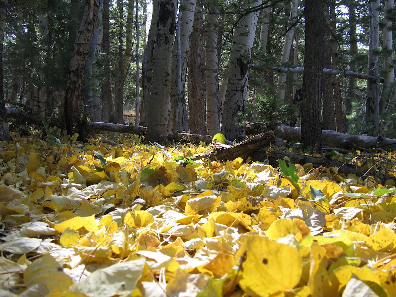
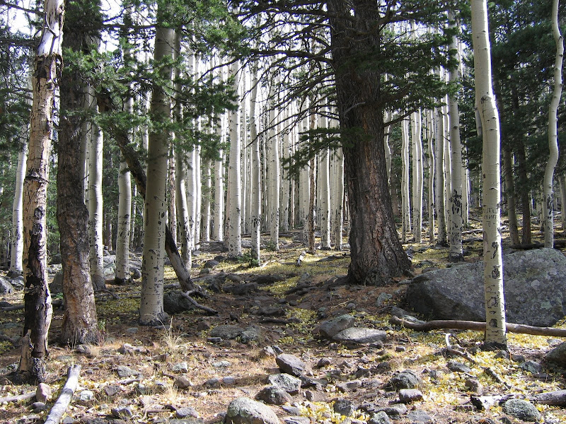
Dropping steeply into the aspens, the upper part is rocky and requires attention, especially when covered in wet, freshly fallen leaves.

 |  |  |
Because the lower sections are less steep than the overall grade of Abineau, Bear Jaw has to make up for it in the upper section. This is one reason most hikers choose to go up Abineau as the climb is relatively steep along the entire trail but shorter overall.
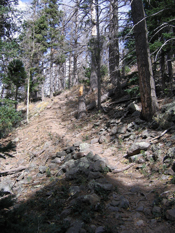
After the trail crosses the head of Bear Jaw Canyon the grade moderates, and becomes more of a steady undulation over the slopes. There is still a fair bit of elevation to lose, but Bear Jaw does it gradually over a longer distance.
 |  |
There is a more open feel to hiking Bear Jaw as the trail stays on the flank on the mountain unlike the canyon-centered Abineau, although it is still heavily forested and views are limited. And similar to Abineau the trail is very rocky in places, requiring the casual hiker to look down at where they place their feet.

The lower section provides a pleasant walk through a forest of ponderosa, aspen, and mixed conifers, and makes for a good end to a great hike. Once the trail levels out it basically continues for .5 of a mile to the junction with Abineau where it all began.
Taking this loop hike is a day well spent, with plenty of fresh air and invigorating activity in a splendid outdoor setting.