Sunday, May 29, 2011

Ocean of Stone: Box - Death Hollow Part II


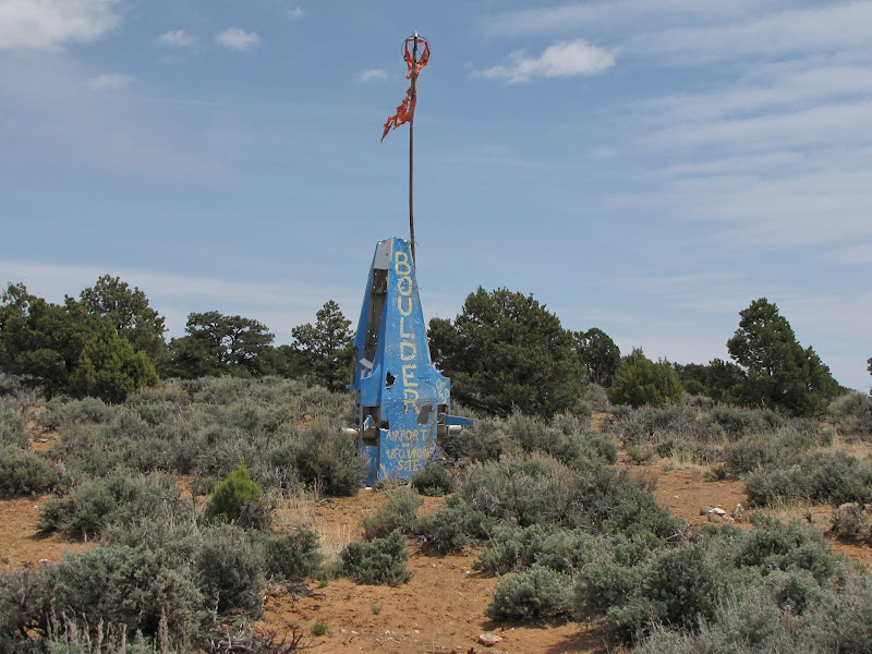
Penetrating the interior of Box - Death Hollow was high on my list of priorities, especially after driving the incredibly scenic stretch of Highway 12 between the southern Utah towns of Boulder and Escalante.

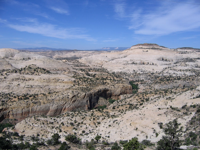
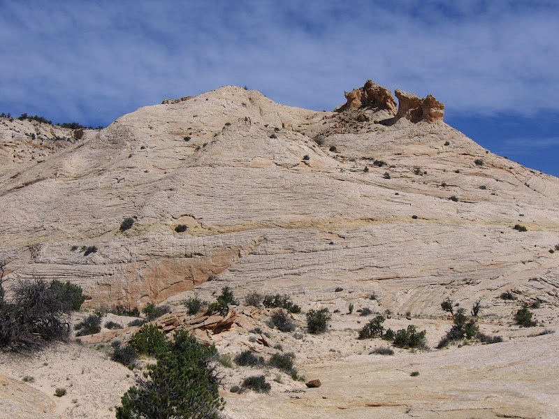
As seen from the road the complex and convoluted landscape appears as a wonderland of sloping domes and benches, with fascinating patterns of swirling cross-bedded sandstone. At first glance the undulating terrain seems benign and relatively easy to navigate, but steep walled canyons hidden in pleats and folds await the uninitiated. In my case the view from outside is irresistible, and the lure of the unknown draws me in.


I chose to explore the heart of the stone sea on a route known as the Boulder Mail Trail. Until Highway 12 was constructed this path was the primary corridor for mail and other supplies to reach the isolated community of Boulder. Traveling 16 miles over and through the canyons of Escalante River tributaries, the trip was a challenge even when weather was favorable. Long since abandoned as a conduit between the towns, Boulder Mail Trail offers the hiker a perfect opportunity to experience the wild and rugged character of the wilderness.

I began the journey with this post, having reached the first benchmark of Sand Creek located approximately two miles from the eastern trailhead. Continuing on to Death Hollow is another 2.5 miles further in - this utterly beautiful and sublime canyon being the destination for my out and back visit to the area.

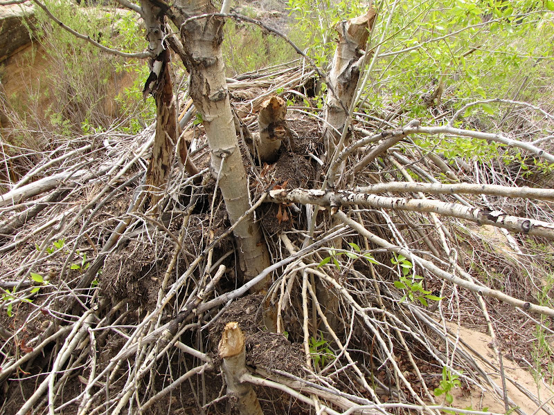
After dropping into the shallow bowl of the Sand Creek Drainage, the trail approaches and crosses the creek. Dense willow thickets and other riparian vegetation crowd the narrow course of the creek, and some minor bushwhacking is needed to get across the narrow but energetic stream.

The route continues along the creek bottom for a short distance before climbing up the western slope. If recent flooding has occurred it may be a slight challenge to locate the precise spot where the trail makes a sudden ascent, but if you've gone too far you'll know it - the canyon continues to narrow downstream and is filled with dense brush, making forward progress increasingly difficult.


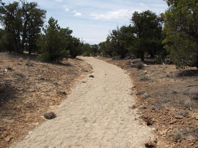
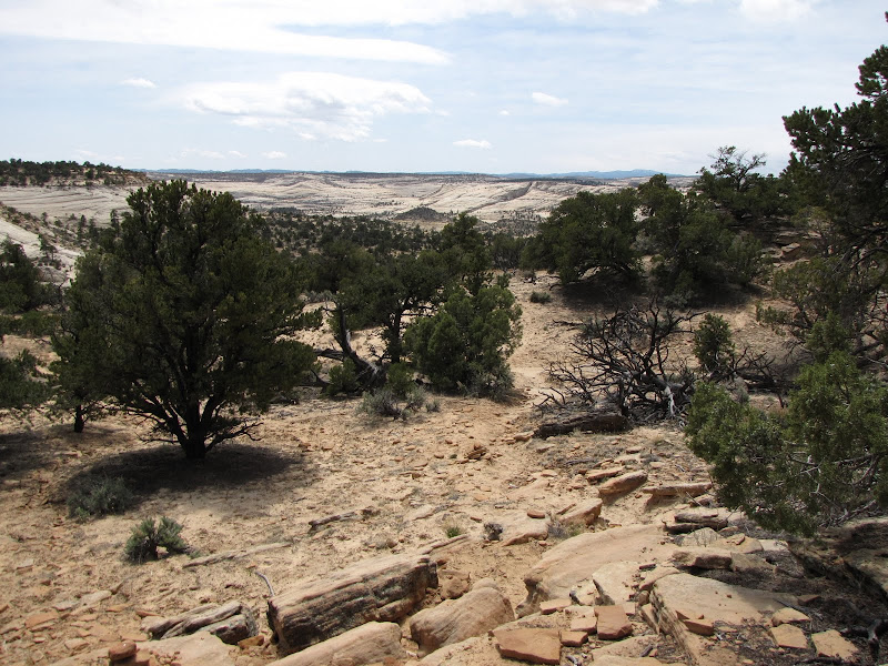
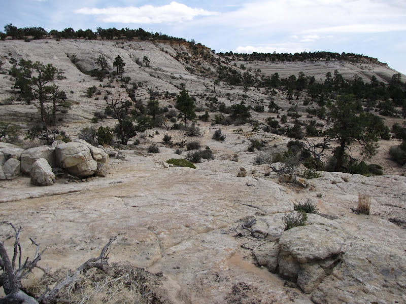
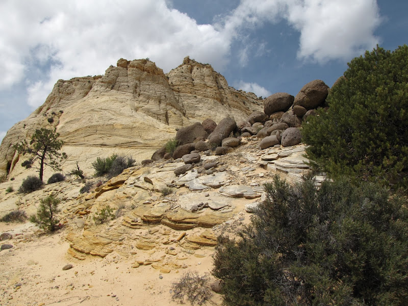
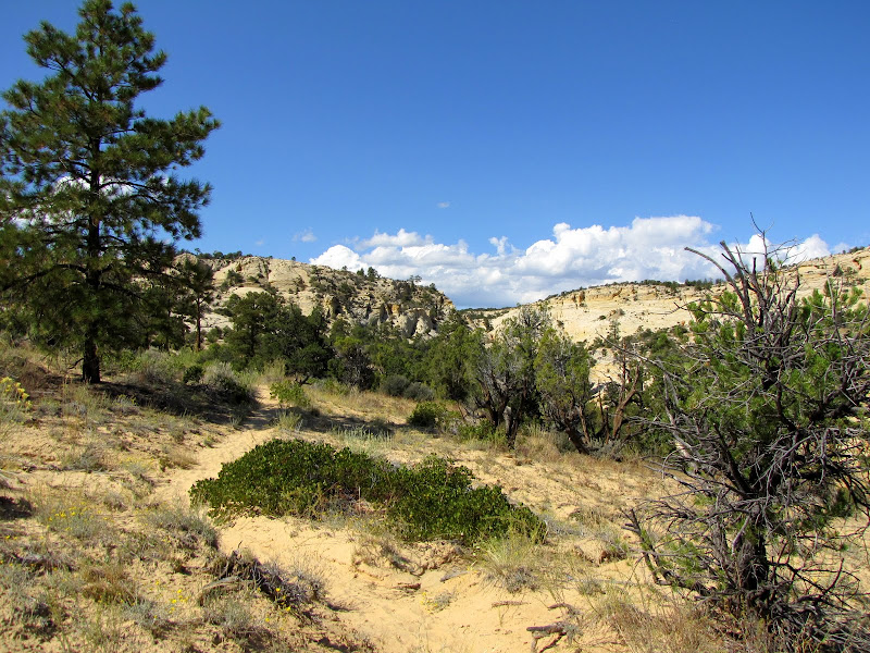
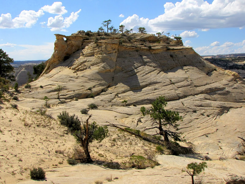
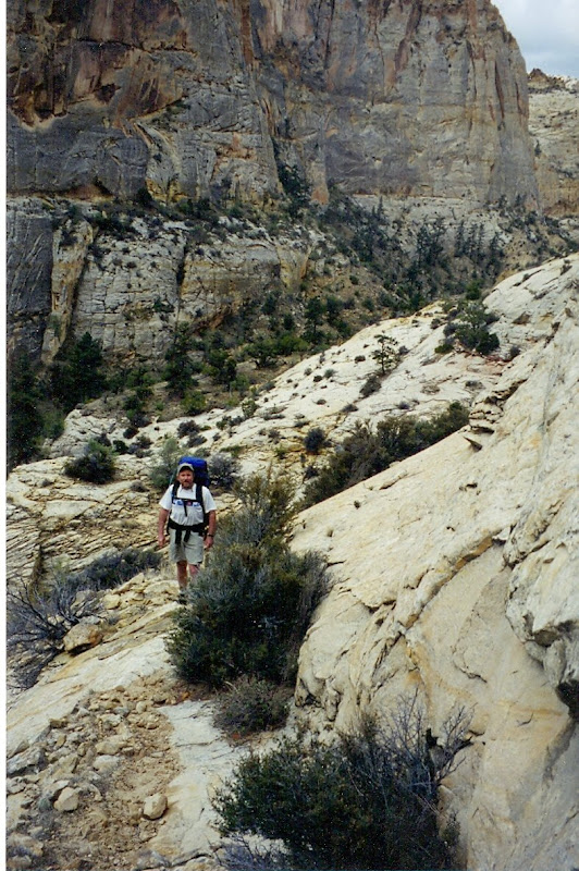
Once you've climbed up and out the trail begins a long scenic trek across the bench. The path alternates at first between short sandy stretches with widely scattered vegetation consisting mainly of waxleaf currant, manzanita, pinyon, and ponderosa pine and broad shelves of naked whitish-yellow slickrock.


The trail is marked by periodic cairns, and careful observation is required to keep moving in the right direction. Another landmark is shown in the pictures below - an old telephone line which still crosses the canyon in places. This link between Boulder and Escalante was a patched up affair, strung along trees and subject to frequent disruption. Notice the baling wire repair on this section.


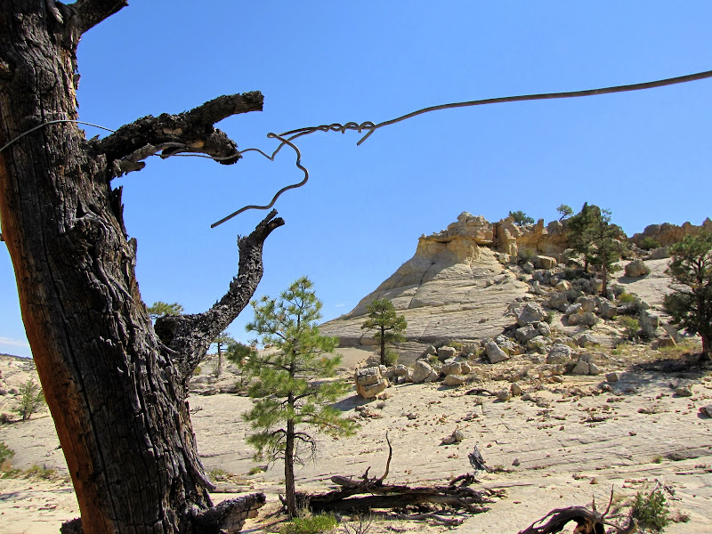
The parallel grooves in the rock show where the line sagged along the ground, allowing the steel to cut into the softer sandstone as wind in the trees created a "seesaw" action.


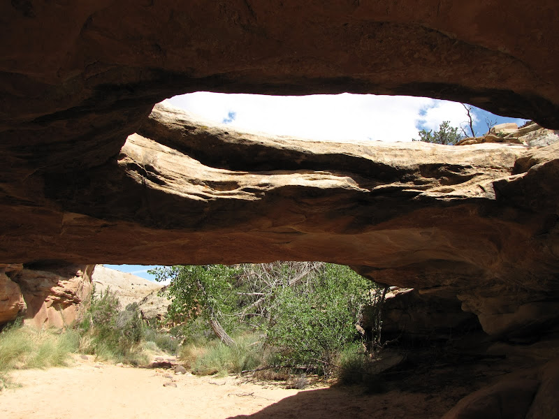
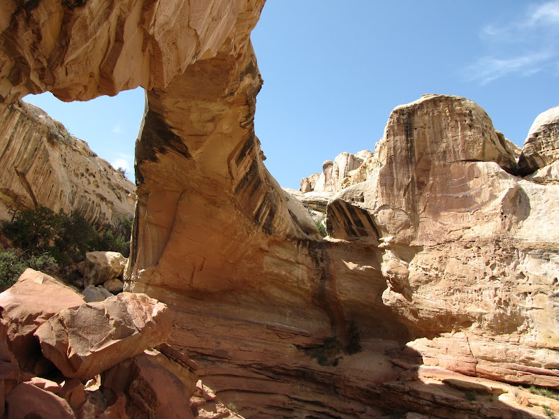
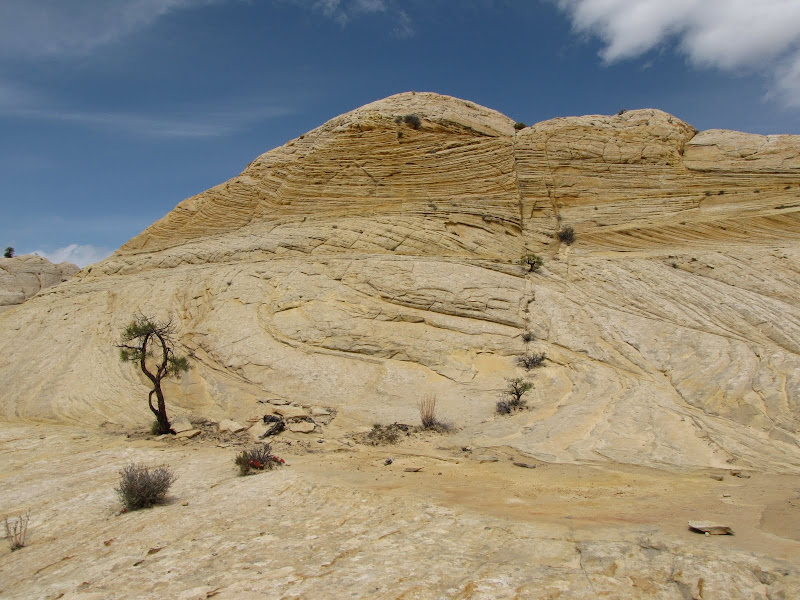
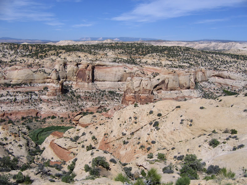
As the trail takes you deeper into the wilderness, the more you can appreciate what a unique environment surrounds you. The shapes and patterns of the cross-bedded sandstone combine with sparse vegetation to create a surreal and starkly beautiful landscape.


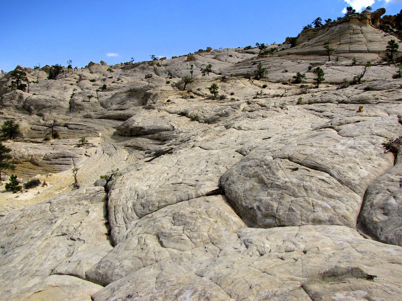
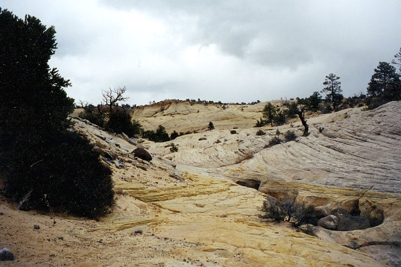
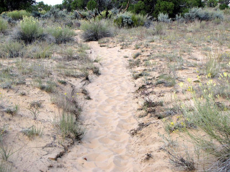
The entire region of Box - Death Hollow is composed of sand in one form or another. The strikingly beautiful Navajo sandstone forms the underlying structure of the canyons and plateaus, and as it loses cohesion it turns to, well, sand. There is a lot of very fine, loose sand on the bench between Sand Creek and Death Hollow, and the trail has to cross extended segments of it. If it's dry, walking these sections is arduous, especially if you are wearing a heavy pack.


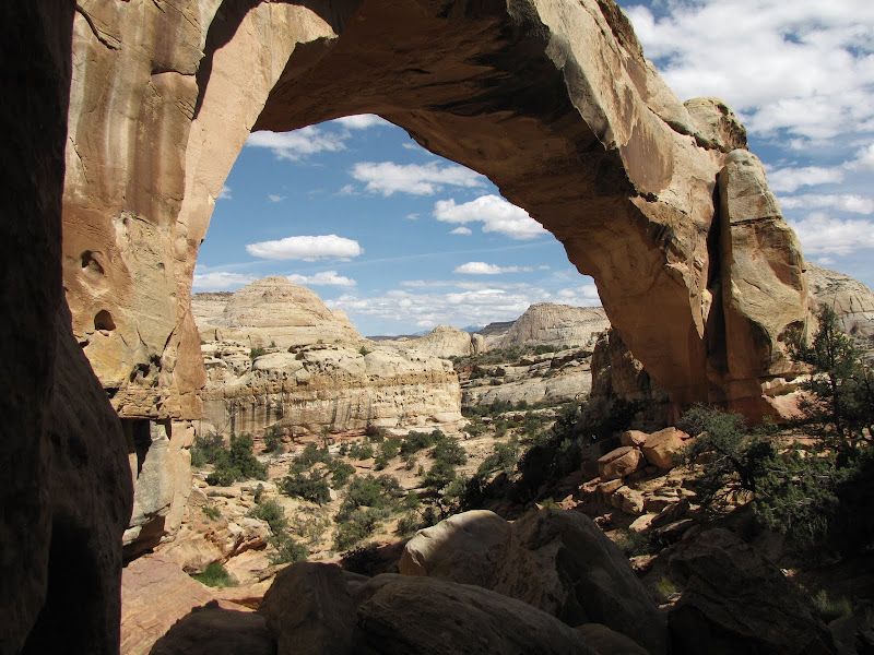
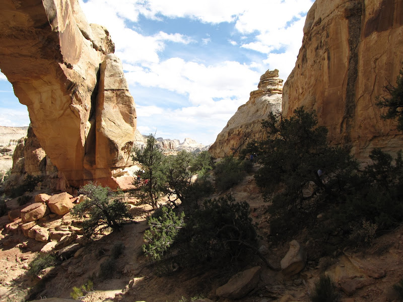
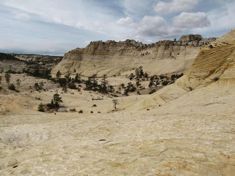
Fortunately there is a great deal of fantastic scenery along the way to help keep the hiker focused and motivated.


The final approach to Death Hollow crosses a particularly long segment of deep sand, but when it's finally over and you get the first glimpse of what lies ahead, you'll know it's been worth it.


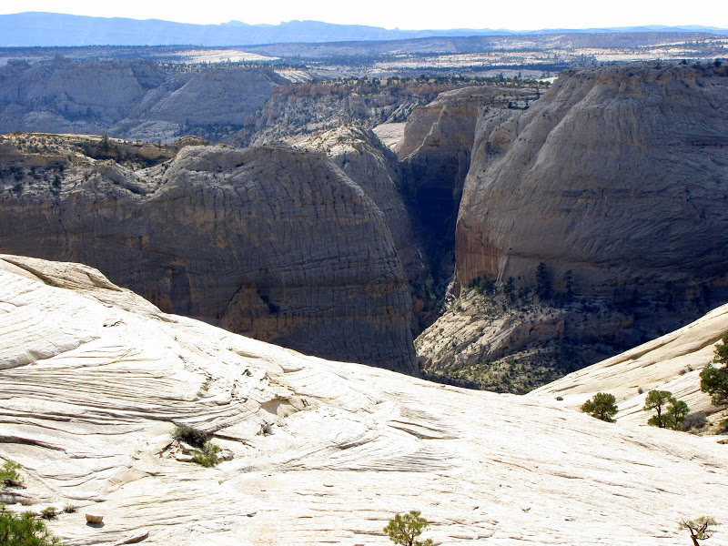
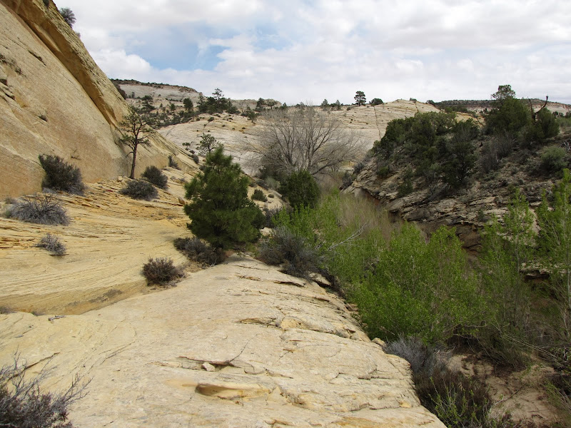
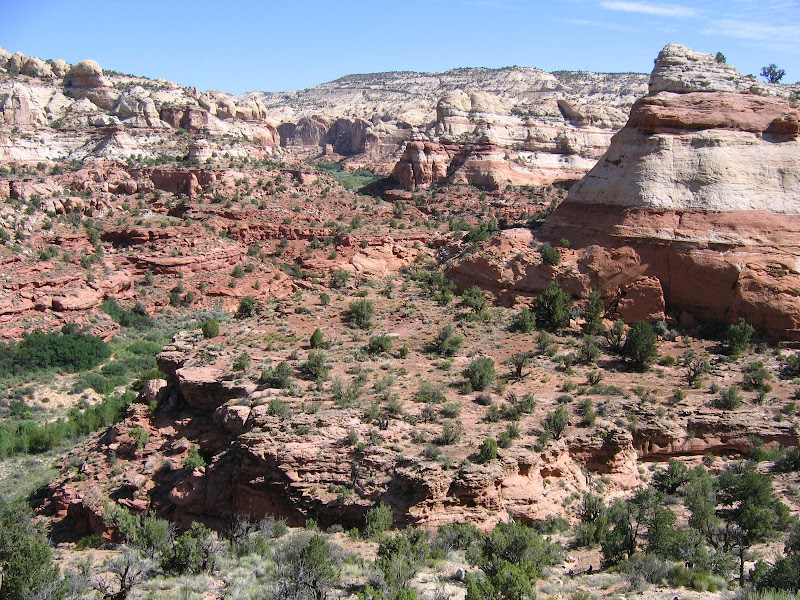
The trail begins to drop steadily over 800 feet from the rim on sloping benches, and it is easy to imagine how the canyon earned the name. When dry, the surface of the rock offers some friction, although in places it's loose and crumbly and needs to be negotiated carefully. When the sandstone becomes wet, you can appreciate how the term "slickrock" came to be. Although the descent is not inherently dangerous, it does need to be respected.


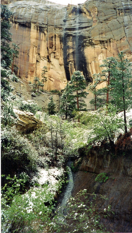
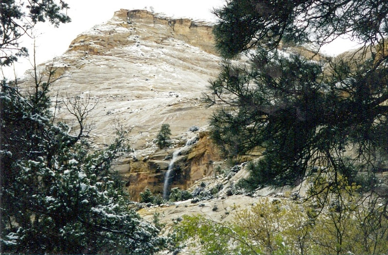
Year-round water flows through Death Hollow, and the bottom of the canyon has accumulated enough eroded material so that plants and trees have a place to take root. Ponderosa trees and riparian species are abundant, and there are some good albeit sandy places to camp along the creek.


The sheer walls of the hollow are impressive, and during storms many small, ephemeral waterfalls can be seen cascading down from above. Water here does not seep into soil, as precious little exists. Nearly every drop that falls from the sky winds up carving its way through countless channels and cracks to the larger creeks, and thence into the Escalante River.


Making this trip allowed me to discover some of the long held secrets of the Box - Death Hollow Wilderness. Like many of the places I've been fortunate enough to visit, I know I've only seen a fraction of what exists. But it's enough to know that coming back here has to be included on my very long list of "musts". When I do return, I'll let you in on it too.

Thursday, May 26, 2011

Navigating Capitol Reef - Hickman Bridge


Capitol Reef offers a network of “front country” trails that lead to outstanding natural features. In presenting those trails it makes sense to start with arguably the most popular and heavily utilized trail, Hickman Bridge. The main reason this attraction sees so many visitors has more to do with its’ proximity to the highway than anything else. Since most visitors are passing through the park on their way somewhere else, a quick trip to see the bridge represents a chance for folks to get out of the car for an hour or so before continuing on.

The relatively easy 2.2 mile (round trip) trail begins at a parking area right alongside Utah Highway 24, just a few miles east of the Visitor Center. At this spot the Fremont River crosses under the road from south to north, and the path is constricted between the water and a sheer rock wall for a few hundred yards. Once past the bottleneck, the trail begins a moderate climb along a maintained route to the terrace above. The grade is not too steep with a small number of switchbacks, although some may find ample excuse to stop and admire the sweeping view while catching their breath.


Once on the level bench the trail splits in two, with the left fork heading for the bridge, and the right fork continuing on higher and farther to the Rim Overlook and Navajo Knobs. I’ll present more information about hiking to these rewarding but more challenging destinations later in another post.


Heading in a general westerly direction, the path enters a modest drainage where a smaller but equally interesting double natural bridge is forming over the shallow dry creek bed.


If you’ve read a previous post I wrote last year about Natural Bridges National Monument, you might recall I discussed the difference between an arch and a bridge. Basically the major factor in shaping each feature and how they are classified relates to running water. Arches typically form primarily where harder rocks overly softer formations, and the opening in an arch weathers out as a result of repeated freeze/thaw cycles in natural cracks, fissures, and faults.


Bridges develop with the aid of water, usually at a gooseneck or meander in the course of the stream or river. The water does not have be perennial or permanent, it just needs enough time to erode the base away more quickly than it is being removed by natural processes from the upper section. Hickman Bridge is such a feature, as water is only present when heavy rain falls on the area, and the instrument of creation is a dry, sandy slickrock wash for much of the year.

At nearly a mile in, the trail splits again, this time forming a short loop which approaches then passes directly under the bridge. No matter which branch you take, the arch appears after a short walk.


The arch is oriented north-south and the best views framing the Navajo domes of the Reef are found on the northwest aspect. As mentioned at the beginning, this is a popular hike and you should expect to share the scenery with others. When I visited in late May I saw around 30 to 40 people at the arch and along the trail, so if enjoying scenery in peaceful isolation is your goal, Hickman Bridge is probably not the place to be.


Even with the considerable traffic encountered here, this is a pleasant walk in beautiful surroundings. No matter how you look at it, it sure beats a day at the office.

Sunday, May 8, 2011

Ocean of Stone: Box - Death Hollow Part I

Box-Death Hollow Wilderness. The name alone entranced me for years. A relatively small, mysterious area about which I knew next to nothing, this intriguing sounding spot in south-central Utah invited exploration ever since I saw it on a map over 25 years ago. Once I finally had a chance to see in person what no contour line on paper can accurately portray I knew I had to check it out.

As a wilderness area Box - Death Hollow has to be explored on foot, although a good idea of what is contained within the boundaries can be gleaned from vantage points around the periphery, including Highway 12 and the aptly named Hell's Backbone road. Comprised of tributary streams which form the headwaters of the Escalante River, the name derives from two geographic features found within. The first is The Box, a sheer walled 10 mile canyon on the west side through which Pine Creek flows.

The second major canyon is Death Hollow, named for hapless livestock which plunged to their doom from sheer sandstone walls. Despite the morbid nomenclature, Death Hollow is a place of surpassing beauty, as is the entire wilderness around it.


There is one designated trail in the wilderness, although others exist that do not merit "official" status (read: they see no maintenance nor does anyone take any responsibility for their use). I have yet to hike the named trail which travels along Pine Creek into the Box, but it's on my list to do soon. For this post I'll share a recent experience on a route that crosses the heart of the region.

Boulder Mail Trail

As names go, the Boulder Mail Trail is quite descriptive. Before the construction of Highway 12 linking the community of Boulder with the outside world, supplies and correspondence had to be transported on horseback across the no-mans land of Death Hollow. The route traverses open benches and terraces of Navajo sandstone for 16 miles, and crosses three canyons enroute. Much of the terrain is bare slickrock studded with occasional islands of ponderosa pine, and some route finding ability is necessary.

The entire hike can be done as a point to point with a car shuttle, or if you are traveling solo a partial trip is possible with a "there and back" approach. I have done the latter as far as Death Hollow, which is an easy 4.5 miles one way from the east side. It is recommended that one way hikers begin the journey from this direction, as the east side is about 1000 feet higher than the west end, making the trip a bit less arduous.

The best time to visit this area is generally spring or fall, since summer heat and flash flooding can present hazards to casual hikers. Water is available in Sand Creek and Death Hollow, but shade is at a premium and bare expanses of rock dominate the landscape. Winter is cold with frequent snow and freezing temperatures; ice becomes a hazard when trying to negotiate exposed sections along canyon walls.

The east end of the trail is located above the town of Boulder, along the Hell's Backbone/Posey Lake road. The turnoff is not signed, but ask a local how to get to the Boulder "airport" and they can give you directions.


The airport is nothing more than a dirt landing strip along McGath Bench, marked somewhat whimsically with the fuselage of an old aircraft stuck nose first in the dirt. When I visited this spring, the sad state of the windsock assured me there was no need to watch for low flying aircraft.

The beginning of the trail is quite innocuous, starting as it does high on the rim through a dwarf forest of pinyon and juniper. Views are limited to the surrounding trees, and the path occasionally opens up into a sea of sagebrush. This is Utah, after all.


After more than a mile, glimpses of white sandstone begin to appear in stark contrast to the dark green layer along the horizon. When the trail finally breaks out to the edge of the canyon, the views are well worth the extended stroll through the trees.


The slickrock benches of the canyon present few opportunities for vegetation to gain a foothold, and soon naked rock dominates the scene. This Navajo sandstone landscape is beautifully illustrative of a depositional environment found in deserts and at the edge of ancient seas. Ripples frozen in stone evoke waves lapping at some long ago shore, and cross bedded layers pull the eye this way and that as the mind seeks to make sense of the overarching pattern.


Looking ahead, the open expanse invites the visitor to ramble aimlessly, but the actual trail is fairly well cairned. Picking a simple line through gently descending bowls and dips, it is hard not to just stop and stare slackjawed at the scenery.


Nearing the bottom of the basin, a small but vigorous stream called Sand Creek appears out of the north. Fed by snowmelt and springs from lofty Boulder Mountain, the water supports a riparian community of willows and cottonwood, as well as industrious beaver.


Amidst the sinuous waves of undulating stone, incongruous black basaltic boulders appear out of place. These volcanic orbs were transported from surrounding plateaus by glaciers during the last ice age, worn smooth through the lapidary action of grinding ice.


My surroundings are nothing short of sublime, and I decide to stop here for a bit to absorb as much grandeur as possible before continuing on to Death Hollow. It's only a couple more miles, and I've got all day to enjoy a truly spectacular setting. Life is good....