Wednesday, April 20, 2011

Spring! Part III


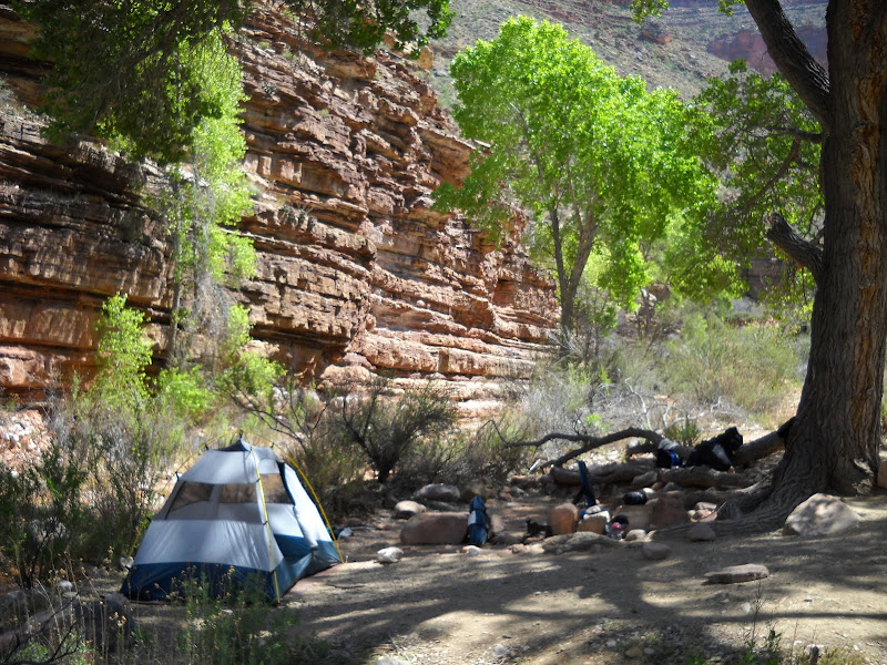
Spending two nights at Hance Creek pretty much by my lonesome (well, except for a few random hikers and the frogs) has done wonders for my state of mind. Not that I am distressed, but I do spend winter dealing with lots of people, and sometimes you just need to get away. Besides isolation, surrounding myself with resplendent scenery helps me focus on what lies ahead for the summer.

Packing up camp and loading all the gear back into the pack, I get a reasonably early start along the way to my next waypoint - Cottonwood Creek.

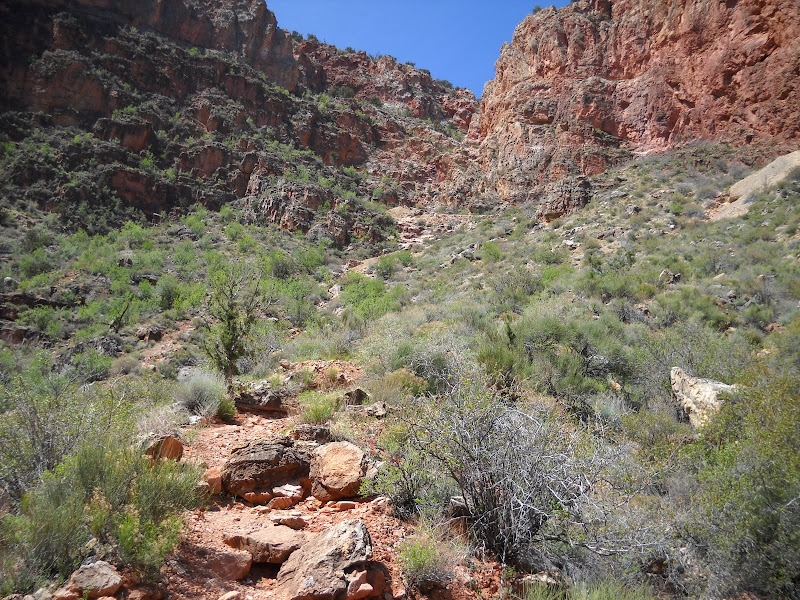
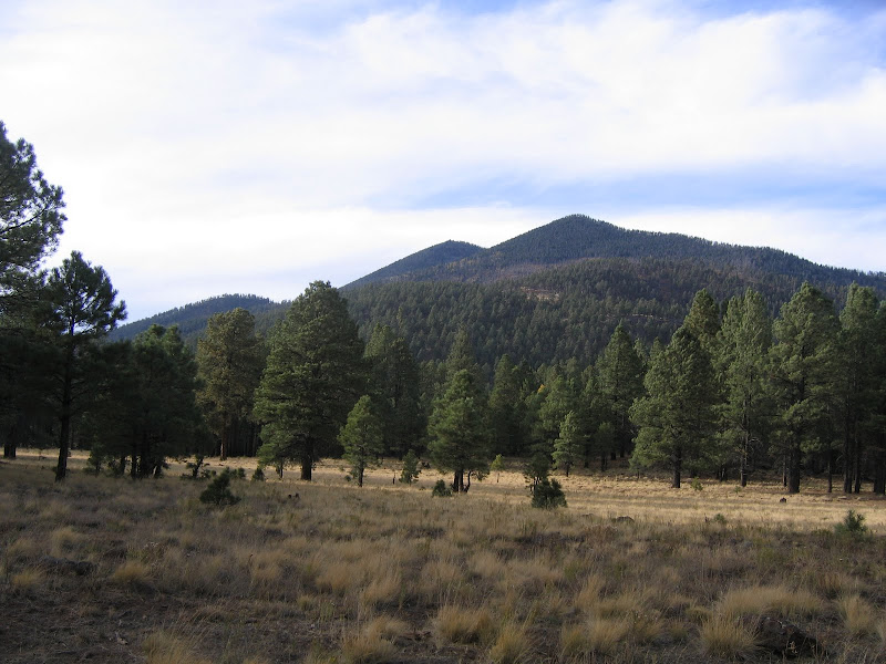
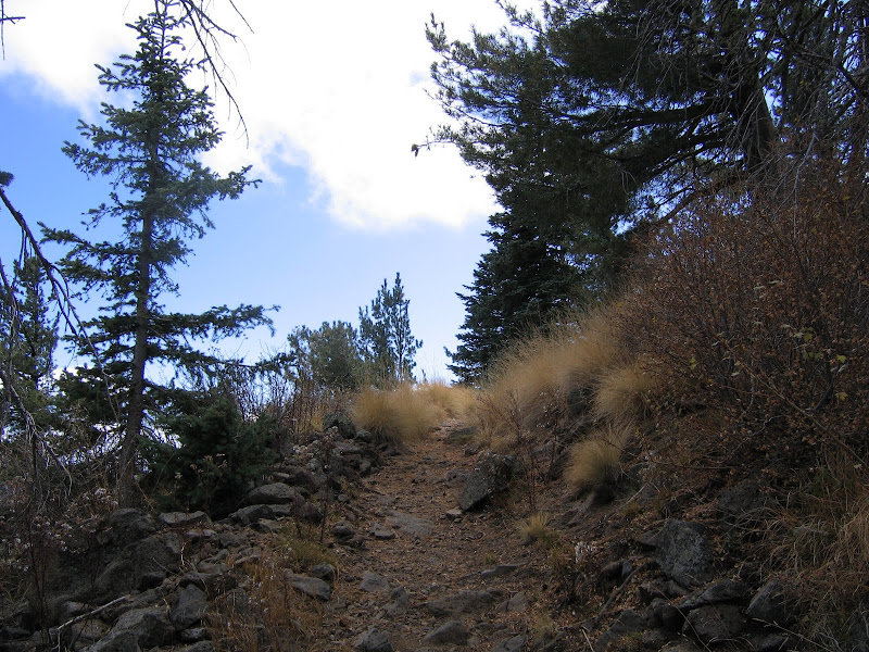
Except for being located on the west side of Horseshoe Mesa, Cottonwood could be a fraternal twin to Hance. Getting there is a relatively easy (as far as Grand Canyon trails go) 5 mile hike along one of my favorite trails: the Tonto.

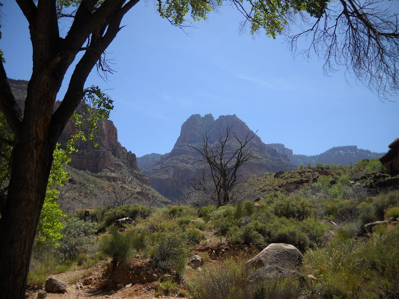
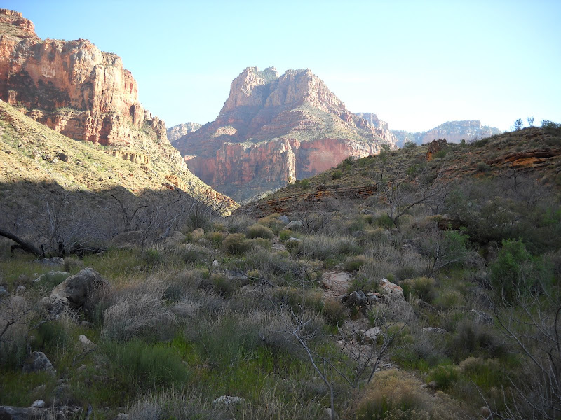
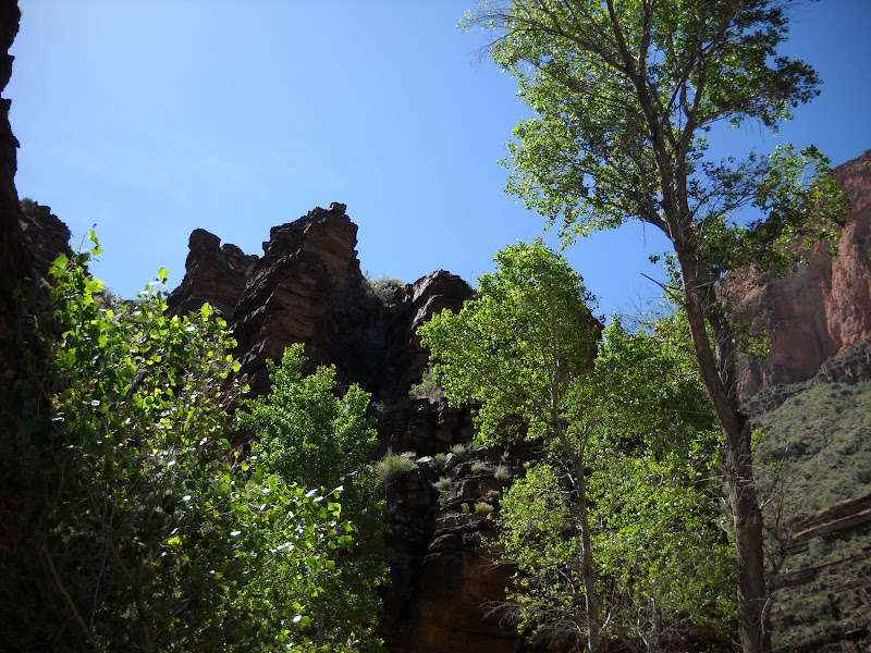
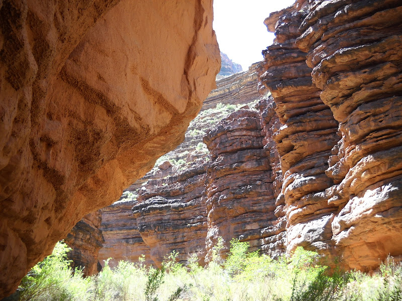
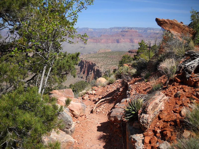
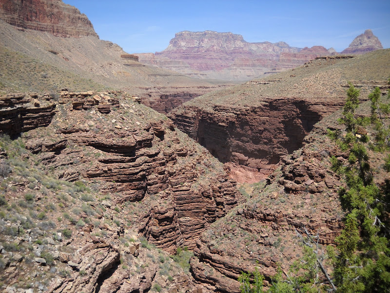
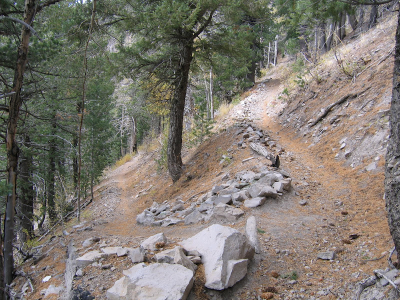
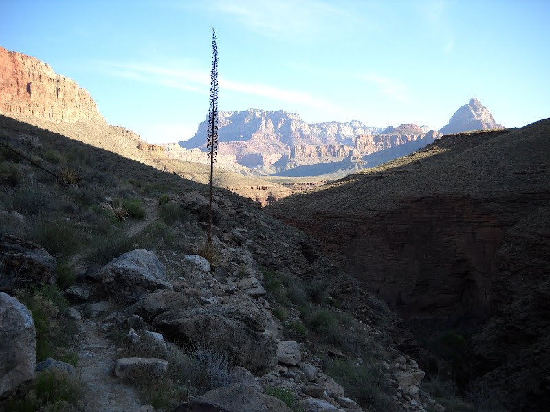
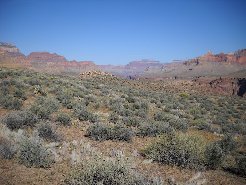
Tonto trail has the distinction of being the only practical east-west route through central Grand Canyon. Stretching over 95 miles, hikers utilize the Tonto to connect with most rim-to-river routes, allowing for multiple choices in trip itineraries. The beauty of this trail is that it's located well below the rim but above the River, so in many instances views are all-encompassing and panoramic.


The Tonto trail is like a contour line on the map. Staying at approximately the same elevation it follows the path of least resistance, which in terms of Canyon geography is definitely not the most direct route, or in many cases the easiest. As there are many side canyons and drainages (erosion channels not yet big enough to be called canyons) that feed into the Inner Gorge, the path must wind its way in and out innumerable times, leaving hikers who wish to make quick progress frustrated at times. And though in most cases there are no significant elevation changes on the Tonto, that doesn't mean there aren't plenty of ups and downs as the trail must negotiate every pleat and fold of the terrain.

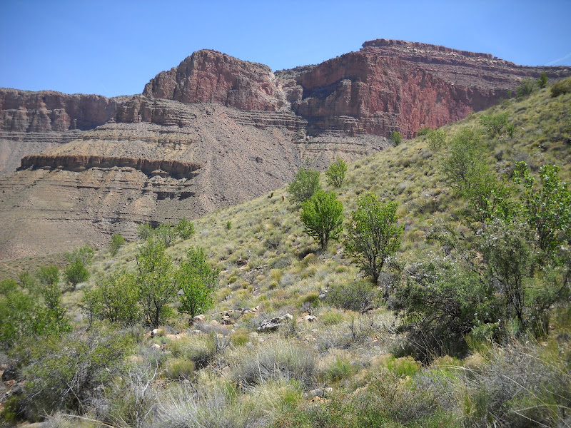
Many times hiking here it is easy to lose perspective because the trail is confined within the walls of a canyon. Since everything you see is on a massive scale, visitors still feel dwarfed by the enormity, yet the bigger picture is missing. Only on the Tonto, floating somewhere above the deepest chasm and below the soaring ramparts overhead does it begin to make sense. This is why I like hiking here.


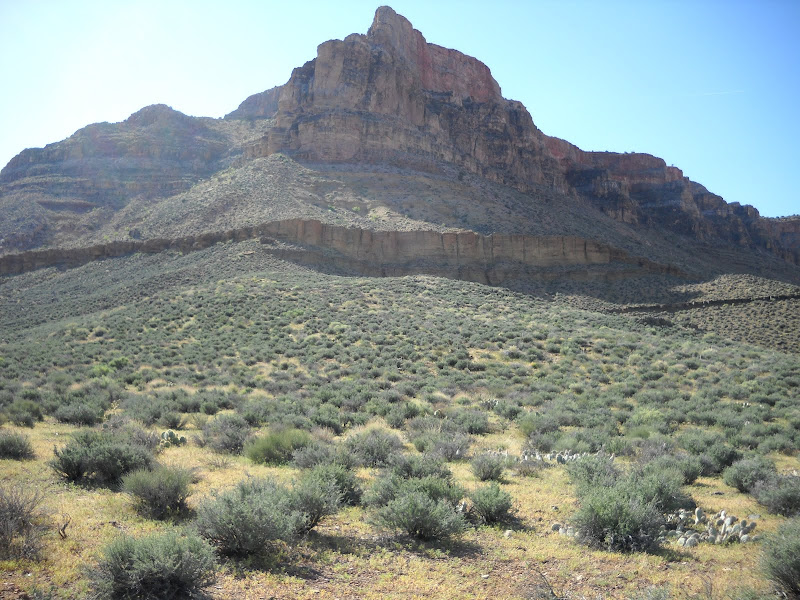
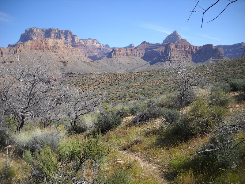
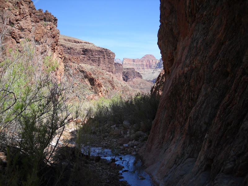
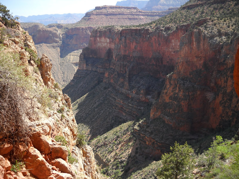
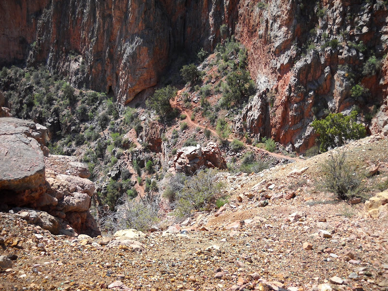
After leaving the yawning bay of Hance Creek, the trail circumnavigates westward along the base of Horsehoe Mesa, eventually turning back south into the mouth of Cottonwood Creek.


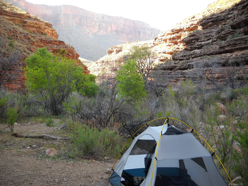
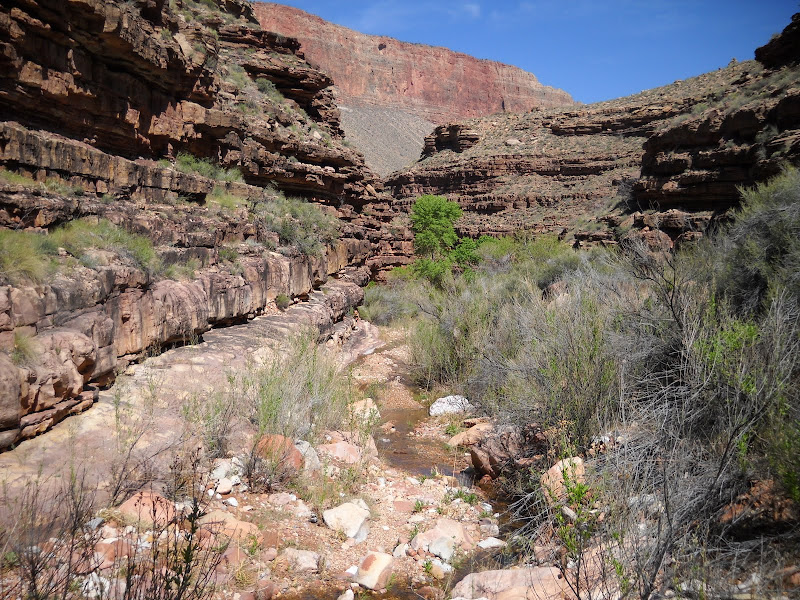
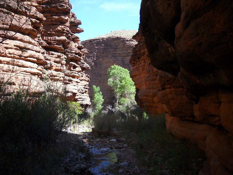
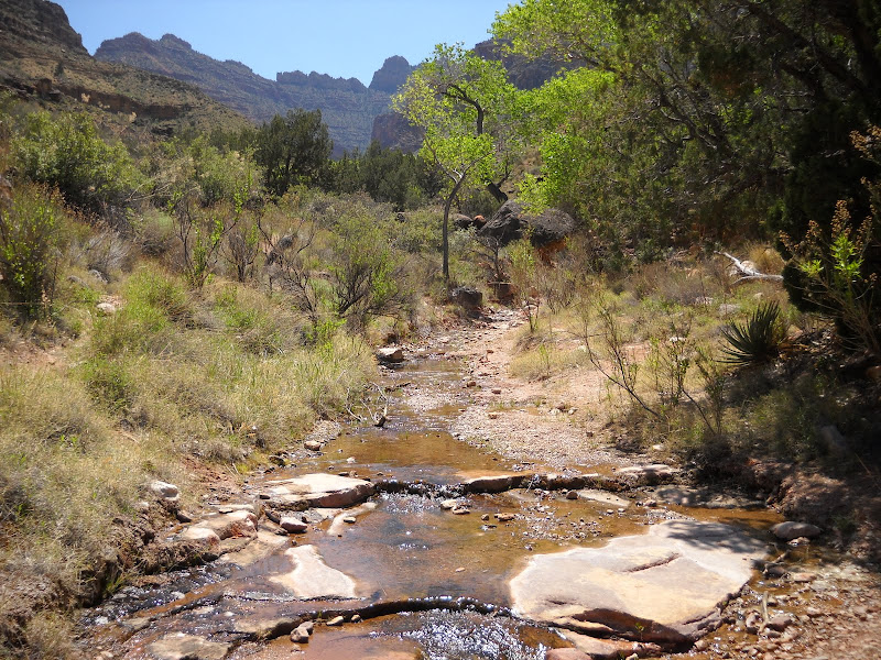
After a few hours spent trundling along the Tonto with my thoughts, I see the first glimpse of a tiny ribbon of water and verdant green trees ahead. Once again I arrive well before any other visitors, and pick out a delightful spot next to the creek, with an outcropping of Tapeats that will soon provide afternoon shade.


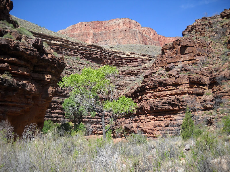
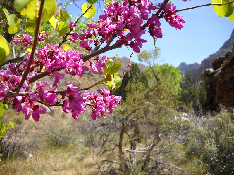
As always I give thanks for the gift of flowing water. Like Hance Creek, Cottonwood provides just enough to support a wonderful diversity of plants and animals, as well as a few thirsty hikers.


This lizard probably doesn't drink much, but I'll bet he feasts on insects drawn to the stream.


The rest of the afternoon and evening pass all too quickly, and soon I find myself preparing for bed. Fortunately the frogs here are fewer in number or perhaps have diminished libido, leaving me to fall asleep quickly. I want to rise early in the hopes of beating the sun before it rises over the Mesa.

By 7:30 I am packed and ready to go. I repeat the Grand Canyon hiker's mantra to myself: One foot in front of the other. I also like the proverb which states the best way to eat an elephant is "one bite at a time". Even though the uphill climb is hard I'm glad I'm hiking instead of eating a pachyderm.


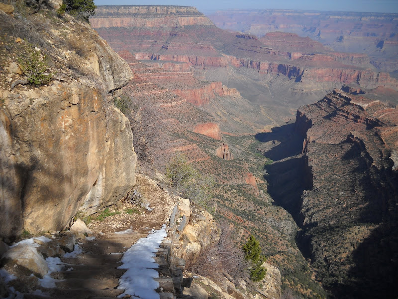
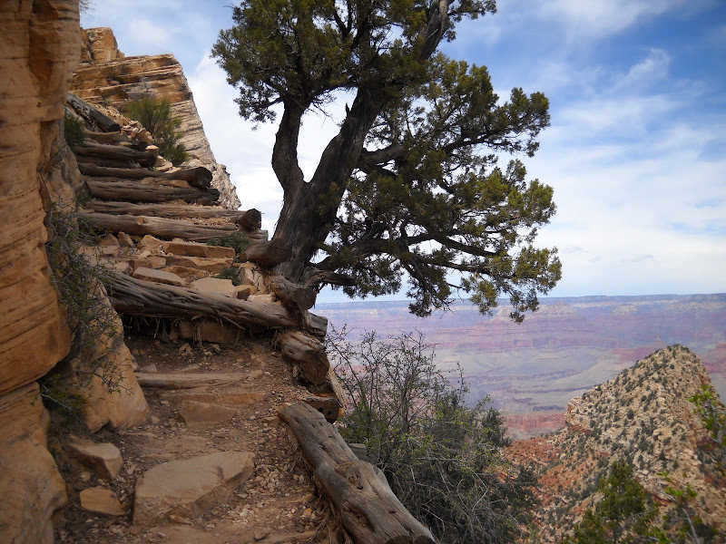
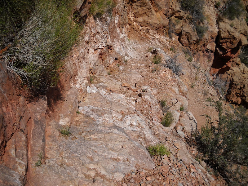
The overall trail out is steep, but the hardest section comes right away - the climb back onto the Mesa through the Redwall. It's a real grunt, but eventually I reach the top.


Once on the Mesa, I take a minute to check out the remains of an old stone cabin left from the days of copper mining. The Mesa and surrounding area are strewn with odds and ends from the late 1800's and early 1900's. It's funny to consider that back then, these guys were just discarding what was broken or no longer useful, something that is called littering today. It makes me wonder if archaeologists and historians of the future will view our detritus the same way.


The remaining 3 miles and 2400 feet await me. I am not as sore as I was when I first arrived a few days earlier, but even so it will take willpower and many breaks to climb out of the Canyon. Still I know the effort is well worth it, for the time I've spent here is more precious to me than just about anything. In fact, I'm already thinking about the next trip.

Spring! Part II

Downhill hiking on a steep trail with a heavy pack (and for some reason my pack is always heavy, in defiance of repeated attempts to lighten it) has never been a favorite activity of mine. So when I finally reach my goal for the day, the very first thing that happens after unceremoniously dropping my burden is to remove my boots, and stick my feet in the cool and soothing waters of Hance Creek.

Soon hot, tired feet cease their complaining, although I notice that black half moon circles are starting to form under the nails of my big toes, confirming that I just spent the last 3 hours jamming both of my feet into the front of my boots.

There are several suitable camp sites located up and down the narrow canyon near the trail junction, however only one has the welcoming shade of a mature cottonwood tree. I noticed as I approached the creek that no one was around, so I quickly staked my claim to this idyllic and sheltered spot. To say I was pleased with myself for having the good fortune to arrive before anyone else is an understatement.

Hance Creek is a small, shallow rivulet of year-round water that provides liquid sustenance for countless plants and animals in an otherwise dry and austere desert setting. For folks from places where running water is abundant and often taken for granted, it may come as a surprise how revered and sacred such a small, apparently insignificant stream is to me or anyone else who has experienced how utterly lacking the Grand Canyon is in moisture.


To illustrate how vital this corridor of life support is, one only has to look up a few feet, beyond where the influence of water subsides. Down in the stream bed, willows, cottonwoods, insects, and other myriad forms of plant and animals thrive in a perpetually wet zone no more than 20 feet across. Outside this narrow envelope life exists, but not in any abundance and only to the extent that nature has developed mechanisms for coping with water deprivation.

Without the certainty of water, life here would surpass being merely difficult and transgress into nearly impossible - unless you're a cactus or other desert adapted plant or animal. For me, it would almost certainly mean a less enjoyable experience, as well as a much more challenging hike. Fortunately, such is not the case, and content with my lot I set up camp and begin to unwind.


After a warm, drowsy afternoon spent alternating between gazing spellbound at my surroundings and dozing in my camp chair, evening descends on the canyon. With it comes the croaking of amorous frogs, a few at first, then a swelling chorus, finally culminating in a soaring crescendo. The sound reverberates off nearby canyon walls, multiplying and echoing the lusty enticements until all other sound is drowned out in a cacophony of desire.

Fortunately I am tired, and the drone of love stricken amphibians soon becomes white noise with which to drift off to sleep.... until the moon rises and wakes me with lambent illumination. Unaware as I usually am regarding the phases of the moon, I was somewhat surprised when the nearly full lunar orb rose over the canyon wall, bathing the surroundings with pearlescent light bright enough to cast strong shadows.

I tried my best to capture the enchantment of the scene using a compact point-and-shoot camera in my possession, however the limited settings available did not allow for adjustment, so you'll just have to believe me when I tell you how I sat on a rock for over an hour marveling at the clarity afforded by the ghostly light. I certainly did not resent the interruption of my slumber, however when I did finally retire to my tent sleep came quickly.


I stayed in my sleeping bag late the following morning, later than I've ever slept on a canyon trip. When I finally rose around 8 o'clock, the day was well under way, although the frogs were silent, apparently exhausted from romantic endeavors during the night. With a full day to lounge around Hance Creek in idle slothfulness, I decided that a simple hike down canyon would help stretch tight muscles and loosen stiff joints.

Before any other considerations however I took time to have breakfast, then made a cup of coffee. I poured boiling water through a filter of ground coffee into my mug, then found a nice flat rock to perch on while sipping the stimulating brew. There are many simple pleasures in life but few compare to a good cup of java, a glorious tapestry of natural beauty, and a day unplanned as yet to unfold. All is right with my world.

Except, as I finish the last of the coffee, I notice there appears to be something semi-solid in my mug. Puzzled, I remove the lid and "pour" the unidentified object onto a nearby rock. It takes a moment, but my eyes soon recognize the amorphous lump lying in a heap as a.... frog. Yikes. My initial reaction isn't disgust or revulsion, but simply curiosity. I realize that at some point during the night the frog jumped in the mug, probably seeking refuge from unwanted suitors. Unfortunately for the frog, the end result was meeting doom in a scalding immersion of strong coffee. Incidentally, the frog did not improve the taste of my coffee, but it didn't hurt it either.


Well, the show must go on, so I rinse out my cup and prepare for the hike downstream. There is somewhat of a trail, but for the most part the walk involves following the creek. At first the canyon is shallow and open, but soon the walls of Tapeats sandstone rise overhead, limiting the view of sky to a narrow strip.


At random intervals stately cottonwood trees (populus fremontii) provide oases of shade, their leaves rustling gently in down canyon breezes. The only other sound is the burble of the creek as it makes a ceaseless pilgrimage to the Colorado River along the stony channel.


As the cleft grows deeper, the upper edge of the oldest layer in Grand Canyon emerges above the creek bed and below the ever rising Tapeats formation. The Vishnu Schist is metamorphic rock, long buried stone from the ever recycled crust of the planet. Enormous pressure and heat warped and twisted the submerged earth, fusing the past into dense, erosion resistant granite. This super hard layer is the bedrock on which the Canyon is built, and presents a dark, forbidding appearance to the Inner Gorge.


The day grows warm, and the exposed black rock of the schist absorbs and re-radiates the heat back outwards. Even with water and shade, this would be no place to be in the middle of summer. I've gone about as far as I desire today, and decide to head back to camp for lunch and probably a nap in the shadow of the giant cottonwood. I am after all on vacation.

Next: A Perambulation on the Tonto

Tuesday, April 19, 2011

Spring! (A New Season For Exploring) Part I


No season gladdens my heart like Spring. I know each quarter of the year has it's own appeal, but as I get older the return of new and dormant life seems to revitalize my spirit. As I've mentioned before, my chosen vocation involves winter sports recreation, and emerging from the cold, short days of the last five months infuses me with enthusiasm for warm, sunny times spent in beautiful places.

I traditionally end my metaphorical hibernation with a backpacking trip into Grand Canyon, a place that couldn't be more different than the mountain I spend all winter on. This year I chose a destination that echoes last year's trip, but with a few key differences. First off this was to be a solo expedition, mostly due to a desire for some reflective time. I also wanted a trip where the ingress and egress were the same, to allow for easier logistical planning.

As a single hiker, I wanted solitude, but I also felt it wise to use areas where I might actually see others on occasion. I am capable and competent, and feel thoroughly comfortable in the backcountry by myself, but random chance and unforeseen accidents happen to even the best prepared individuals, and my inclination is to minimize unnecessary risk. (Author's aside: for compelling accounts of the many dangers that await visitors to this amazing place be sure to read Over the Edge: Death in Grand Canyon).

For this reason I selected a relatively straightforward hike involving circumnavigation of Horsehoe Mesa using a combination of the Tonto and Grandview trails. This option allows for campsites that provide access to flowing water, as well as scenic side canyons with verdant cottonwood trees and riparian vegetation to soothe away the winter doldrums.


All Canyon hikes begin with a descent into the depths. Viewing the abyss from above provides no real perspective for the distance to travel and elevation to lose, and it's not until the trail drops below the rim that a sense of scale begins to take hold.

Scenery notwithstanding, Grandview is assuredly one of the steeper trails, and the effort required to brake forward momentum with each step takes a cumulative toll on leg muscles that will definitely be felt later.

The upper trail is characterized by acutely pitched but well engineered sections that negotiate sheer faces of Kaibab limestone and Coconino sandstone. This masterpiece of rockwork was completed in the 1890's by miners to facilitate the removal of tons of high grade copper ore on the backs of hapless mules. To truly appreciate the labor and audacity required to construct it, it must be seen in person.


After a rapid descent through relatively erosion resistant upper layers the path begins a lengthy traverse through the Supai, a mixture of shale and limestone formed in a shallow marine environment. This relatively unstable formation is prone to slides, and this means frequent scrambles over large piles of rocks. Although the grade is not steep, the trail makes steady downward progress towards Horseshoe Mesa, a large U-shaped promontory atop Redwall limestone.


Once atop the mesa, there are basically three options to choose from. One includes a dry camp on the mesa itself, which many hikers do. The down side to this approach (literally) is the need to negotiate several hundred feet of very steep and loose trail to reach Page (or Miner's) Springs, where hikers can resupply with water.

Another option is to use the same steep and unstable trail to continue past the spring and eventually reach the perennial stream at Hance Creek, which is my first night's destination. The third choice is dropping off the opposite side of Horseshoe Mesa into the side canyon of Cottonwood Creek, where water is usually available during the cooler months.

By now I've descended 2500 feet below the rim and traveled about 3 miles, but the steepest pitch is yet to come. Before continuing I take a few moments to rest tight muscles and recharge my energy with a snack while enjoying the view. Below me I can see just how quickly the trail winds downs through the Redwall, the canyon's most prominent and formidable layer.


There is no subtlety to the trail at this point, as geography dictates that passages through the sheer Redwall use fault lines to negotiate what constitutes an impassable barrier through most of the Canyon. Down goes what can be loosely described as a trail, and great care must be exercised to prevent slips and falls on the way. I normally eschew the use of trekking poles, but this is one section that practically requires them to assist in maintaining balance while preventing an uncontrolled and accelerated descent into the depths.


By the time I reach the comparatively modest slope of talus about a third of the way up the Redwall, my thighs are trembling with exertion as my feet (toes, particularly) protest such inhumane treatment. Soon the ordeal is over, and in less than a mile I've dropped an additional 1000 feet to the Tonto platform, a broad expanse of Tapeats sandstone that forms a bench throughout much of central Grand Canyon.


This picture provides a look back up to the break in the Redwall that provides for passage of the trail.

Since I no longer have to give 100% of my attention to the trail, it's time to start enjoying the scenery again. One of the main reasons I choose to hike the Canyon in spring is the likelihood that plants, trees, and shrubs will be greening up at the lower elevations, and that temperatures will be pleasantly warm and inviting. Once again I am not disappointed with my expectations.


The trail climbs a small hill and at the summit the destination is revealed.


The deep side canyon of Hance Creek shallows at the Tapeats formation to meet the Tonto trail, where hikers can access the small but reliable stream. Water loving vegetation clings to the narrow but vital ribbon of precious moisture. It is here I will pass the next two nights, soaking up sunshine, self imposed isolation, and incredible natural beauty.

Next: Frogs, the Full Moon, and the Tonto Trail

Friday, April 8, 2011

On Foot Part VI - Kendrick Mountain Trail

Spending a day in a beautiful natural environment that offers a satisfying physical challenge is something I value greatly, and fortunately I am located in the midst of many such opportunities.

In this post I continue showcasing another rewarding hike located a short distance from my home in Northern Arizona. This particular outing takes me to the second highest point in the region, Kendrick Mountain.

Like all vertical features found in the area, Kendrick is a volcanic remnant of the extensive field found around Flagstaff. Rising to 10,418 feet above sea level, the summit offers possibly the best all encompassing view of the surrounding area.

Three trails ascend to the top of the mountain, although only the Kendrick Trail on the southern aspect sees much use. The other two, known as the Pumpkin Trail and the Bull Basin Trail ascend the western and northern flanks, and have suffered from fire and disuse. For this trip I ventured on the Kendrick trail, which is fairly easy to access on reasonably well maintained Forest Service roads.

The trailhead is well signed and has ample parking, although truthfully I've never seen more than a couple of other cars at a time. Kendrick is far enough off the beaten path so to speak, that not many casual hikers make the trip. Suits me just fine. There is also an information kiosk at the designated start, with information on the Pumpkin Fire which burned large parts of the mountain in 2000.

Since the trail must ascend 2400 vertical feet in just over 4 miles, it wastes no time getting started up a flank of the mountain. The path is very easy to follow, and in part uses an old road that once climbed the lower section. At a base elevation of 8000 feet, the surrounding forest is dominated by relatively young Ponderosa pine trees, whose black bark lend a somber appearance to the landscape.


Soon burned over areas appear, and the views towards the summit and out to the south improve markedly.


Like many mountain trails in Northern Arizona, Kendrick offers a steady grade, traversing across the slope through evergreen forests which gradually change with elevation. The omnipresent ponderosa soon give way to other species such as fir, aspen, and spruce as climactic conditions provide a slightly cooler and wetter environment.


As the summit gets closer, tantalizing views of the fire lookout appear ahead and above, encouraging hikers who may be flagging from the constant uphill grind and thinning oxygen content.


The trail finally reaches a ridge just below the summit, and this broad platform provides the setting for the old lookout cabin as well as an outstanding place to pitch a tent for overnight hikers.


To reach the apex of Kendrick Mountain, hikers must summon up another burst of energy to climb the remaining distance up a relatively short but fairly steep trail.


Once you reach the fire lookout, it is time to reward yourself for the effort by soaking up the panorama which surrounds you. If you hike Kendrick during fire season, you may also be able to visit with the lookout on duty (they usually welcome the company) and get an even easier 360 degree view. On a clear day, the North Rim of Grand Canyon is easily visible, as well as the highest point in Arizona, the San Francisco Peaks.


The lofty views and peaceful surroundings make a great destination for a challenging yet fulfilling day. Kendrick also works great as a relatively easy backpack for those who wish to stay and absorb as much of the inspiring landscape as possible. This particular hike ranks as one of my all time favorites, and I highly recommend it for anyone who wants to experience northern Arizona away from summer crowds found on more popular trails.