
 Spending a day in a beautiful natural environment that offers a satisfying physical challenge is something I value greatly, and fortunately I am located in the midst of many such opportunities.
In this post I continue showcasing another rewarding hike located a short distance from my home in Northern Arizona. This particular outing takes me to the second highest point in the region, Kendrick Mountain.
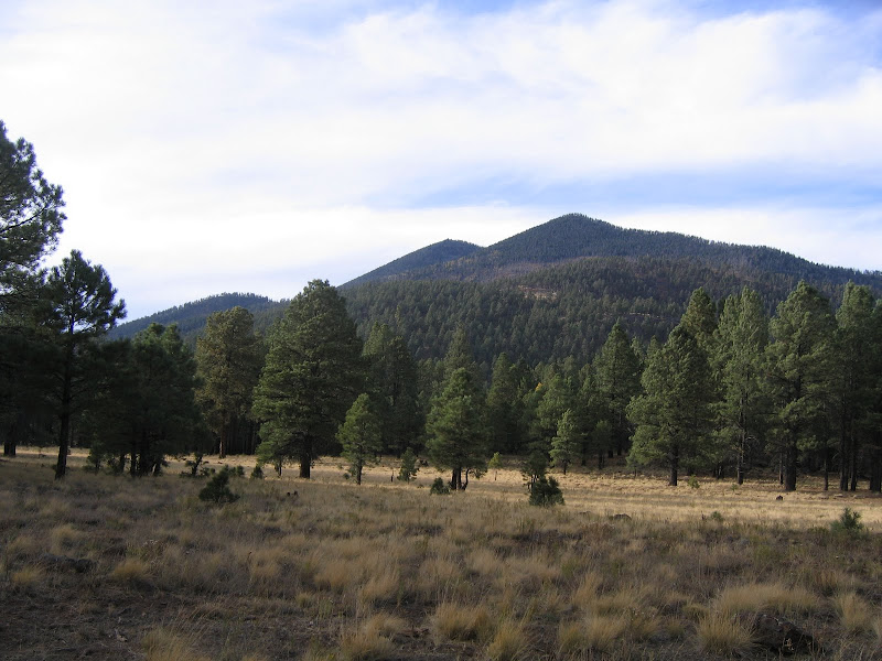
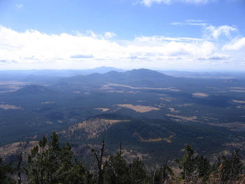
Like all vertical features found in the area, Kendrick is a volcanic remnant of the extensive field found around Flagstaff. Rising to 10,418 feet above sea level, the summit offers possibly the best all encompassing view of the surrounding area.

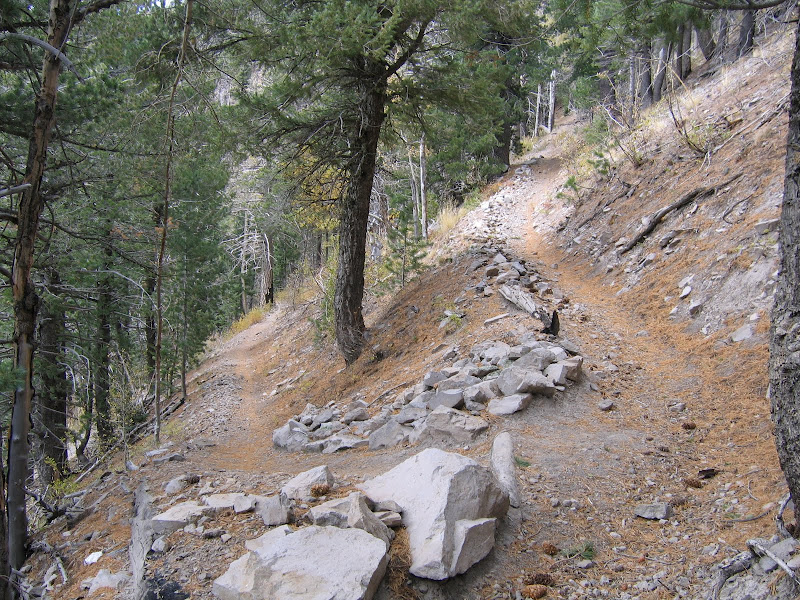
Three trails ascend to the top of the mountain, although only the Kendrick Trail on the southern aspect sees much use. The other two, known as the Pumpkin Trail and the Bull Basin Trail ascend the western and northern flanks, and have suffered from fire and disuse. For this trip I ventured on the Kendrick trail, which is fairly easy to access on reasonably well maintained Forest Service roads.
The trailhead is well signed and has ample parking, although truthfully I've never seen more than a couple of other cars at a time. Kendrick is far enough off the beaten path so to speak, that not many casual hikers make the trip. Suits me just fine. There is also an information kiosk at the designated start, with information on the Pumpkin Fire which burned large parts of the mountain in 2000.

Since the trail must ascend 2400 vertical feet in just over 4 miles, it wastes no time getting started up a flank of the mountain. The path is very easy to follow, and in part uses an old road that once climbed the lower section. At a base elevation of 8000 feet, the surrounding forest is dominated by relatively young Ponderosa pine trees, whose black bark lend a somber appearance to the landscape.

Soon burned over areas appear, and the views towards the summit and out to the south improve markedly.


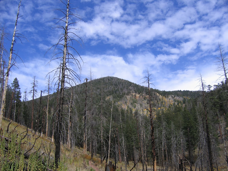
Like many mountain trails in Northern Arizona, Kendrick offers a steady grade, traversing across the slope through evergreen forests which gradually change with elevation. The omnipresent ponderosa soon give way to other species such as fir, aspen, and spruce as climactic conditions provide a slightly cooler and wetter environment.

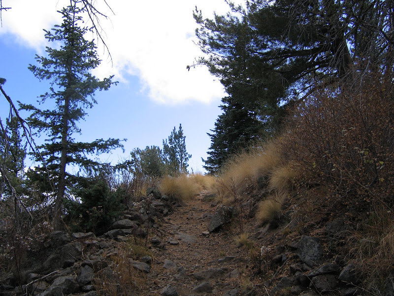
As the summit gets closer, tantalizing views of the fire lookout appear ahead and above, encouraging hikers who may be flagging from the constant uphill grind and thinning oxygen content.
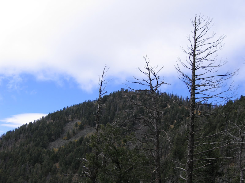
The trail finally reaches a ridge just below the summit, and this broad platform provides the setting for the old lookout cabin as well as an outstanding place to pitch a tent for overnight hikers.


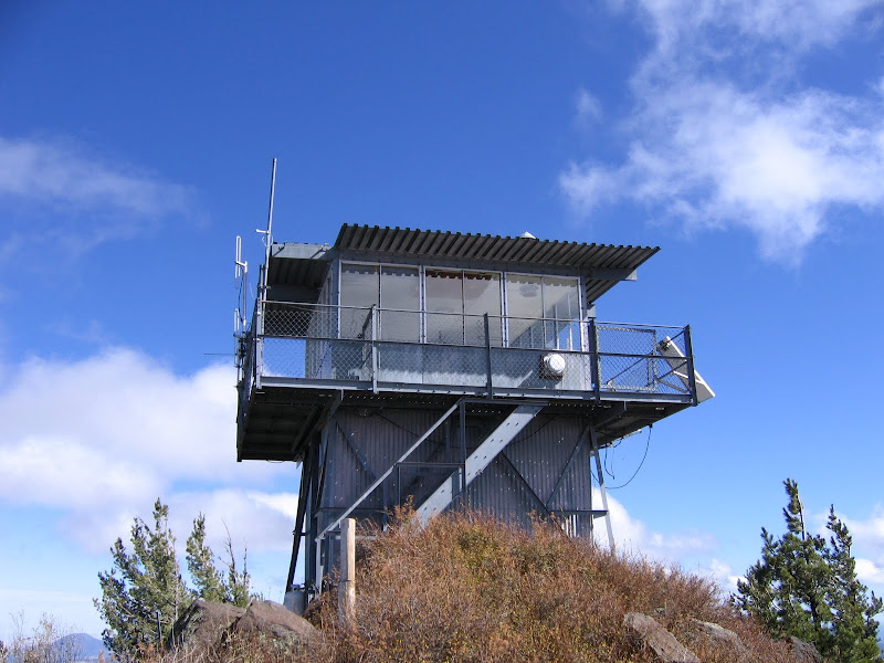
To reach the apex of Kendrick Mountain, hikers must summon up another burst of energy to climb the remaining distance up a relatively short but fairly steep trail.
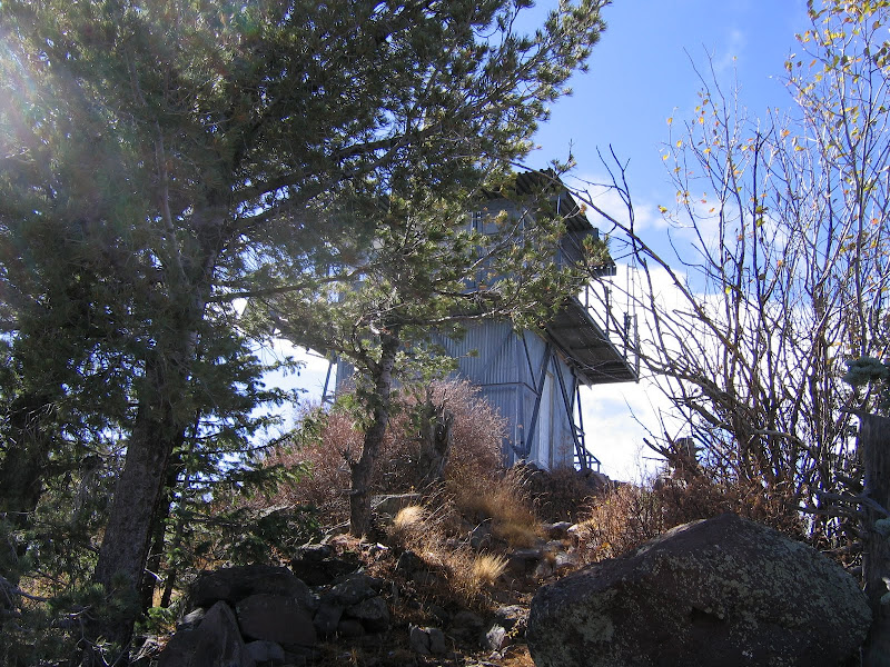
Once you reach the fire lookout, it is time to reward yourself for the effort by soaking up the panorama which surrounds you. If you hike Kendrick during fire season, you may also be able to visit with the lookout on duty (they usually welcome the company) and get an even easier 360 degree view. On a clear day, the North Rim of Grand Canyon is easily visible, as well as the highest point in Arizona, the San Francisco Peaks.


The lofty views and peaceful surroundings make a great destination for a challenging yet fulfilling day. Kendrick also works great as a relatively easy backpack for those who wish to stay and absorb as much of the inspiring landscape as possible. This particular hike ranks as one of my all time favorites, and I highly recommend it for anyone who wants to experience northern Arizona away from summer crowds found on more popular trails.
No comments:
Post a Comment