
 Bryce Canyon. Zion. Canyonlands. The names of these incredible geological wonders are familiar to the majority of the traveling public, and rightfully so since they contain a broad spectrum of the spectacular geology of southern Utah.
It would be easy for visitors to feel as though they had "covered the bases" by seeing these National Parks, however they are denying themselves an opportunity to experience a more intimate and equally beautiful showcase of nature's splendor if they miss a small and often overlooked treasure found in the southeastern corner of the state: Natural Bridges National Monument.
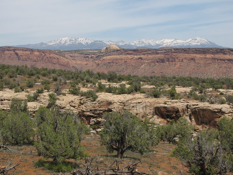
Located roughly 35 miles west of Blanding on Utah Highway 95, the Monument is accessed at the end of the short spur Highway 275. The entrance to the Park has a Visitor Center, as well as a small campground that fills quickly in the summer months. Fees are modest, but services are limited to water and vault toilets, so visitors should arrive prepared to be self sufficient.
The Monument's lack of notoriety is primarily due to a location off the beaten path, as well as being surrounded by a landscape that is replete with spectacular geology. The sad truth is that the Monument is simply overshadowed by more well known attractions to the north and west. It's easy to imagine that if the natural bridges had occurred anywhere else in the world, they would have considerably more attention.

The main attraction consists of three natural stone bridges carved from the walls of White Canyon. The term natural bridges is used instead of arches because of the distinct way these features are formed. Simply put, an arch weathers out of the stone without the aid of water, while a bridge occurs where a stream, creek or river erodes rock at the base of a canyon wall, usually in an entrenched meander. The three bridges here are named Kachina, Sipapu, and Owachomo and they represent different stages in the life cycle of this formation, with Kachina being the youngest and Owachomo the oldest.
Most visitors to the Park see the bridges by car, making use of a convenient one way nine mile long loop road. There are pullouts located at various points along the way that provide fairly good views of the features, but short and often steep paths lead to the bridges themselves providing the best experience.
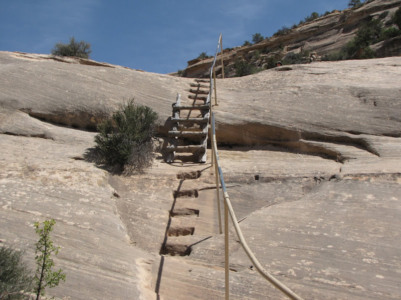

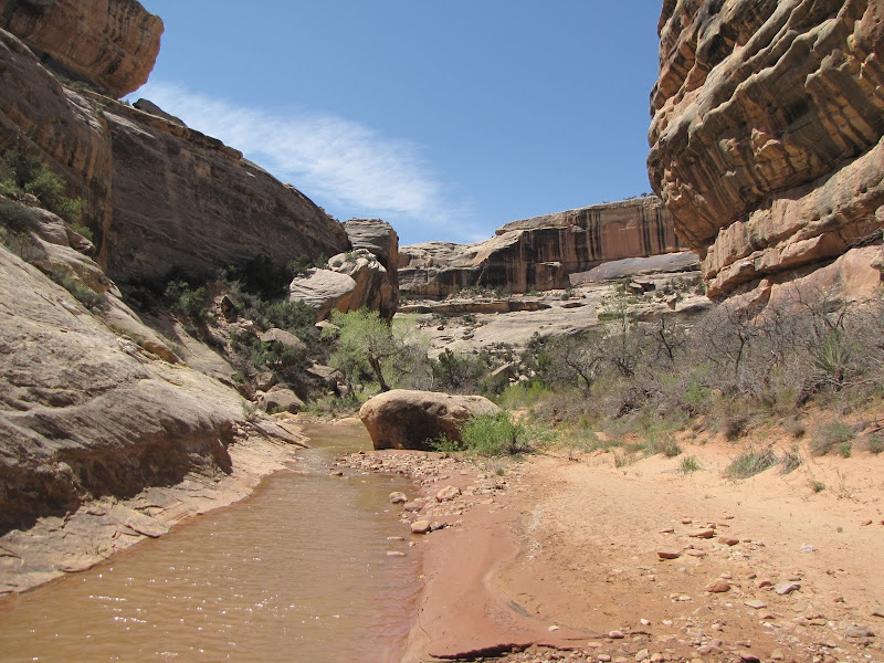
In my opinion the best way to experience the park is to hike along the bottom of White Canyon from one bridge to the next. The beauty and solitude found wandering amidst green cottonwood trees under smooth white sandstone walls is well worth the effort, and hikers can choose to do one segment or all depending on stamina and willingness. Be warned however - summer months can be downright hot, and the additional danger of flash flooding is high during the thunderstorm season, as illustrated by the debris seen here.

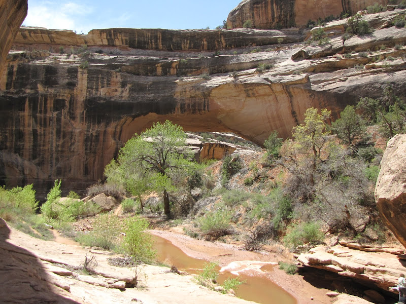
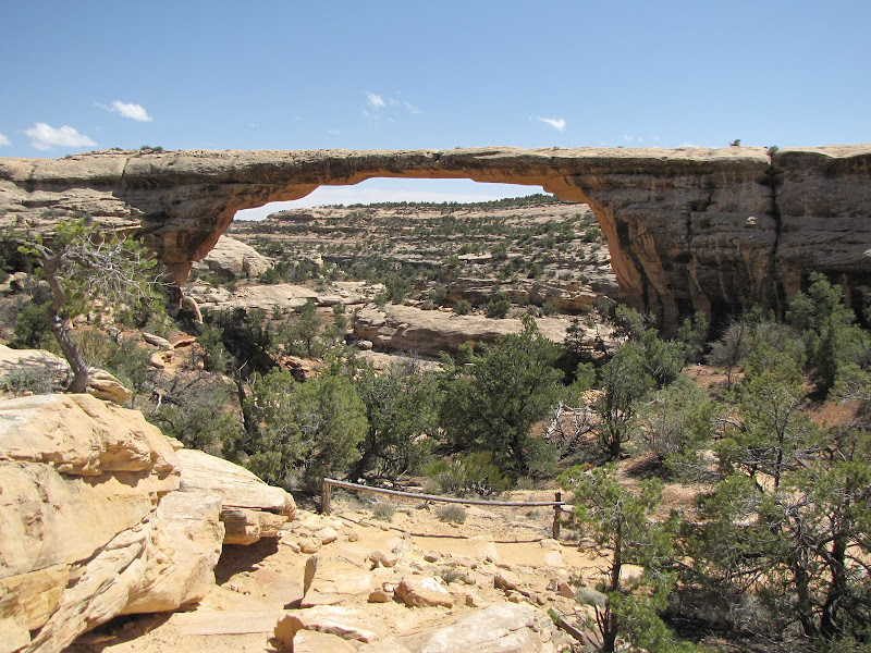
Whether traveling by car or on foot, the first bridge encountered along the loop is Sipapu. The name refers to a native term for "place of emergence" and is used by some southwestern tribes to designate the starting place for their presence in the world. This bridge is midway through the geological lifespan for this type of feature, having a well defined and solid span over the creekbed.
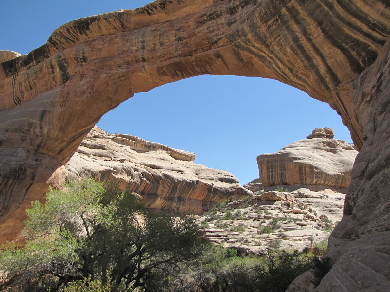
Standing beneath the bridge and gazing upwards allowed me to imagine that I was looking at the graceful neck of some giant prehistoric plant eater, a notion reinforced by the nearly symmetrical stripes of desert varnish painting the flanks.

After gazing at this stupendous marvel of natural engineering while letting my mind wander for a while it was time to press on downstream. Although the canyon is relatively shallow (as canyons in the southwest go) the sense of isolation and solitude was complete, and the only sounds were a light breeze fluttering new leaves of cottonwood and willow accompanied by the burble and chuckle of the small creek.
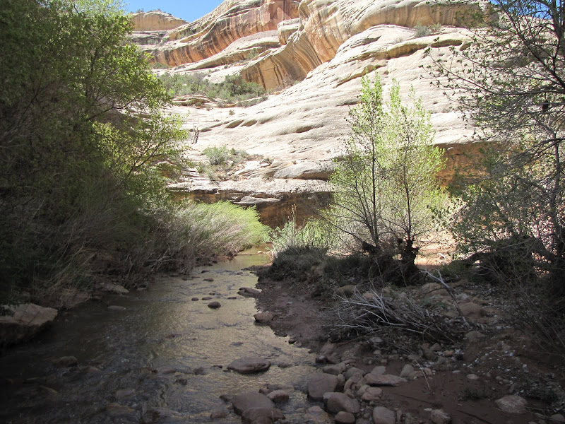 | 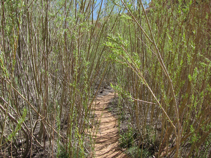 |  |
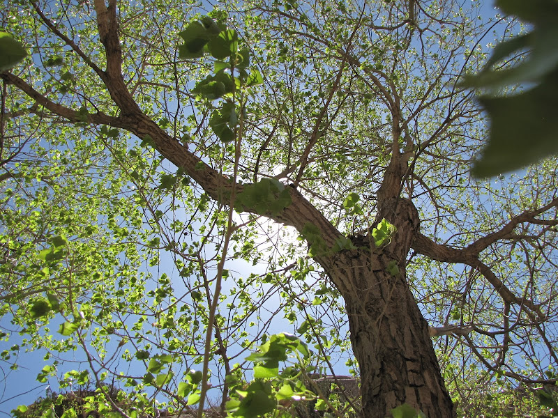
Walking the canyon bottom is relatively easy, although there are a few creek crossings where you may get your feet wet. Time passes quickly as you contour around sheer walls of sandstone streaked with black mineral stains, occasionally passing through stands of willow and small groves of cottonwood trees.
Before you know it the trail rounds the bend, and at first you think you are looking at a dead end as the canyon walls rise before you. Closer examination reveals an opening down low, and you realize you've reached Kachina natural bridge, the "baby" of the family.
The word Kachina comes from the Hopi tribe, who are believed to be descendants of ancient puebloan peoples commonly referred to as the Anasazi. A more accurate spelling of the word is "Katsina" and refers to the spirits who dwell on the mountain who provide life giving rain and snow to the people.
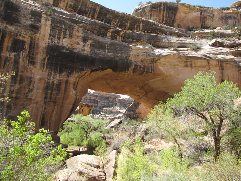
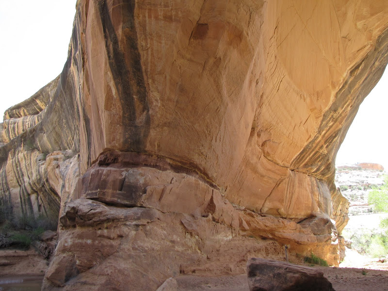
The bridge itself is hefty, with a small opening and a significant amount of material left in the overlying layers, which indicates a relatively short life to date. Standing underneath the impression is one of solidity and stability, although several tens of thousands of years will change that.
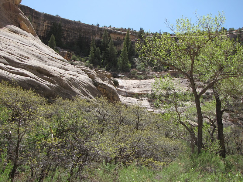
Continuing downstream to Owachomo the small stream disappears underground, altering the feel of the canyon substantially. The way ahead is blocked by a large "pour-off" or steep drop in the streambed, so those wishing to walk to the last bridge must exit here, and reenter the canyon further down.

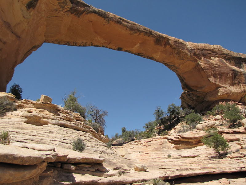
The last stop on our tour of Natural Bridges is Owachomo. Unlike the other two bridges the name has no spiritual significance. Instead Owachomo translates as "rock mound" and refers to a formation found at one end of the bridge. This feature is the easiest one for travelers to reach, with a trail that has a very moderate grade for most of its length.
As the oldest span, Owachomo looks delicate and fragile to the untrained eye. However while it is certain to collapse at some point in the future, I doubt it will be in my lifetime.

 There are also other trails in the Park that cross the mesa top, allowing for a variety of hiking loop combinations. I also noticed other visitors using bicycles to make the circuit around the bridges, and with relatively few cars and a fairly level road this could be very practical.
Taking time to travel to far flung places and experience the road less traveled definitely has rewards. While I certainly recommend folks see the big attractions that Utah is most famous for, I also suggest that you leave some time for the quieter, less populated, but no less beautiful places like Natural Bridges. Trust me, you'll be glad you came.