Wednesday, February 24, 2010

Beef Basin

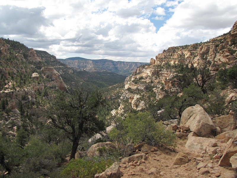
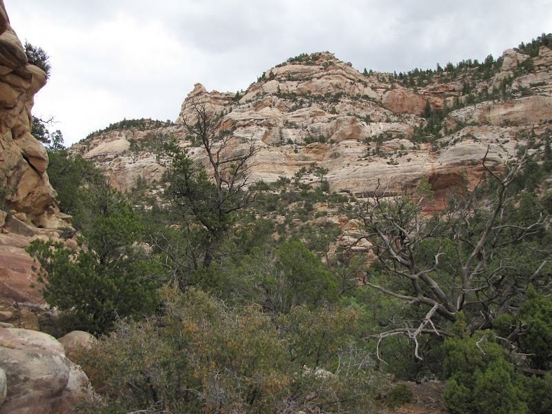
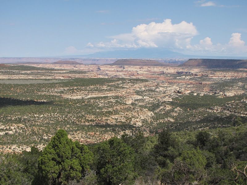
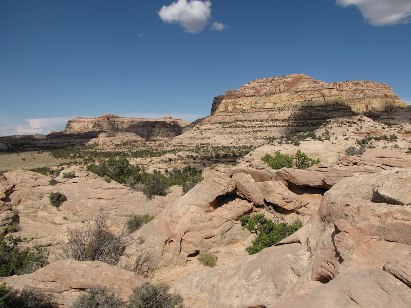
Picking up where I left off at Trail Canyon, there is much more to explore north of Dark Canyon Plateau. The area is referred to with the colorful name of Beef Basin, which derives from the historic use of the valley as winter grazing range for the legendary Somerville and Scorup Cattle Company. This rugged but stunningly beautiful country is comprised of sandy valleys and colorful buttes and mesas between the plateau and Canyonlands National Park.

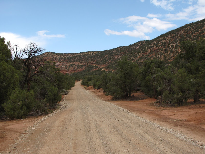
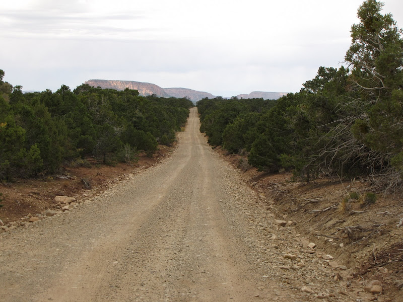
Getting there can be a challenge year-round. Only two access roads lead to the basin, one of which passes over the famous Elephant Hill 4x4 trail in the National Park. The other route leads over the northwestern flanks of the Abajo (Blue) Mountains on a dirt road which is closed for much of the winter, and becomes impassable when wet in the summer.
I have yet to travel the road in from the Park side, mostly because the route provides significant obstacles to anyone not using a modified off-road vehicle. Elephant Hill is only one of these challenges; Bobby's Hole is another that is sometimes impossible even for the most hard core four wheeler.

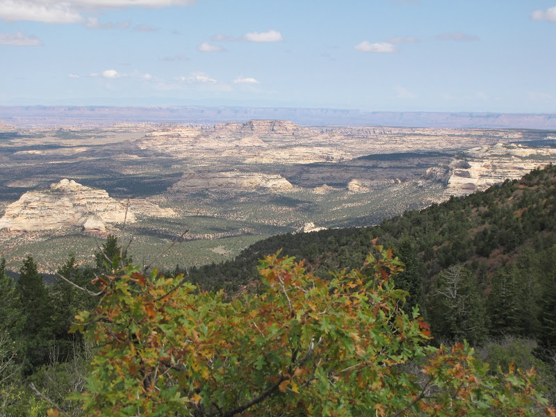
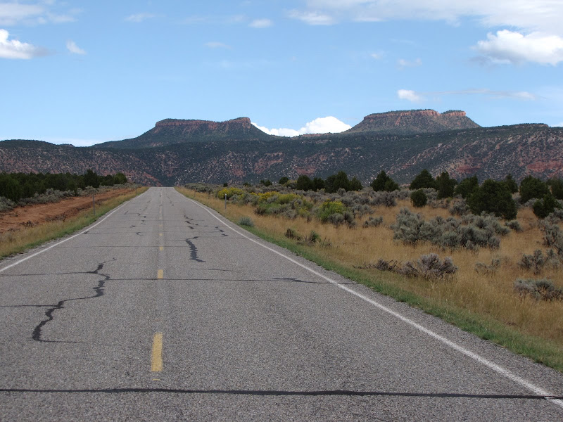
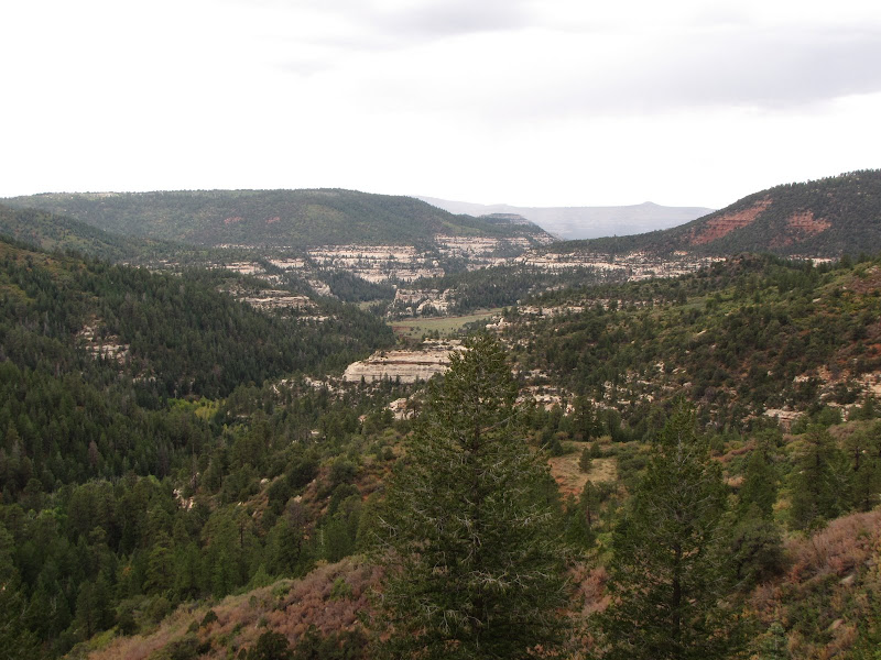
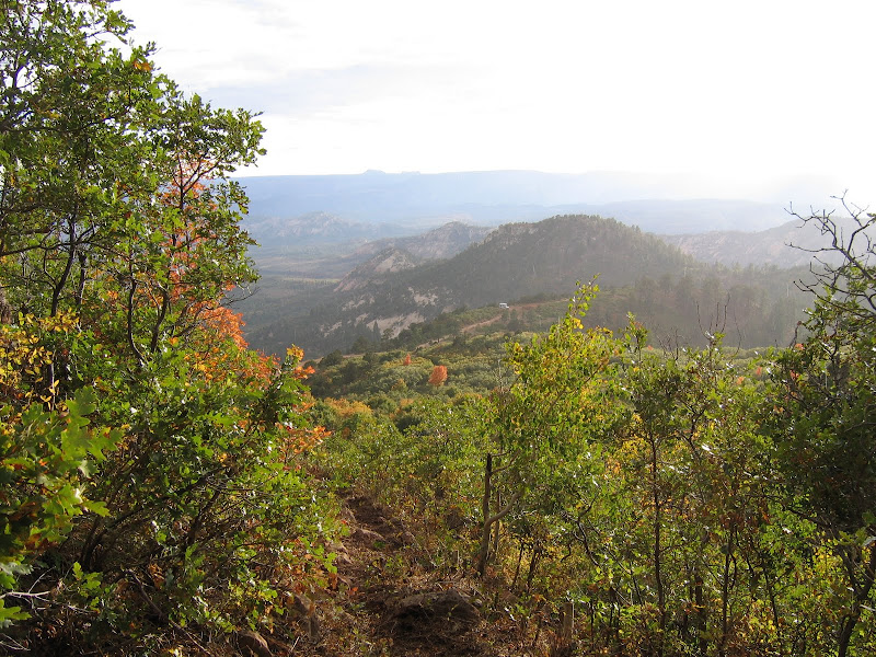
Coming in from the south or east using a combination of County and Forest Service roads, the route drops down into the basin from above, while providing sweeping views across the landscape.Given that much of the region is public land with Canyonlands to the north administered by the Park Service, Dark Canyon to the south managed by the Forest Service, and Beef Basin being part of the BLM, it's no surprise that the area offers multiple opportunities for recreation.
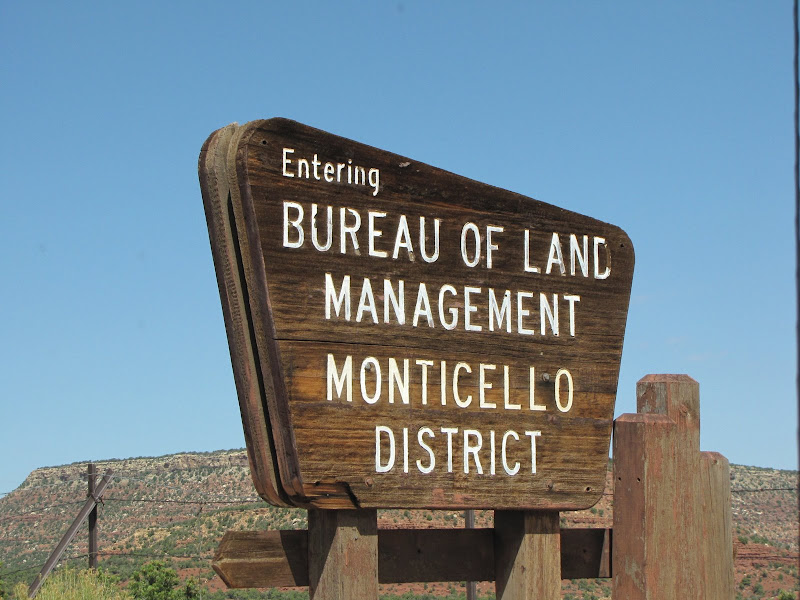
Camping, offroading, hiking and exploration of many ancestral puebloan sites are big attractions for the traveler. Just experiencing the absolute solitude while immersed in outstanding natural scenery is reason enough to visit.


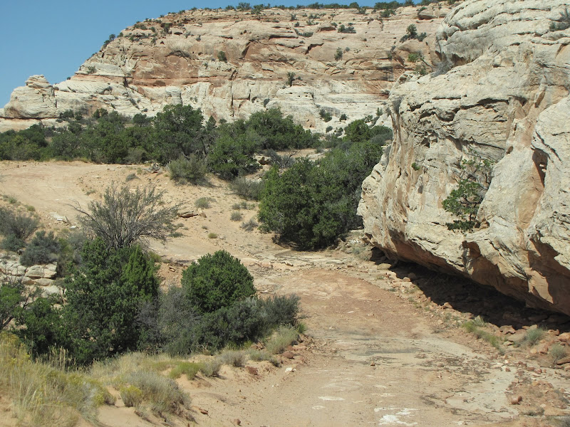
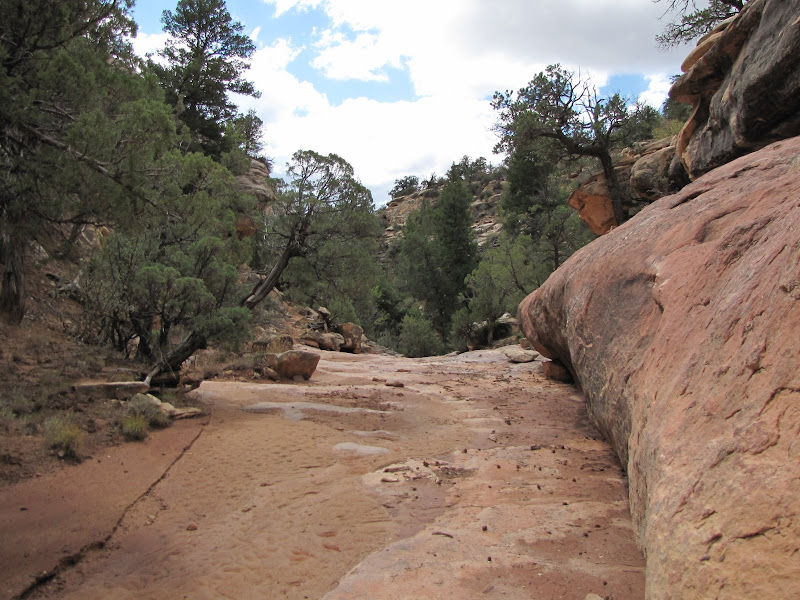
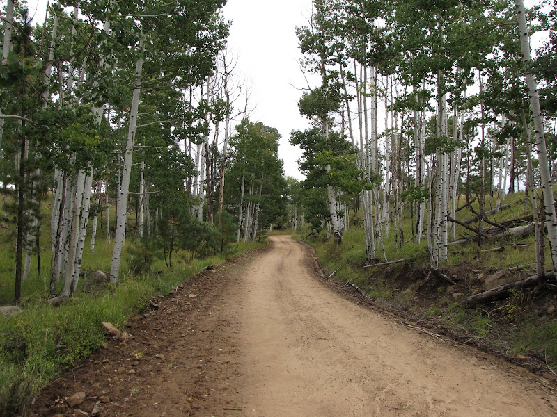
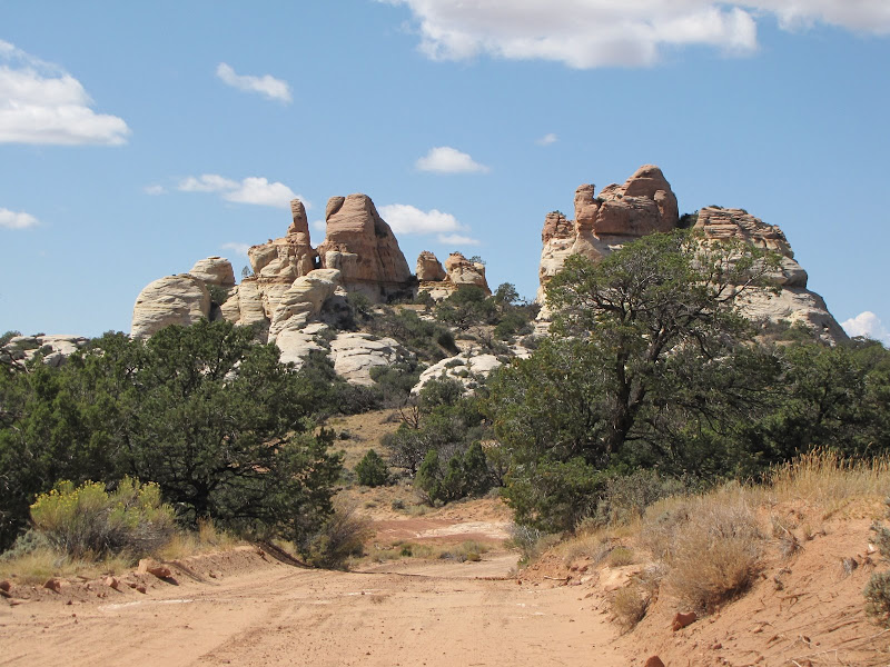
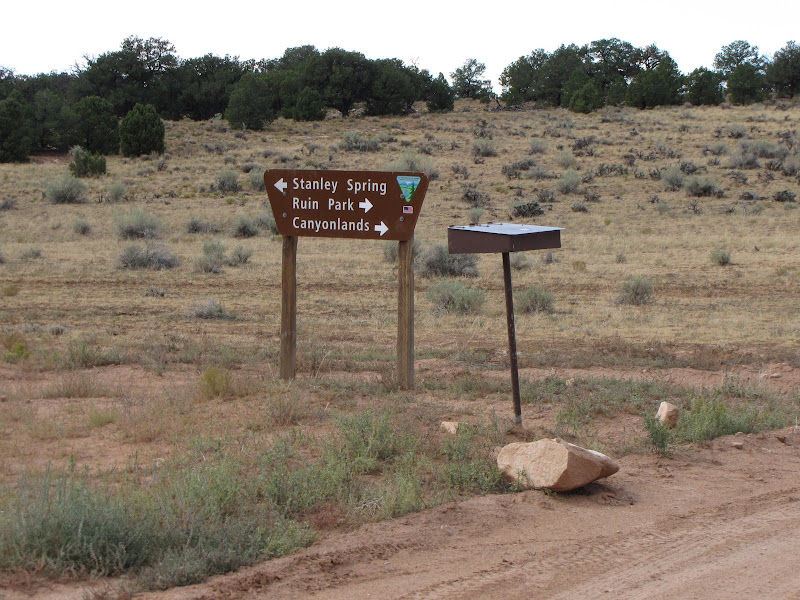
After several miles of moderately rough dirt road you reach the valley floor where the route comes to an intersection, with the north branch heading for Ruin Park and Canyonlands (and the aforementioned 4x4 challenges). The other direction leads to a loop road traversing the basin. Many prehistoric dwellings can be found along the loop, some near the road and others accessed by short hiking trails. This area could be explored for several days at a stretch, using many dispersed camping opportunities along the way.


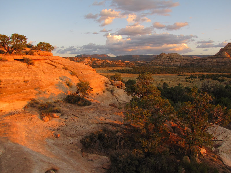
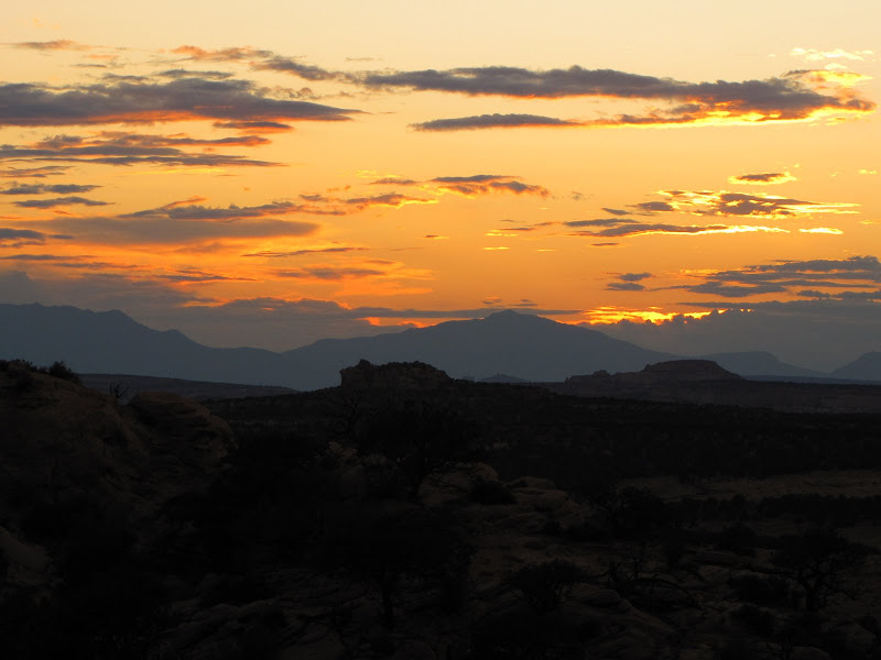
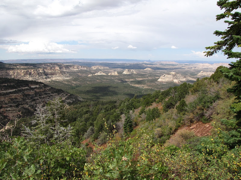
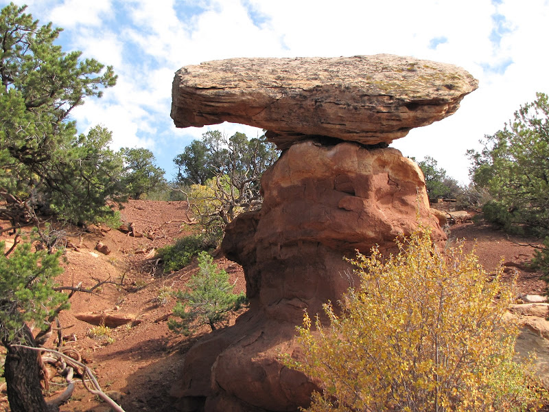
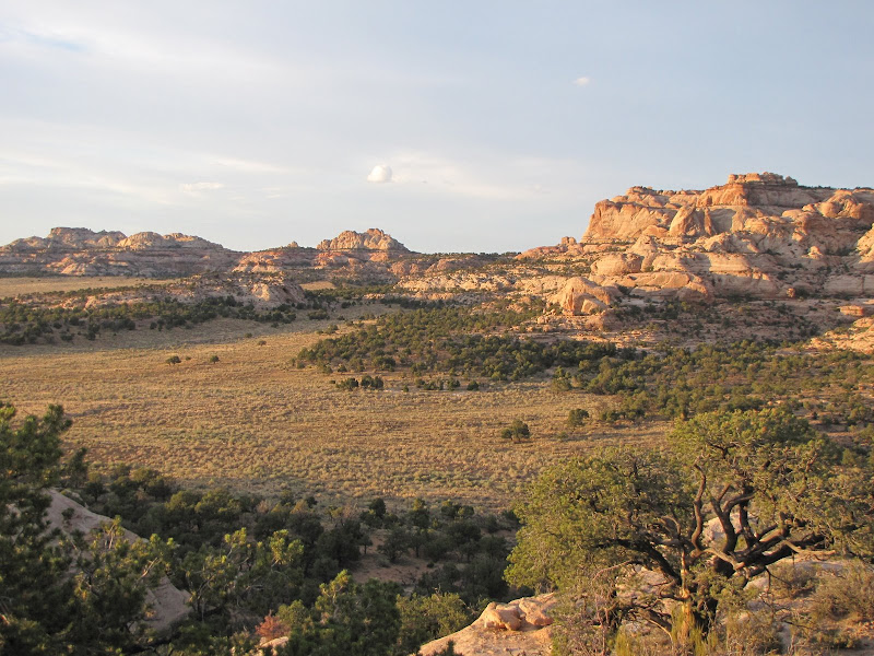
The country is wide open, with isolated forests of pinyon, juniper and sagebrush clustered around islands of sandstone rock.


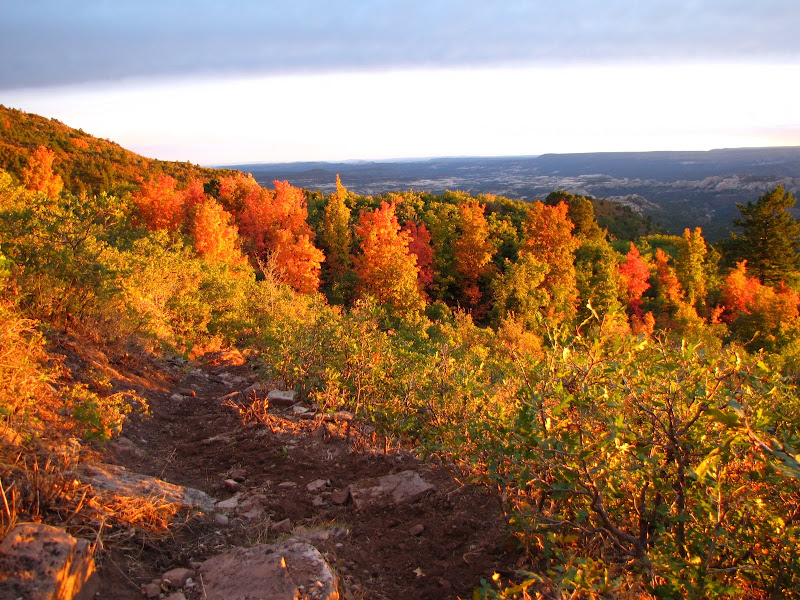
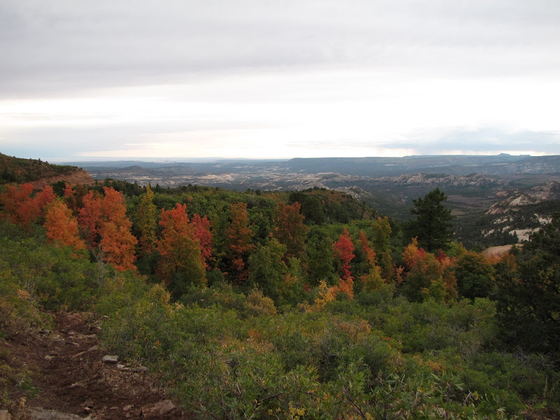
Spring and fall provide the most pleasant weather conditions for an extended visit, as long as late or early season snowfall keeps at bay. Summer may be too warm for some folks, and there is also the dreaded southwestern Cedar Gnat to contend with - these minute bloodsucking pests leave an itchy welt after feeding, and clouds of them hovering around the head can drive a person to distraction.

As this was my first visit, I can assure you there will be more trips here in the future to further investigate the surroundings. Besides, I want to poke around into Canyonlands from the south, and perhaps even try my skills/luck at some of the four wheeling to be found in the area. As the well known line from the "The Terminator" goes: "I'll be back"

Tuesday, February 9, 2010

Deeper Into Darkness

Exploring the region of the Dark Canyon plateau could easily take several years, as there are canyons, mountains, and mesas in abundance. I have to pick and choose carefully on this trip as time is limited.

With my truck I can reach a great many locations, but the inner canyon is not one of them. In an earlier post I mentioned the lone road into Dark Canyon, called the Peavine Corridor, however this trail is better suited to a purpose built 4x4 or an ATV. Since I wanted to get a better look at Dark Canyon from the inside, the only other option was my feet.

There is a variety of trails that descend into the canyon, which except for Peavine Corridor is managed as wilderness. I chose a likely looking route called Trail Canyon, which is located off a peninsula of plateau referred to as Long Point. The drive out to Long Point is particularly scenic, with open meadows studded with aspen and scrub oak, and further on excellent views of the canyon out north to Beef Basin.


The road drops several hundred feet off the main plateau to the west, where the trailhead for Trail Canyon descends into the gorge. The well-signed departure point has a register as well as some prominent warnings about the country being prime black bear habitat, putting hikers on notice.


On my visit the register indicated that very few people visit this remote and rugged area, with the most recent entry showing two hikers entering the canyon in May, nearly three months earlier. As far off the beaten path as Trail Canyon is it's easy to understand why more people don't make the trip.

The trail is rough and rocky, and wastes no time heading for the bottom. As Trail Canyon is a tributary of Dark Canyon, views on the way down are limited to the walls on either side and a few glimpses of the main stem canyon several miles ahead.


The geology is classic Colorado Plateau construction - layers of sedimentary rock, in this case primarily sandstone, with occasional volcanic intrusions like this granitic quartz seam.


The white and buff colored sandstone stands in contrast to the dark evergreen forest of pine, juniper, and fir. The relatively soft and easily eroded rock forms domes, alcoves, and hoodoos to capture the eye and the imagination.


The trail eventually reaches the bottom of the narrow canyon and follows the rocky streambed for several miles as it makes the journey towards the main canyon. There are a few small springs that surface and submerge in the channel, but otherwise there is little evidence of permanent water. Even so hikers would do well to remember that water is the chief architect of these canyons, and being down here during thunderstorm season is a risky proposition.


I did not have time to make the 10 mile round trip to the junction of Dark Canyon and Trail Canyon on this visit, but I went far enough to experience the absolute solitude and rugged beauty of this little known area. There are many more miles of trails to explore, and I learned later from locals that there are quite a few cliff dwellings tucked into alcoves and under ledges all through Trail Canyon.

Sounds to me like a pretty good reason to go back.

Thursday, February 4, 2010

The Heart of Darkness

No, not the Joseph Conrad novel, rather the large and remote Dark Canyon plateau. I had wondered for years about this region, seeing it as a mysterious blank spot on the map, where it bears the ominous name of Dark Canyon Primitive Area. My travels in the region always skirted the unknown, leaving this terra incognita to the imagination as an island of questions. As far as I knew, dinosaurs and cannibalistic pygmies made their home there, and wild amazon women ruled from elaborately constructed treehouses.

O.K., I'm being more than a little dramatic here, but in truth the area is little known outside the local community despite being stunningly wild and beautiful. I finally made a commitment to visit last fall, and I am happy to report there is much to enjoy about the region, and little to fear. I will definitely make a point of going back in the future.

On this trip I approached from the south over Cedar Mesa. There are only two "major" roads that bisect the plateau, one running roughly north/south and the other trending east/west. I took the northern route, which is called Elk Ridge Road. The turnoff is located just above the junction of Utah Highway 95 and State Route 275, which leads to Natural Bridges National Monument.


As you approach the plateau from the south, you are greeted by prominent and recognizable landmarks shown in the photo above. The two ragged buttes on the horizon are called appropriately enough the Bears' Ears. Rising above the edge of the elevated mesa, they are visible across a large part of southeastern Utah, and they serve as the gateway for Elk Ridge road as it climbs onto the plateau.

As is the case with many Utah landscapes in the southern part of the state, the predominant vegetation at the lower elevations is juniper and pinon pine. These dense forests of "dwarf" trees mantle the terrain, disguising the rugged contours of canyons and mesas.

Elk Ridge road (also signed as County Road 268 and Forest Service Road 092) rises steadily until it reaches the mean elevation of the plateau.

Gradually the pinons and junipers give way to trees more suited to cooler and wetter conditions, and ponderosa and aspen groves soon form the road boundary.
The region encompassing the plateau is part of the Manti-LaSal National Forest, and the area surrounding it is administered by the Bureau of Land Management. These public lands offer an wide array of recreation, and encompass an astonishing variety of wildlife. I saw more wild turkey and deer during my visit here than just about anywhere else I had been this last year, and I probably would have seen elk had hunting season not been in full swing.

The funny thing about Dark Canyon is that the canyon incised into the plateau is not dark at all. In fact the layers of sedimentary rock exposed here are white and buff sandstone which appears all the more striking due to the blanket of conifers that drape the slopes.


There are many side roads off Elk Ridge that lead to canyon vistas, but almost no way for full sized vehicles to access the canyon itself. The chasm of Dark Canyon is protected as a wilderness except for a narrow route to the bottom called the Peavine Corridor. I had wanted to explore this 4 wheel drive trail into the depths, but the scant information I had at my disposal and the overgrown nature of the upper trail ultimately dissuaded me. There is also a network of ATV trails in the area, and perhaps a future trip will include an offroad excursion with a fourwheeler instead of my truck.

As it contours around the edges of the surrounding canyons Elk Ridge road negotiates a variety of terrain including a narrow neck between defiles called the Notch. The road leading to and from this scenic feature is narrow and steep, and drivers should be prepared for the possibility of being unable to turn around or pull off when oncoming traffic approaches. In addition these backroads like so many others in Utah become impassable during heavy rains - you've been warned!

The other significant road across the expanse of the plateau is encountered near the northern end of the plateau. On maps it is referred to as Gooseberry Road, and it includes a section called the Causeway which contours around the southern exposure of the Abajo Mountains - named the "Blues" by locals. Rising even higher above the surrounding area, this laccolithic range is blanketed with maple and oak trees. During my visit I was fortunate enough to see an explosion of autumnal color unlike the typical golden aspen display found in the southwest.


There is an abundance of hiking trails throughout the area. Some descend into the canyon while others climb the lofty heights of the Blues. I did some of each, although I barely scratched the surface on this trip.


There is still a lot to discover here on the Dark Canyon plateau. My next post will continue to unravel the mystery of this beautiful and wild area.

Tuesday, February 2, 2010

Buried Alive

I thought the passing of the holidays would herald a less hectic time in my life, and that I would be able to get some long overdue posting up to the blog. To paraphrase what Robert Burns wrote "..the best laid plans of mice and men go oft awry" I neglected to consider the plans of Mother Nature, and in doing so was rewarded with a week long snow event that will be remembered long after this winter.

From January 19th to the 23rd, Flagstaff received over 60 inches of snow, and much more came down on the mountain. As a result I spent many hours digging out both at home and work to keep from going under. When the skies finally cleared the snow had ended but the crowds were just beginning. We lost power at the ski area on Thursday afternoon and it was not restored until Saturday morning. Additionally we were unable to clear the heavy snow mountain wide until Sunday, so there was a great deal of pent-up demand for skiing and riding the fresh powder.

For nearly seven days afterwards we hosted capacity crowds hungry for the best snow conditions in years. Even though the season prior to this had been going well, the new snow dramatically changed the outlook and assured us of a strong finish into April. As a resident of an area that often contends with a lack of consistent snowfall, the abundant moisture is welcome on many fronts. All hail El Nino!