Saturday, October 17, 2009

Cedar Mesa and the Moki Dugway

Driving into Utah on U.S. Highway 163 in this remote southeastern corner is a journey into the heart of canyon country. Beginning at the border with Arizona the towering rock buttes and mesas of Monument Valley set the tone for the scenery ahead. Broad, arid basins separate ridges and canyon rims across wide expanses, while in the distance dim blue mountains ring the horizon.

To the east lies Colorado and the rugged San Juan Mountains, north leads to the Abajo and LaSal Mountains, and westward over the canyons of the San Juan River are found the Henry Mountains. From the high desert floor to the summits, the elevation change is over 7000 feet, and many different environments exist in this rugged landscape. In between the highs and lows are flat topped expanses of plateaus and mesas, most covered in a blanket of pinyon, juniper, and sagebrush - the ubiquitous southern Utah plant community.

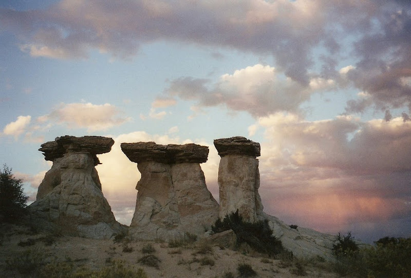
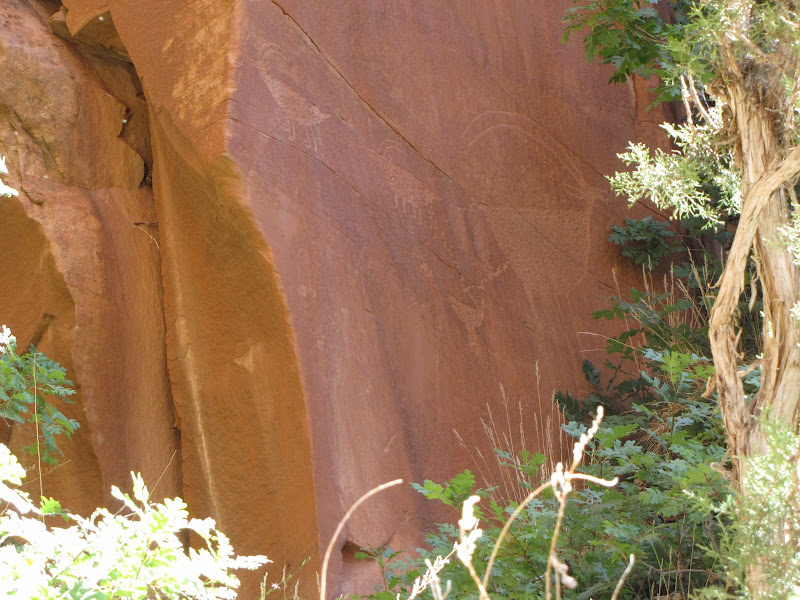
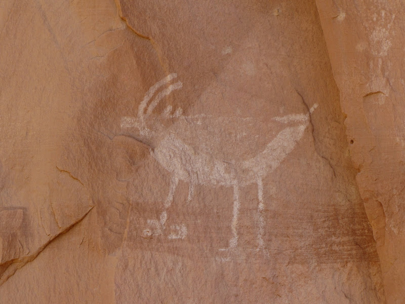
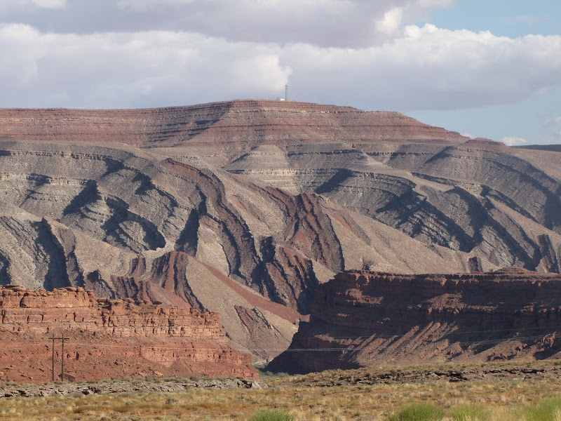
The Colorado Plateau as a whole is a vast region of fairly uniform sedimentary rock uplifted thousands of feet above the surrounding landmass. Within this area are singular and distinct formations created by unique processes outside the uplift, and when the forces of erosion and weathering are applied the result is nothing short of spectacular. Comb Ridge, shown here just east of the town of Mexican Hat is one such example.

Comb Ridge is an anticline, or huge fold in the crust of the planet. It stretches nearly 100 miles along a north/south line, rising over 1500 feet above the San Juan River on the southern end. The scale and magnitude of the forces at work here are truly impressive.

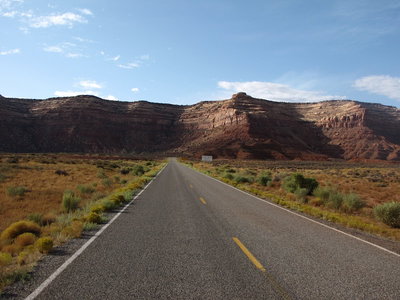
Highway 163 crosses the San Juan River at the small community of Mexican Hat. The town was founded in 1882 after oil was discovered in the basin, and a short lived boom led to a population of 1000, followed by decline. Then in the middle part of the last century the town became the center of uranium mining and processing for the region, but hard times returned for the remaining residents after falling demand for yellowcake ore. Today the primary economic force is tourism and river runners who use Mexican Hat as a staging point for trips.

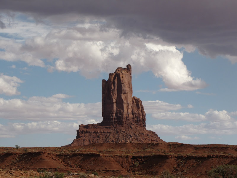
As the highway continues in a northeasterly direction, the curious formation that gives the town its name appears to east - the Mexican Hat, named for the similarity to an upside down sombrero. Though the rock appears precariously balanced it is in fact stable enough to allow for two climbing routes, and in geologic terms will probably appear much the same 10,000 years from now.
Just past the eponymous rock is the junction for Utah Highway 261 heading west over Cedar Mesa. U.S. 163 continues on 21 miles to Bluff and U.S. Highway 191, and eventually to Canyonlands and Arches National Parks - but that's another story. For this entry we're turning north onto 261 towards the Moki Dugway.


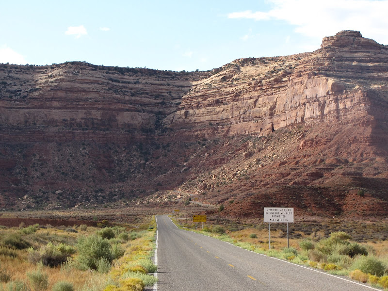
Immediately after making the turn, a large yellow sign warns motorists of hazardous road conditions - "10% Grades, Switchbacks, Narrow Gravel Road, 23 miles ahead." Another warning appears that says "Not Recommended for Trucks over 10,000 lbs., RVs, Buses, Vehicles Towing." Despite the ominous language, only semis and oversize RVs really have cause for concern. In the meantime another junction is coming up - the Goosenecks of the San Juan State Park turnoff is just ahead.

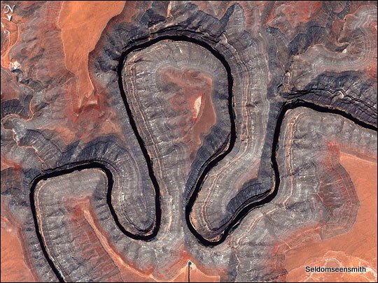
Heading 3.5 miles to the southwest Utah Highway 316 leads to an overlook of the San Juan River. Goosenecks State Park offers no amenities but has outstanding views of a geological feature known as an entrenched meander. The river flowing 1000 feet below loops back on itself several times, and narrow ridges of limestone and shale separate the channel. The picture below is from a NASA satellite image and it shows the twisting course of the river through the canyon.


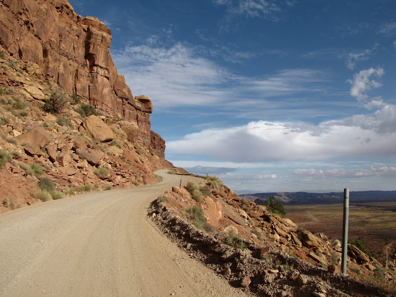
Returning to Highway 261, the road makes steady progress towards the base of Cedar Mesa. To ascend the plateau, a unique trail has been chiseled out of the face of the cliff, using long traverses and tight switchbacks to reach the top. Built in 1958 to access uranium mines on the mesa, the Moki (also sometimes spelled Moqui) Dugway offers spectacular views of the surrounding area.


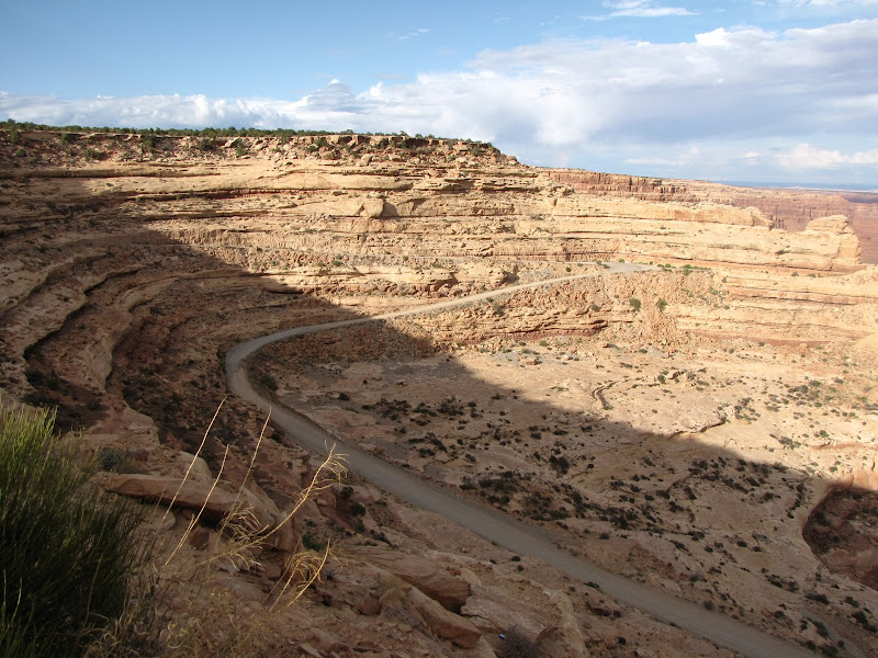
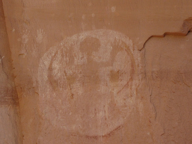
The term Moki Dugway refers to handholds and steps carved into cliff ledges by ancestral puebloan people whose culture once thrived in the region.. In similar fashion Mormon pioneers who subsequently settled this rugged land improved these ancient paths to create passages, enabling wagons and livestock to reach remote areas.

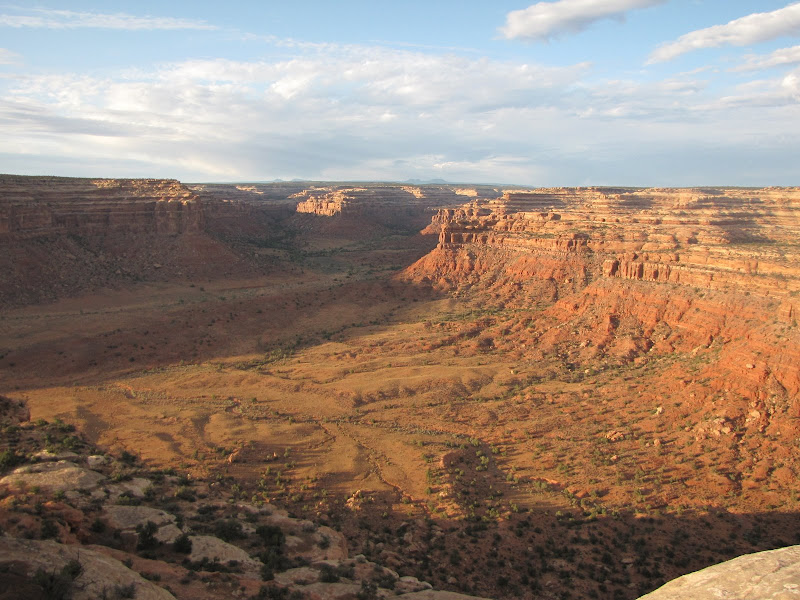
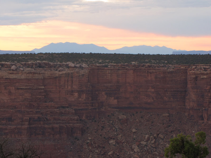
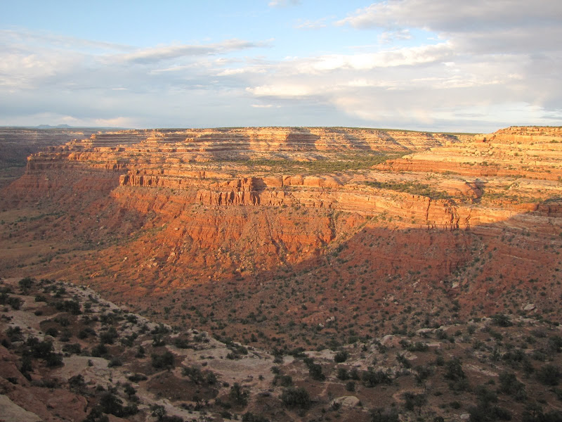
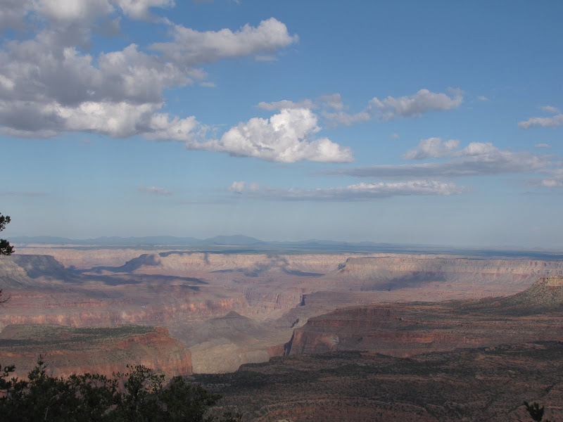
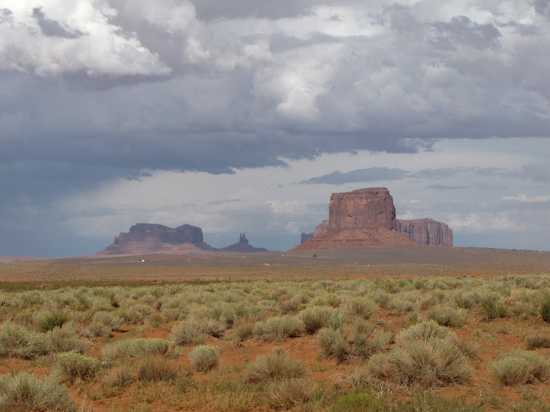
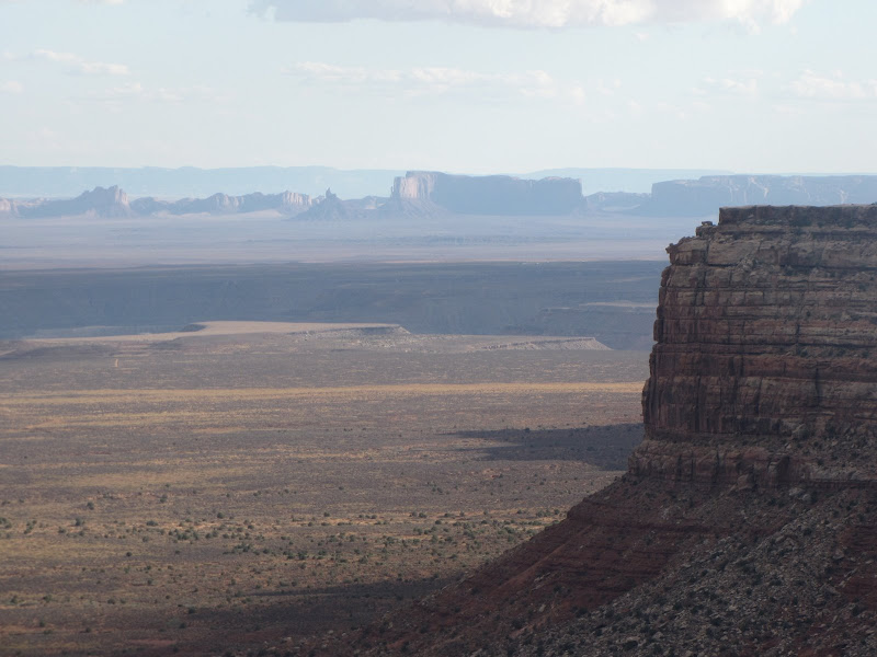
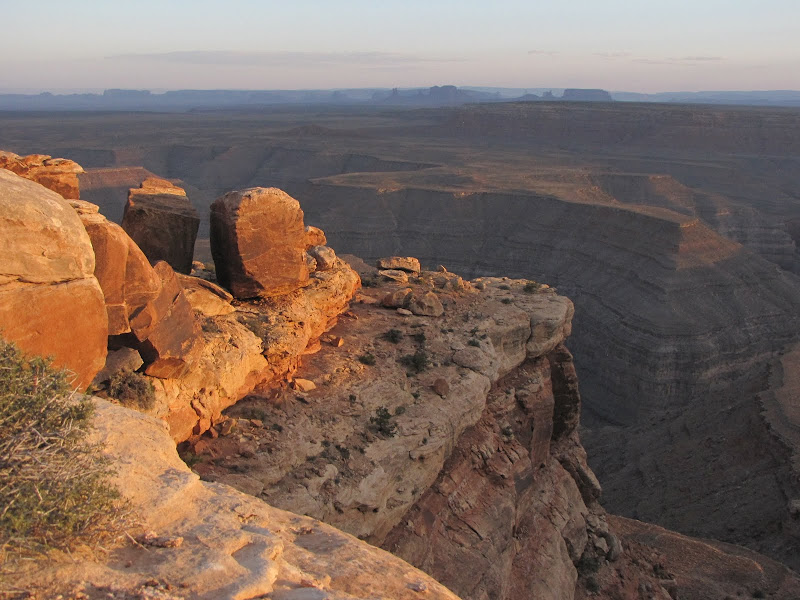
At the top of the dugway, the views are breathtaking. To the east, Comb Ridge and Valley of the Gods lie below. Even farther out the dark silhouettes of the Rocky Mountains appear on the horizon. The southern view reveals the monoliths of Monument Valley, and even further southeast to Shiprock in New Mexico.


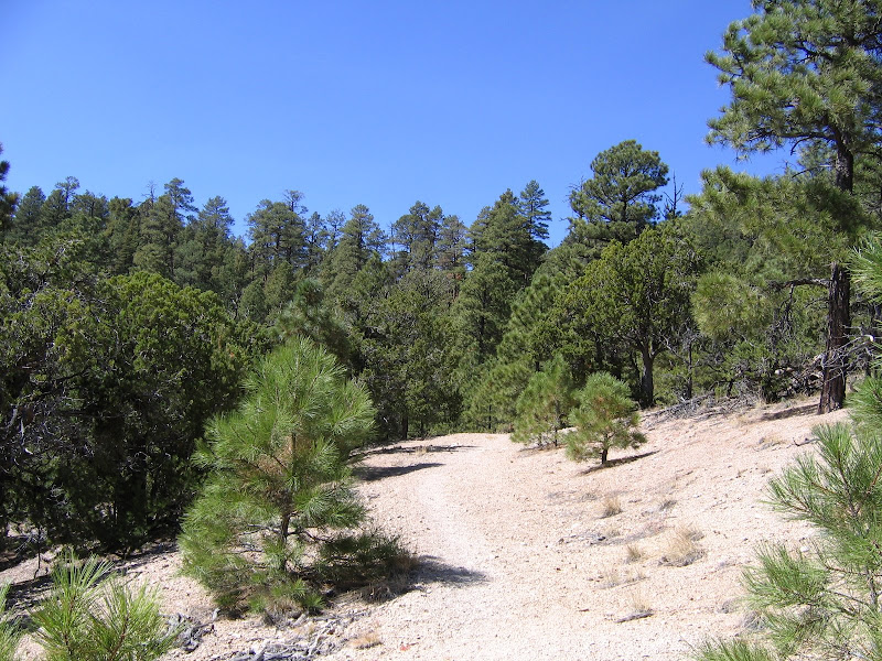
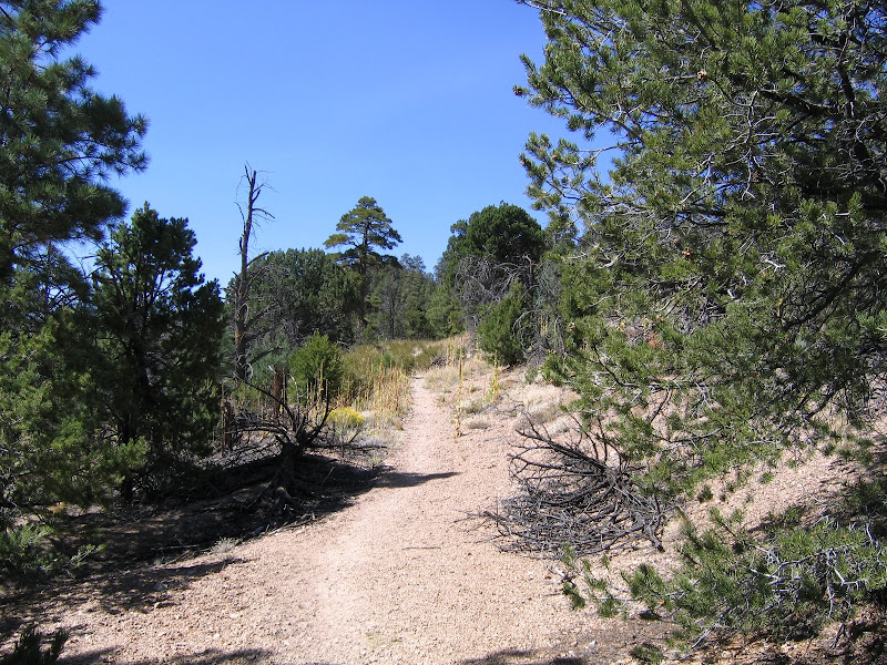
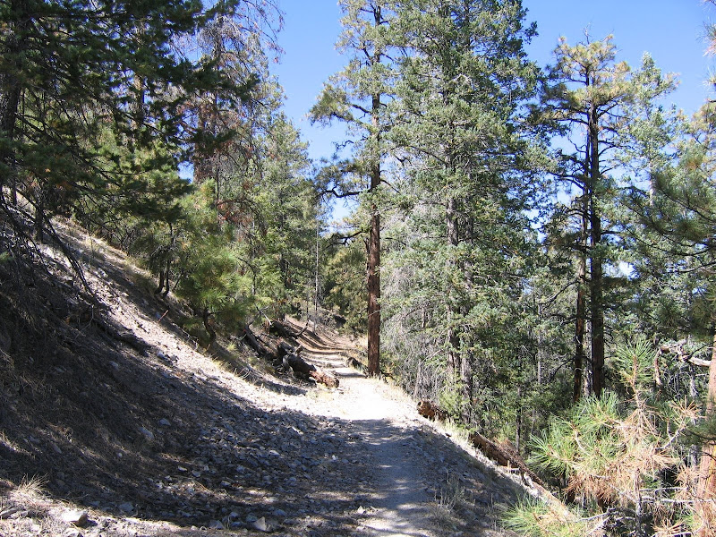
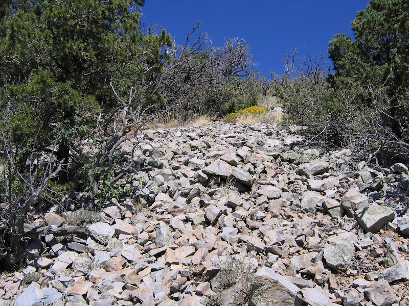
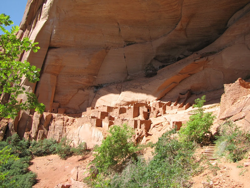
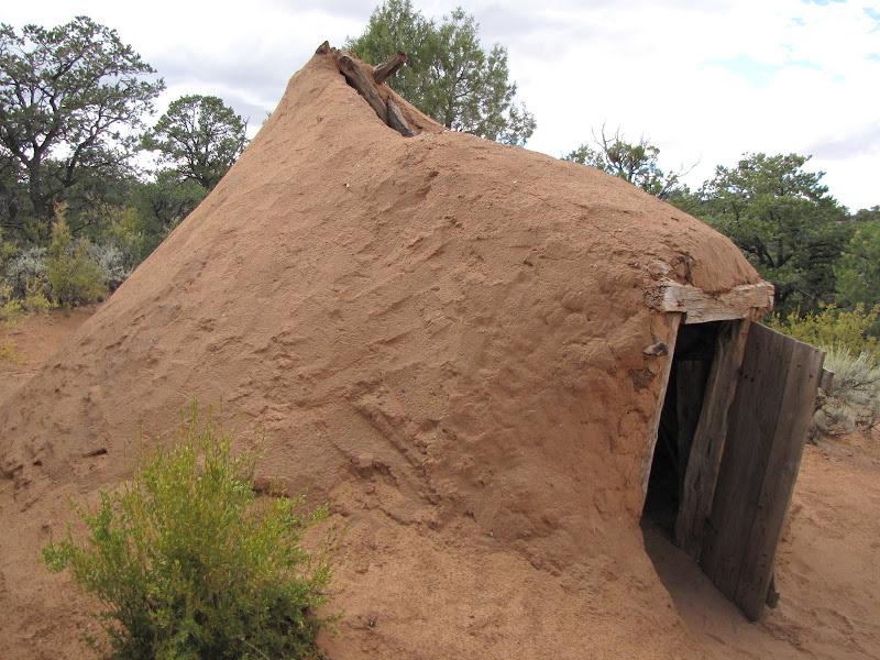
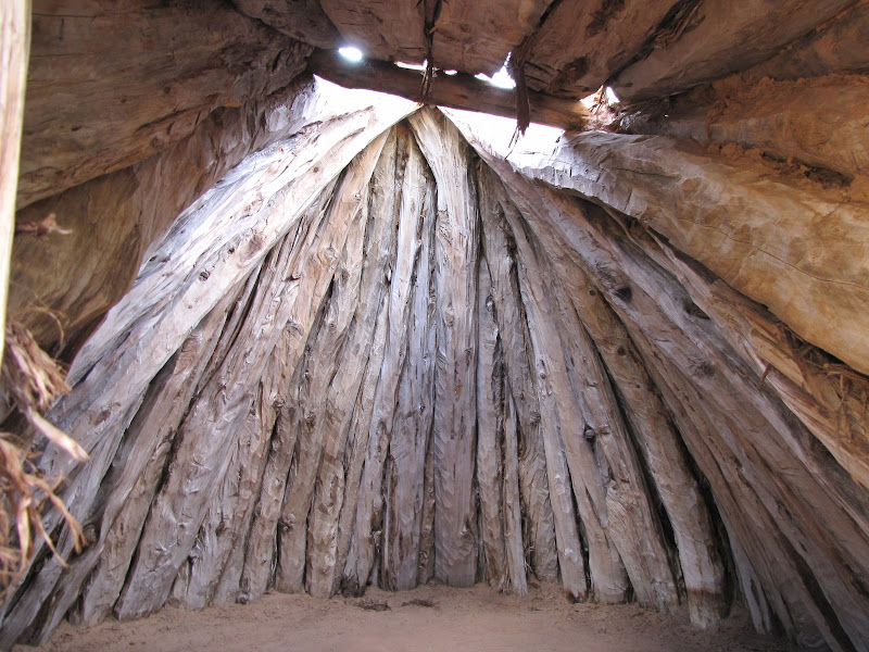
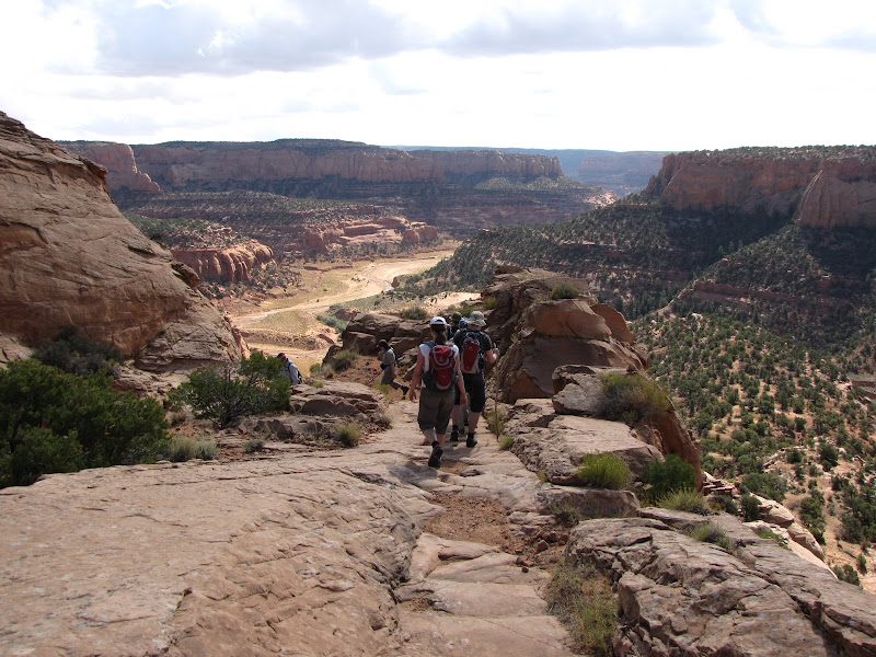
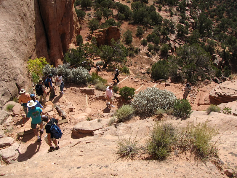
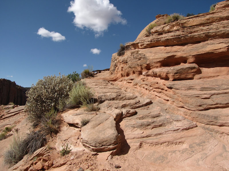
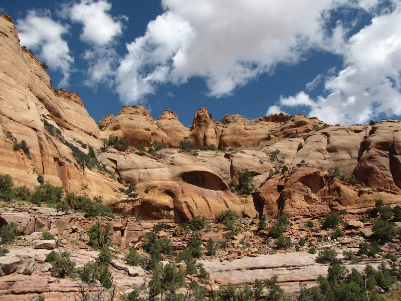
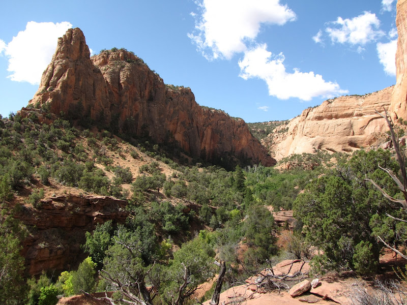
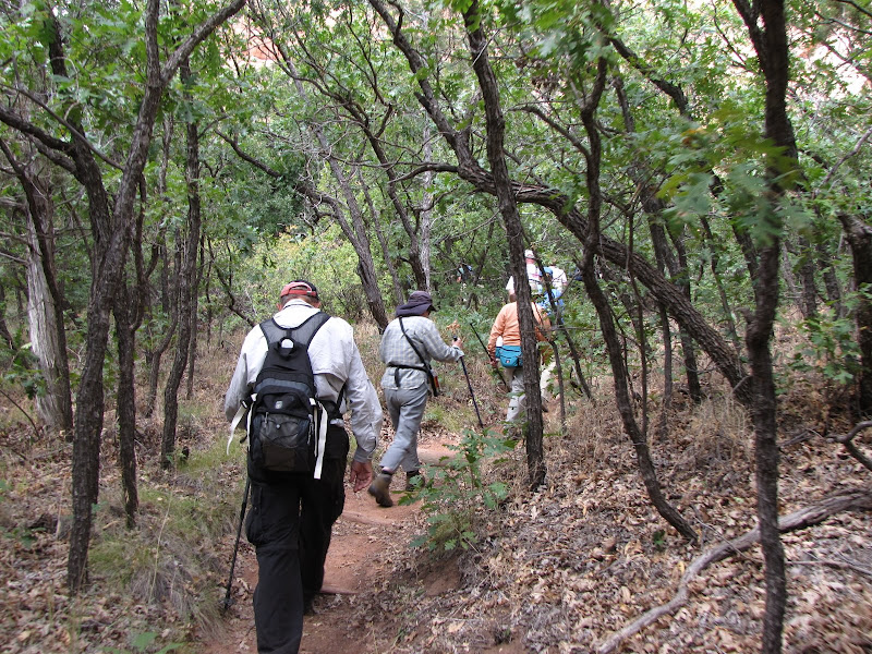
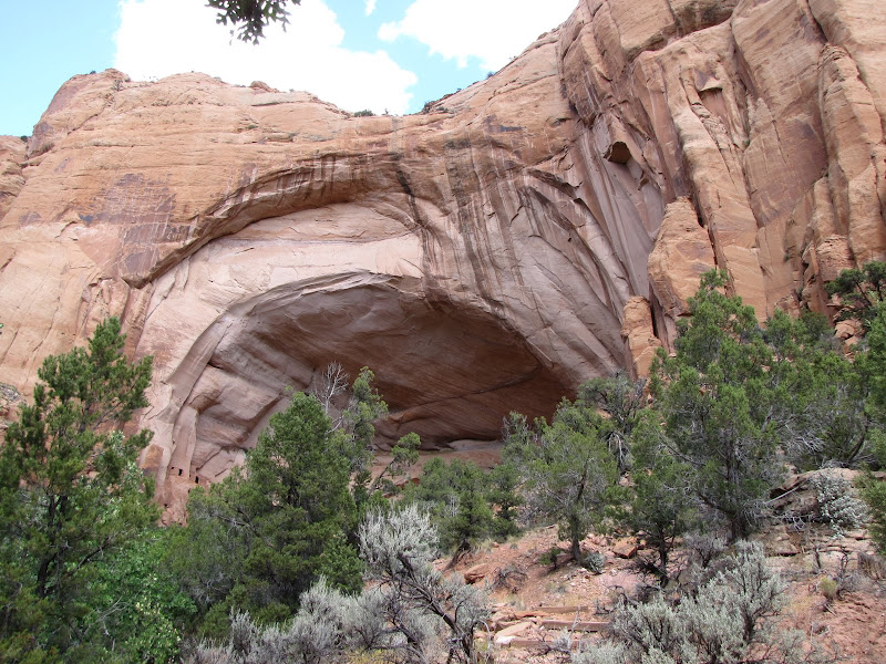
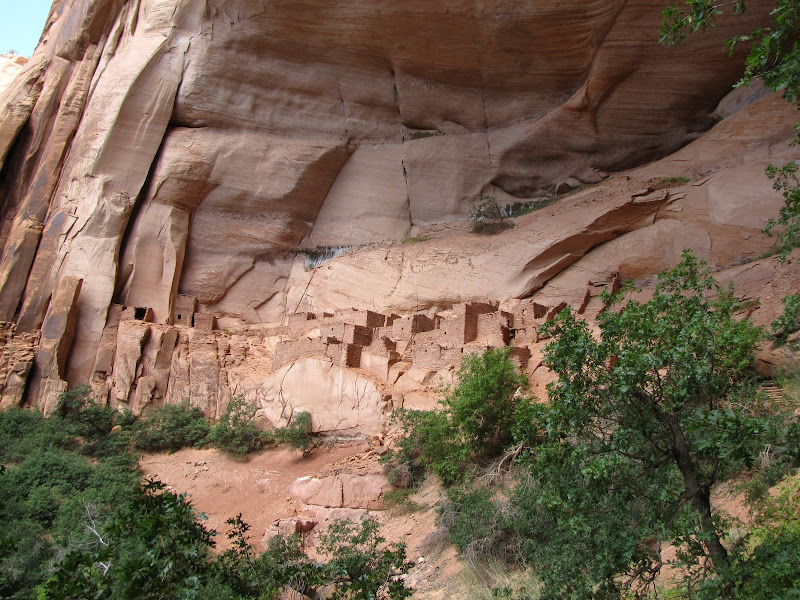
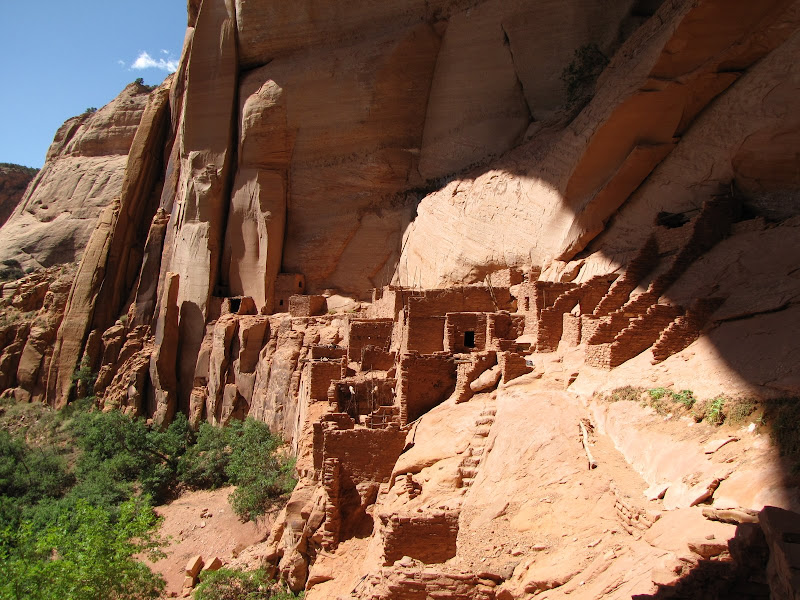
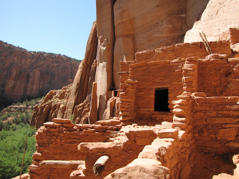
The road becomes paved at the summit, and leads north to Utah Highway 95 and the outstanding Grand Gulch Primitive Area. This BLM managed recreation site contain hundreds of ruins and cliff dwellings located in canyons cut into Cedar Mesa. Access is managed and permits are required for overnight visits as the area is popular with backpackers, especially in spring and fall.

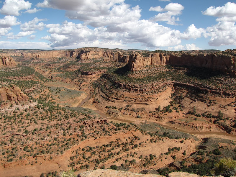
Where the pavement returns a dirt road leads approximately 5 miles southwest across the mesa to Muley Point. This high and lonely outlook provides an outstanding panorama of Monument Valley and the San Juan River canyons. The road is usually kept in reasonable condition, but as with all unimproved routes in canyon country wet weather can quickly render them impassable.


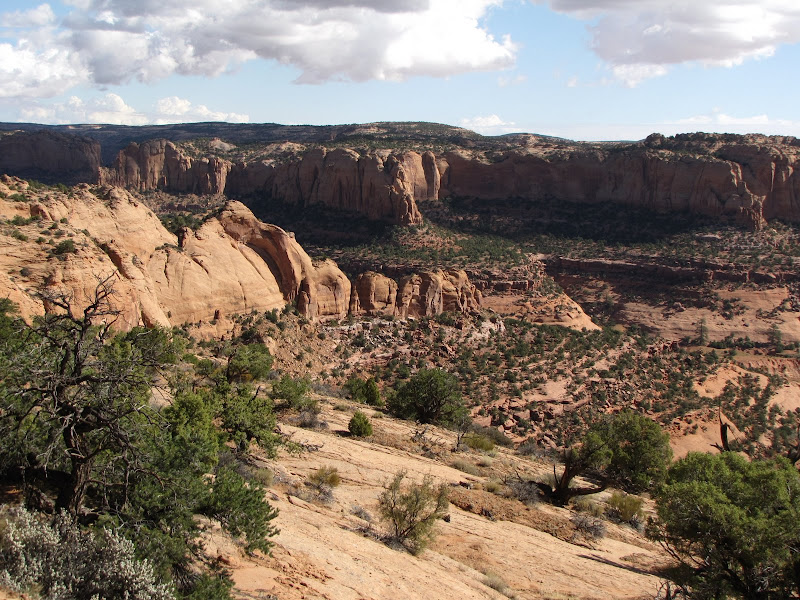
Another worthwhile destination on Cedar Mesa is John's Canyon. This tributary of the San Juan cuts northward through the mesa, and several spur roads head west off Highway 261 or Muley Point road that lead to the edge of the gorge. This extensive canyon system offers ample opportunity for exploration and solitude for the visitor who is prepared.

Wednesday, October 14, 2009

On Foot Part IV - Slate Mountain


The arrival of fall in the high country brings shorter, cooler days that are perfect for a day hike. Given that I'm fortunate enough to live in an area that boasts nearly unlimited outdoor recreation opportunities you can be sure I take advantage of it whenever possible.

On this day I'm traveling a little farther than usual - although the excellent Dry Lake Hills trails are just a couple of miles away, they are but a few of the options available. Instead I follow U.S. Highway 180 north towards Grand Canyon, where several other rewarding hikes can be found. In this case I'm heading for Slate Mountain, one of many hills that dot the region around the San Francisco Peaks.

Located approximately 23 miles northwest of Flagstaff, Slate Mountain lies near the limit of the San Francisco volcanic field, a collection of nearly 600 cones, craters, and extrusions that tell the story of 600 million years of vulcanism. Some of these features rise a few hundred feet above the surrounding area, while others such as Kendrick Mountain tower nearly 3000 feet over the land.

Slate Mountain is fairly modest with a 1000 foot rise, and the trail to the summit takes a leisurely 2.4 miles to reach the top. Because it is far from town the hike is not well known or frequently visited making it a great place to find peace and solitude.

The turnoff is well signed, and from the highway it's two miles to the trailhead on a rocky dirt road that is best suited to high clearance vehicles.

Like a number of other trails on the National Forest the route up Slate Mountain follows an old road grade that used to serve a fire lookout at the summit. The lookout is long gone, and the obvious road bed is slowly being reclaimed by cliffrose and rabbitbrush.


Initially the trail follows a shallow drainage where in the late 1990's a fire burned through, and the skeletons of juniper and pinon pine stand sentinel over the landscape. Soon leaving the worst of the burned area behind, the trail begins the first of several long traverses through a pinon/juniper woodland.


By this time the hiker will have noticed Forest Service interpretive signage located at seemingly random intervals along the way, with each noting a particular tree or species of plant. These curious artifacts are a good example of man's best intentions thwarted by Nature - when the signs were placed in the early 1990's, there were actual trees and plants associated with them, but the subsequent fire and other natural changes destroyed or eliminated the subjects. Even though in most cases the examples no longer exist, the placards are nonetheless informative.

As the trail climbs higher, views east towards the San Francisco Peaks and Kendrick Mountain improve. Ponderosa pine begins to dominate the forest as slightly cooler and wetter environmental conditions exist at the higher elevations.


The trail grade is moderate over the entire length, and few switchbacks are required to negotiate the hill. As it nears the summit, the trail winds its way around the mountain like stripes on an old barber pole , and 360 degree views of the surrounding area are provided as you make steady progress to the top.


Slate Mountain was so named by early settlers for the gray rock found on the upper slopes. The material does resemble slate in color and in the way it fractures along angular lines, but like all other features in this part of northern Arizona is volcanic in origin, and is actually called rhyolite.


The summit is an unremarkable rocky knob that offers outstanding views in all directions. On clear days the cleft of the Grand Canyon is visible to the north, with the San Francisco Peaks on the eastern horizon, and Kendrick Mountain looming to the south. This is a good place to pause for lunch, or to simply enjoy the peace and quiet of a high, lonely outpost in the great outdoors.


Sunday, October 4, 2009

Northern Exposures


When I first started this blog in May, my intention was to provide a firsthand look at the incredible array of diverse landscapes here on the Colorado Plateau. I began with the area immediately surrounding my home in Flagstaff. As I covered the cardinal points of the compass in that introduction, I mentioned that in almost all cases my primary direction of travel is north.

There are worthwhile and interesting features to be seen in central and southern Arizona, and eventually I may get around to showcasing them. My preference however runs to the canyons, plateaus, and deserts to the north, especially those of southern Utah.

The geography of this wildly varied area is visually stunning, and the combination of challenging terrain and harsh environment effectively limits exploration to those are are determined and prepared. The few highways that do exist serve as conduits for travelers to pass through on the way to more developed and accessible areas, while primitive dirt roads penetrate the very heart of this wild and remote country, enticing the adventurous soul to experience unparalleled beauty and solitude.

When I head north from Flagstaff, the options are pretty straightforward. The enormous size of Grand Canyon occupying much of the northern third of Arizona effectively determines the way - northeasterly on U.S. Highway 89.

As it leaves the cool forested heights near the San Francisco Peaks, the road drops in elevation to the high deserts of the Navajo Indian Reservation. This immense stretch of mesas, sprawling canyons, open badlands, and rugged mountains covers nearly all of northeastern Arizona as well portions of New Mexico, Utah, and Colorado, and all roads north lead through it.


Few large communities exist on the reservation, or "Rez" as it is referred to locally. Most Navajo (or Dine') live in small family groups on land passed down through generations according to clan association. Countless unimproved dirt roads lead from the main highway to clusters of dwellings that often mix old and new - traditional hogans stand side by side with mobile homes or small single family houses. In many cases the people live without basic utilities, such as electricity, water, and phone service. The size of the reservation and the scattered, random nature of these settlements make providing services difficult at best.

About 67 miles north of Flagstaff, the option of continuing on 89 or heading east towards Colorado presents itself at the junction of U.S. Highway 160. Again geography plays a role in determining which choice the traveler must make. Lake Powell, created by the impoundment of the Colorado River at Glen Canyon Dam divides the region much the way Grand Canyon does downstream, effectively eliminating the idea that the shortest distance between two points is a straight line.


Those travelers electing to stay on 89 will cross the river either at Navajo Bridge over Marble Canyon or the dam itself near Page. Either way that road will take you to Kanab, Utah and the southcentral part of the state. Anyone choosing Highway 160 that leads north and east into Utah or Colorado will find the next available crossing of the river occurs 140 miles away as the crow flies. That fact alone says much about the rugged topography of the region.

On this journey I choose Highway 160 as my goal is the corner of southeastern Utah. After the junction the highway climbs modestly onto Moenkopi Mesa, and soon arrives at one of the few developed towns in the area - Tuba City. The whimsical sounding name has nothing to do with brass musical instruments, rather it is a Anglo corruption of the proper Hopi name Tuuvi. Tuba City highlights cultural differences between Navajo and non-native society in that the primary purpose of the community is not to congregate the population into neighborhoods, but to concentrate services such as schools, markets, and medical care in a central location.

Beyond Tuba City the vast open space of undeveloped land stretches to the horizon. In the north the flat tableland of White Mesa looms on the horizon, while to the south the western edge of Black Mesa begins to rise gradually over the countryside. About 56 miles beyond Tuba City and Moenkopi railroad tracks appear to the north, running parallel to the road. This electric train transports coal directly to the Navajo Generating Station near Page from the mines on Black Mesa.

Not long afterwards the coal loading chute appears overhead, descending from the heights of Black Mesa. As the road begins a scenic passage through a deep valley formed by the Shonto Plateau on the north and Black Mesa on the south, the junction of Arizona 563 appears leading to Shonto and the beautiful but infrequently visited Navajo National Monument. Canyons cut into the plateau are home to the well preserved cliff dwellings of Betatakin and Keet Seel. Read more about the Monument and Betatakin in my previous post HERE

Continuing on the road offers intriguing glimpses north into Tsegi Canyon, where sheer walls of Navajo sandstone tower over the valley. The small roadside development known as Tsegi has a motel and restaurant for weary travelers at the mouth of the canyon, while the road drops into a broad basin below. In a few more miles, another relatively large community has grown up around the junction of 160 and U.S. Highway 163 - Kayenta

This crossroads town is the last "large" development until Cortez, Colorado and it serves a widely scattered population in the region. Like Tuba City, the town is not a large population center as much as it is a focal point for goods and services. Likewise for travelers headed north, Kayenta is a good place to stock up on groceries and sundries before venturing into the relatively unpopulated region ahead.

Heading north on U.S. Highway 163, the town quickly disappears in the rear view mirror. Scattered houses at the end of two track dirt roads appear randomly across the landscape, and towering cliffs and mesas begin to dominate the horizon. This is the way into the land of the giants, and the first towering monolith to appear is both striking and imposing, if somewhat different from those ahead - Agathla Peak


This jagged spire of rock once formed the throat of an ancient volcano. When the lava cooled and hardened a plug of erosion resistant rock remained in place to be buried in sediments over millions of years, only to reemerge when forces of wind and water stripped the softer overlying sandstone away. Unlike the linear shape of the buttes, mesas, and canyons found in the region, Agathla reminds visitors that fire as well as wind and water forged the outstanding beauty of the area.

Just around the corner from Agathla Peak is the entrance to one of the Wests' most photographed landscapes - Monument Valley. Monument Valley has served as a backdrop for countless movies, television series, and commercials, and the iconic images of these sandstone sentinels are recognized throughout the world.

Monument Valley is not a valley in the classic sense. No single river or stream carved the land, leaving these isolated formations to rise above the surrounding desert. This deservedly famous and scenic area is a result of the relentless action of water that penetrates small cracks, fissures, and faults in the overlying sandstone of the Monument Upwarp, an uplifted region of stratified sediments. The water repeatedly freezes and thaws, chiseling away the rock along angular lines, leaving behind the classic butte and mesas that have graced many a western film.


For many Monument Valley can be experienced just by driving through on the highway, stopping at one of many pullouts along the road to marvel and take pictures. If that does not satisfy the truly curious however, be aware that this is still the Navajo reservation, and off road travel is restricted. To get up close and personal with the rock formations, you will need a guide, which can be arranged through the Navajo Nation Tribal Parks Department.

The state line between Arizona and Utah bisects the Valley, and the border is easy to miss with all the scenic distractions. From here the heart of canyon country is just over the horizon.

Friday, October 2, 2009

Navajo National Monument - Betatakin

Growing up in the southwest exposed me at an early age to the presence of people who lived here long before I arrived on the scene. Not far from where I was raised is an excellent example of prehistoric occupation, the ruins at Casa Grande National Monument, shown at the left in a picture from the early 1900's.

Casa Grande is only one of many abandoned ruins and dwellings found in the Colorado Plateau region, and they represent a rich legacy of ancient cultures and people who called this place home. In the north where I live today, inhabitants known commonly as the Anasazi developed a culture and lifestyle that flourished in the Four Corners region from around 500 A.D. until 1300 or so.

Anasazi is a Navajo word, translating roughly as "ancient ones" or "ancient enemy", and the use of the term has fallen out of favor, being replaced by a more accurate description - ancestral puebloan peoples. Although the actual culture as studied by paleontologists no longer exists in the modern world, there is ample evidence of their lives in the form of abandoned cliff dwellings and pueblos found all throughout the Colorado Plateau.

Some of the more well known of these are Mesa Verde, Chaco Canyon, and Montezuma Castle, although many others exist. These ruins provide a fascinating look at a prehistoric way of life where traditional hunter-gatherers evolved into farmers, settling into communities in which agriculture replaced nomadic migrations tied to the seasons and wildlife.

One of the least visited but best preserved homes of the ancestral puebloans is located at Navajo National Monument in northeastern Arizona. Here three intact cliff dwellings present the history of a people who lived in harmony with their surroundings, using all the natural resources at their disposal to feed, clothe, and shelter their families in an often harsh and unforgiving environment.

On a recent visit, I was fortunate to take part in a ranger-led hike to Betatakin, the closest and "easiest" to access of the three ruins.

Navajo National Monument

The sprawling Navajo Reservation is vast, larger than many eastern U.S. states. Covering parts of Arizona, New Mexico, Utah, and Colorado it also completely surrounds the Hopi Indian Reservation - somewhat of an irony since the Hopis lived in the region long before the Navajo migrated into the area from the north. It is the Hopis who are believed to be the descendants of the ancestral puebloan people whose dwellings are found throughout canyon country.

Likewise with Navajo National Monument, home of Betatakin. This small but very well managed unit of the National Park Service is bounded on all sides by the Navajo Reservation, although the ruins and remnant culture are associated with the Hopi tribe. The Monument is located nine miles north of U.S. Highway 160 which travels between U.S. 89 and Kayenta, 20 miles to the northeast. The well signed junction onto Arizona 564 climbs up on the Shonto Plateau, where the many canyons cut into the Navajo sandstone provided shelter for the inhabitants.

Navajo National Monument is unique among western parks in that there is no admission fee, no charge for ranger led hikes, and no cost to use the campgrounds. Despite the lack of collected revenue however, the Monument is clean, well run, has excellent exhibits at the Visitor Center, and the staff is friendly and helpful.

The three ruins located here are Betatakin, Keet Seel, and Inscription House. Of the three, only Keet Seel and Betatakin are open to the public - Inscription House has been closed to visitation since the late 1960's to preserve the fragile structures. Both Betatakin and Keet Seel can be viewed only with a ranger at scheduled times, which vary according to the season. Getting to them is definitely more of a challenge than the ruins at some parks - Betatakin is accessed by a 5 mile round trip hike into the canyon, and Keet Seel is best seen as part of an overnight backpack of 8.5 miles each way.

The Rim

As Monument headquarters are located on the plateau and the cliff dwellings are found in the canyons below, reaching them can be a challenge for the average visitor. A descent of 800 feet is required, along with hike of 2.5 miles to reach the alcove where Betatakin is situated. During the hotter summer months, the hike could be difficult even for people in reasonably good shape, as along the trail shade is infrequent and no water is available in the canyon.

For those unable or unwilling to make the trek to see the dwellings up close, there is the paved Sandal Trail, a one mile round trip along the rim to an overlook of the ruins.


Along the way is a short spur trail that descends 300 feet to a view of a "relict" forest of aspen trees within the canyon. This normally high elevation species grows in the shadier, cooler protection of high canyon walls, remnants from the last ice age over 10,000 years ago.

In addition to the rim trail, those not inclined to more strenuous activity can explore the Visitor Center for displays of ancestral puebloan life, including baskets, pottery, weaving, tools, and construction techniques. There are also lots of books and other resources for sale detailing more about native arts, culture, geography, and the natural history of the area.


The heavily forested rim also offers the Canyon View trail, which leads to different perspective on Betatakin Canyon, as well as leading .3 of a mile to Canyon View Campground, one of two at the Monument.


The Hike


The trip into Betatakin begins in front of the Visitor Center, where you'll be introduced to the guide. On my visit we had the pleasure of meeting a Navajo volunteer who had retired from the Park Service several years past. As a tribal member, he brought his unique cultural perspective to the land and peoples who used to inhabit the region, as well as insights to life on the reservation today. After a brief orientation was presented, it was off to the trailhead.

Because the Monument and ruins are located on tribal lands, only people with a Park Service escort are allowed to visit the cliff dwellings. This becomes obvious once the hike begins as several locked gates must be negotiated along the way. The trail initially follows a little used road along the crest of a ridge between canyons, offering outstanding alternating views to either side.


After less than a mile of walking, the trail drops steeply off the ridge into the canyon below. Steps initially incised into the Navajo sandstone by CCC workers during the 1930's have been further rounded and sculpted into the rock by thousands of hikers who've passed this way. Dropping over 800 feet to the sandy wash bottom, there are excellent views downstream into the intersecting canyons.


Once the trail levels out, the perspective changes to towering walls of smooth, rounded sandstone heavily streaked with black desert varnish.


The trail heads up canyon, passing through small groves of Gambel oak. Along the way are many different plants native peoples used for various purposes in daily life. Juniper, cliffrose, Mormon tea, sagebrush, rabbitbrush, and pinon pine all provided some use or function - as natural materials for weaving, coloring and construction, and for food, medicinal, or ceremonial purposes. As our guide explained, everything a person needed for survival came from the environment, and the natural world was the native person's supermarket.


After a pleasant and scenic walk through the canyon bottom, the arching alcove of Betatakin rises over the trees, and the trail climbs to reach the ledge where the ruins are perched.

Betatakin


Betatakin is another Navajo word meaning "ledge house" and it's an appropriate term. There are many aspects of alcoves that made them attractive to early inhabitants, and Betatakin is no exception. Formed over many thousands of years by the slow action of water, the alcove was gradually transformed into a sheltering space from wind and wet weather.

The creation of the alcove is a result of rain or snow falling on the region, which seeps through the porous sandstone until it reaches a less permeable layer such as shale. There the water must move laterally, and this results in two very important processes. First, it accumulates in the overlying rock, and an endless cycle of freeze and thaw gradually carves the relatively soft rock into the shape we see today. Secondly, where water emerges at the base of the sandstone we find life giving springs like those found at Betatakin.

Aside from water the most important factor making this a good choice for settlement is the east-west orientation of the canyon and the south facing aspect of the alcove. In summer, the sun is high overhead and the alcove remains shaded and cool. In winter the low angle sun shines directly into the alcove for much of the day, warming walls and people.


Visitors are led into the alcove after appropriate warnings from the guide about falling sandstone (and not to touch!) - after all, people may have abandoned the area but nature is still hard at work on the landscape.


Close examination of the ruins reveals several clues about the former inhabitants. The foremost impression is they must have spent the majority of their time outdoors, as the rooms are very small with low ceilings. Places where humans sheltered from the elements have blackened walls from smoky fires, and during the long cold winter is must have seemed claustrophobic.

These people hunted game on the plateau above, but what made their lives more predictable and secure was farming. Corn, beans, and squash were plants that provided a food supply which could be easily stored through the winter, and unlike wildlife it was not necessary to move seasonally to obtain it. Although the crops were located nearly a mile downstream at a suitable location, they were still near enough to make living in the alcove practical.


Other parts of the construction indicate tightly mortared walls with doorways that could be secured. These areas served as food storage, where corn and other staples were kept away from rodents like this packrat - a resident who still calls Betatakin home.


It is estimated that at the height of human occupation, Betatakin had around 120-150 rooms hosting several extended families. The dwellings were only occupied a relatively short time before being abandoned, around 50 years or so. The actual reasons for the departure can only be speculated at, but drought and a decrease in wild game may have played a role. Today is it widely accepted that the ancestral puebloans are ancestors to the Hopi, who now live on the mesas to the south.


A few petroglyphs adorn the walls above the rooms on the east. Their significance to the story of these people is that modern day Hopi recognize the sign of the Fire Clan, an existing tribal family.


Others drawings are not so clear, but echo those found in other prehistoric sites throughout the southwest.


The story of Betatakin is familiar to students of southwestern history and native cultures. Unfortunately it seems most visitors to the region bypass Navajo National Monument in favor of other larger and more well known sites like Mesa Verde. I for one am glad I took the time to visit the ruins at Betatakin, and I will return soon to make the journey to Keet Seel. When I do, you can sure I'll let you in on it.

Note: For a link to the photos from my visit to Navajo National Monument and Betatakin, click HERE