Tuesday, September 8, 2009

On Foot Part III - Brookbank Trail


If I haven't got a trip planned during my days off, I'm usually making the most of my time by wearing out my hiking shoes. As mentioned before, the area around Flagstaff has many trails of varying difficulty to explore. Right now I'm covering some favorites which also happen to be easy to access, in the Dry Lake Hills just a few miles from home.

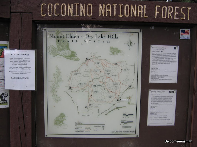
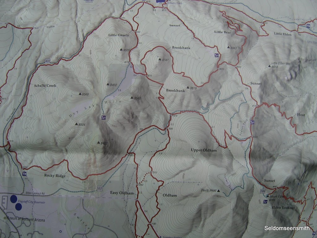
Before I share the next installment in this "footloose" adventure, I would be remiss if I did not mention the excellent map I use to navigate the labyrinth of trails located around me. It's called simply enough Flagstaff Trails Map, and it was compiled by Emmitt Barks Cartography. For years I walked better known paths, and then one day came across this guide in a local bookstore. Since then I've discovered a number of new trails thanks to this excellent resource .

Printed on durable and waterproof plastic, the map (a portion of it is pictured above) has excellent features including elevation profiles, mileages, and descriptions. I highly recommend it for hikers and map junkies alike, both categories into which I fall.

Brookbank Trail

Like so many trails in the Dry Lake Hills, Brookbank Trail can either be walked as a standalone outing or incorporated into a loop - it really depends on how far you want to go. Also like other trails in the area, it follows an old road so the grade is not too steep, even though a few sections of prolonged "up" will leave you breathing harder than usual.

The name Brookbank is somewhat misleading, as there are no brooks to be found in this region. The volcanic geology of the area has created a porous and permeable surface layer which greedily absorbs all water, leaving no trace on the ground. Only during sustained heavy downpours or in spring with sudden snowmelt do any of the ravines and drainages run with water, and then only ephemerally.

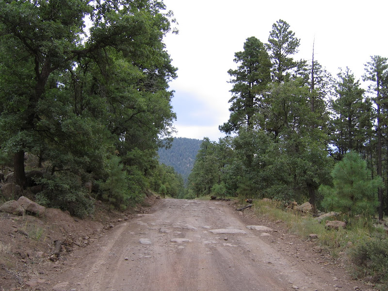
The trailhead is located a few miles up Elden Lookout Road - see the previous entry titled "On Foot" for how to get there. I usually prefer to park at the Lower Oldham/Rocky Ridge trailhead just .2 mile south. Vehicle space is limited at Brookbank, and given the opportunity I try to avoid any more bouncing around on this rough and rocky road than I have to.

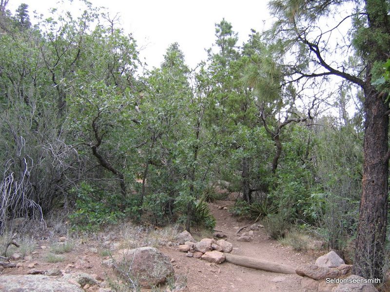
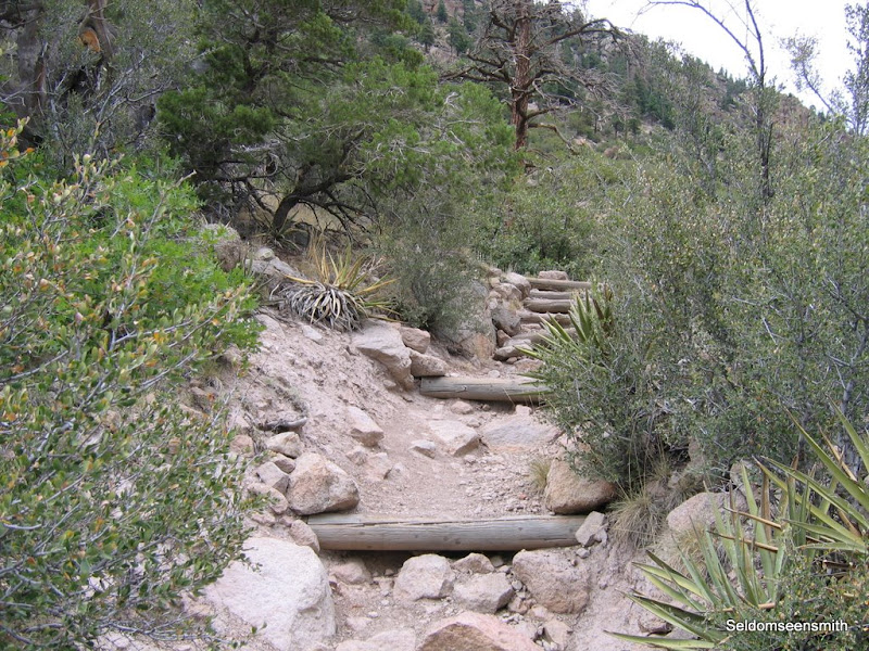
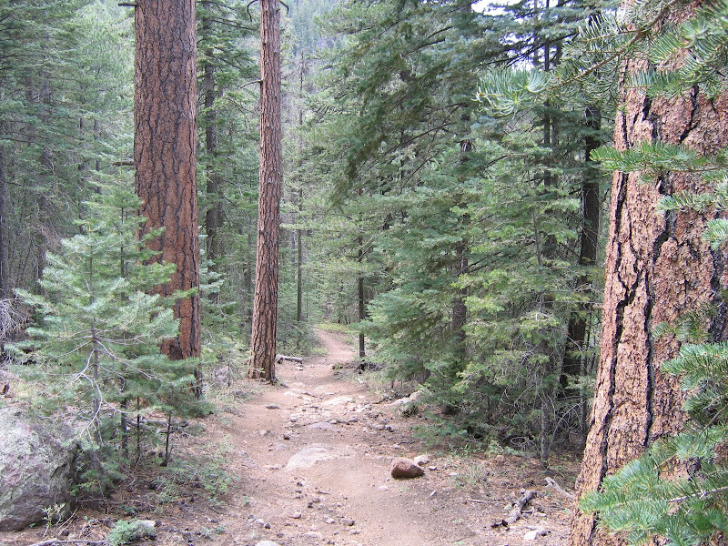
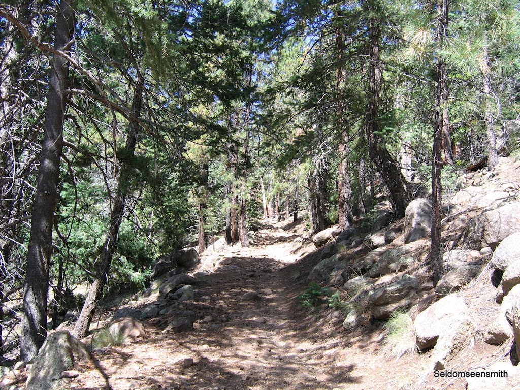
The trail starts west up a gradual and stony slope that roughly parallels a drainage. In the sunny open areas ponderosa pine and gambel oak dominate the landscape, while several species of fir linger in cool and shady folds of the canyon. Rocks and boulders of varying sizes and shapes dot the slopes and gullies, many wearing pale green coats of lichen.


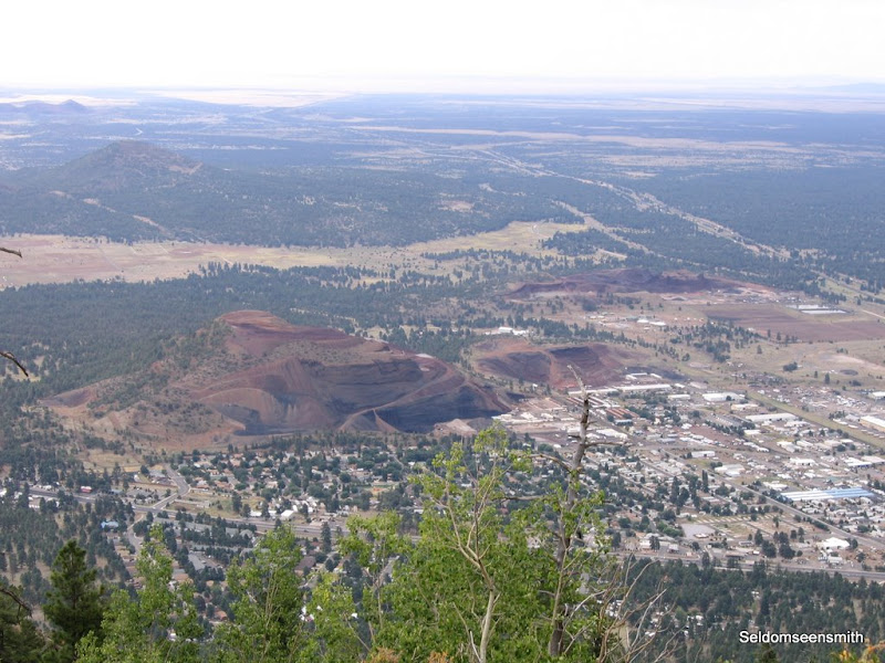
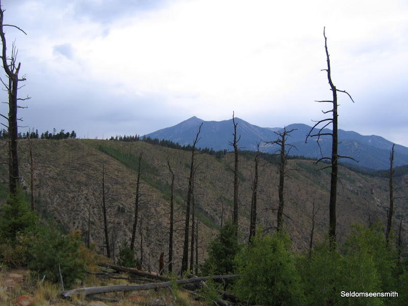
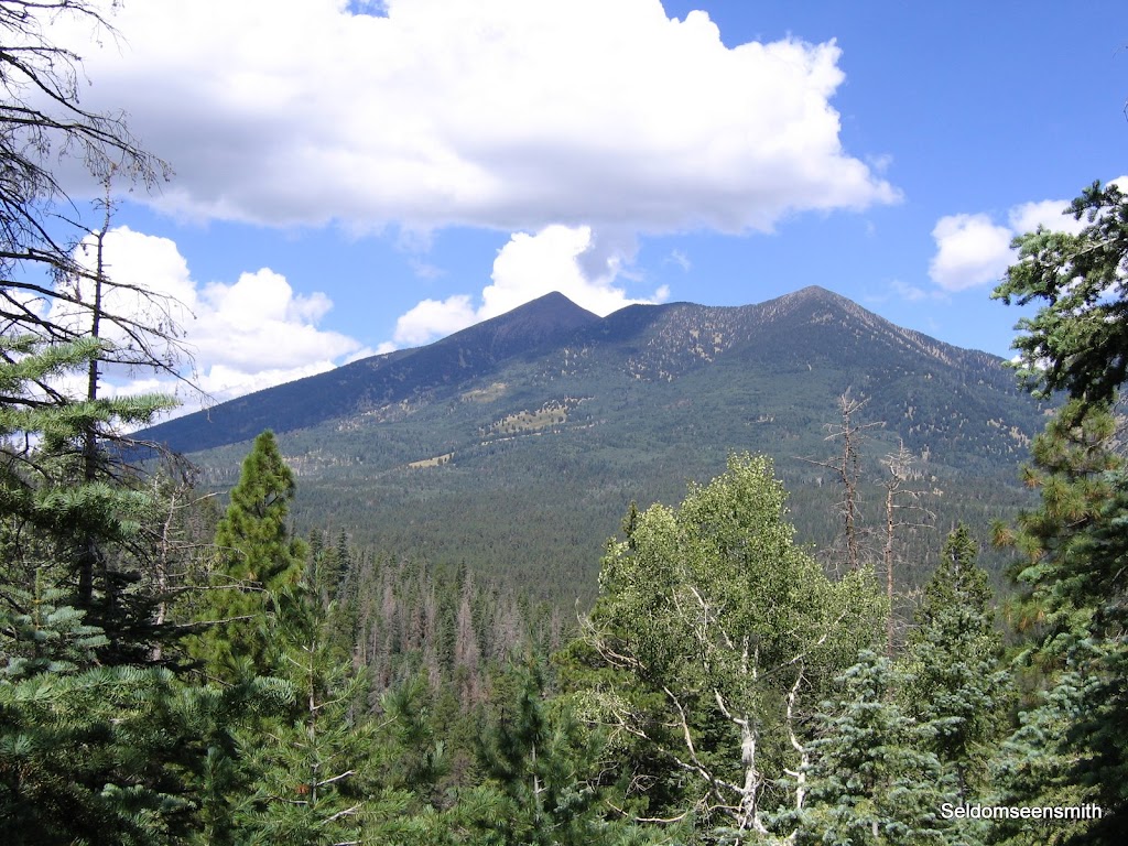
The path crosses a dry streambed then begins to switchback up the southern slope, making several long gradual traverses. At a couple of points the trees give way to framed views of Flagstaff to the south.


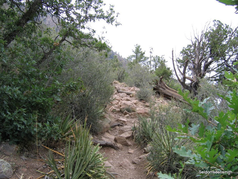
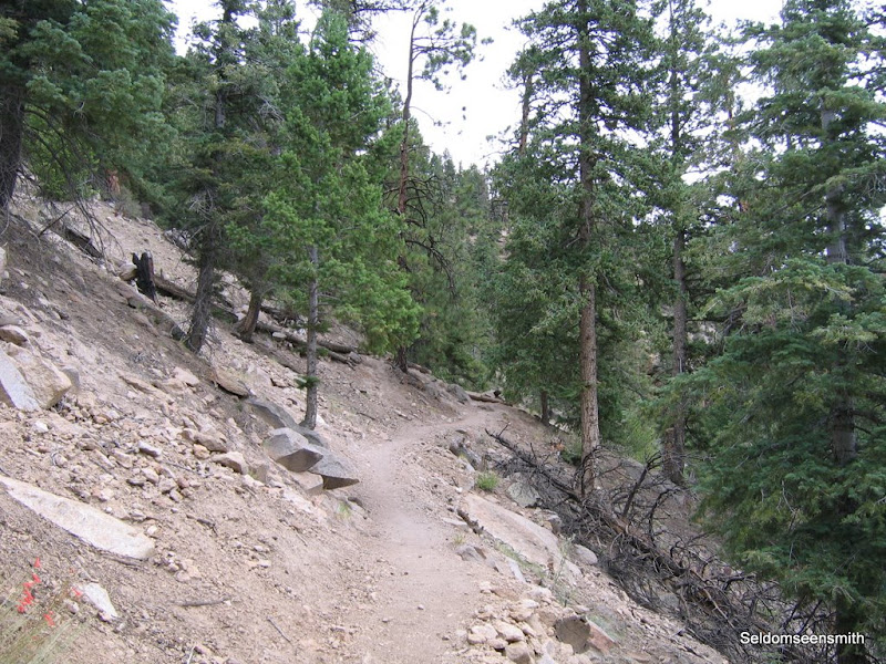
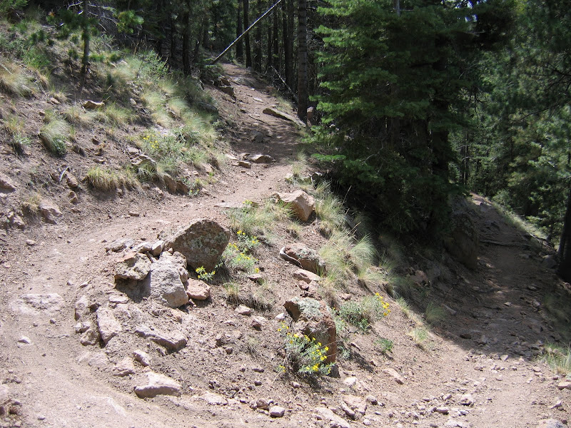
For the most part the average hiker will spend more time looking at the tops of their shoes as they grind up the hill, which is o.k. since not many opportunities for panoramic views present themselves on this section of trail. Like just about all of the Dry Lake Hills paths, Brookbank is intent on reaching the summit and it climbs steadily up to reach that goal.


Just before reaching the top the trail splits. The path continuing west comprises the Schultz Loop, while Brookbank goes north. On this trip I'll follow Brookbank for another mile or so, then return to this area to explore more of the Dry Lake Hills.


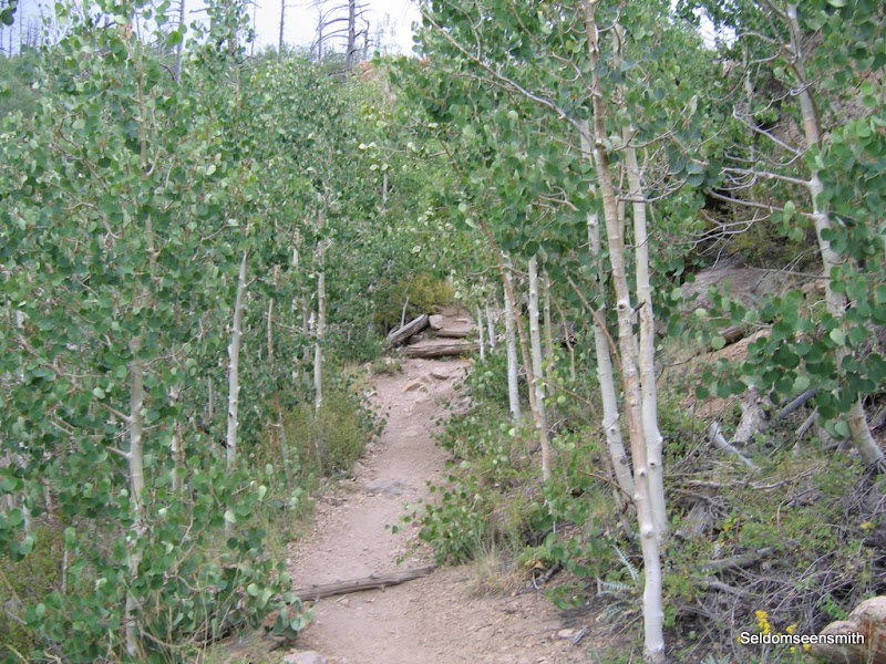
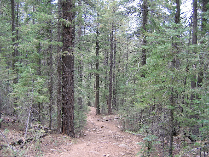
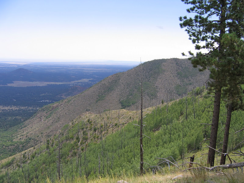
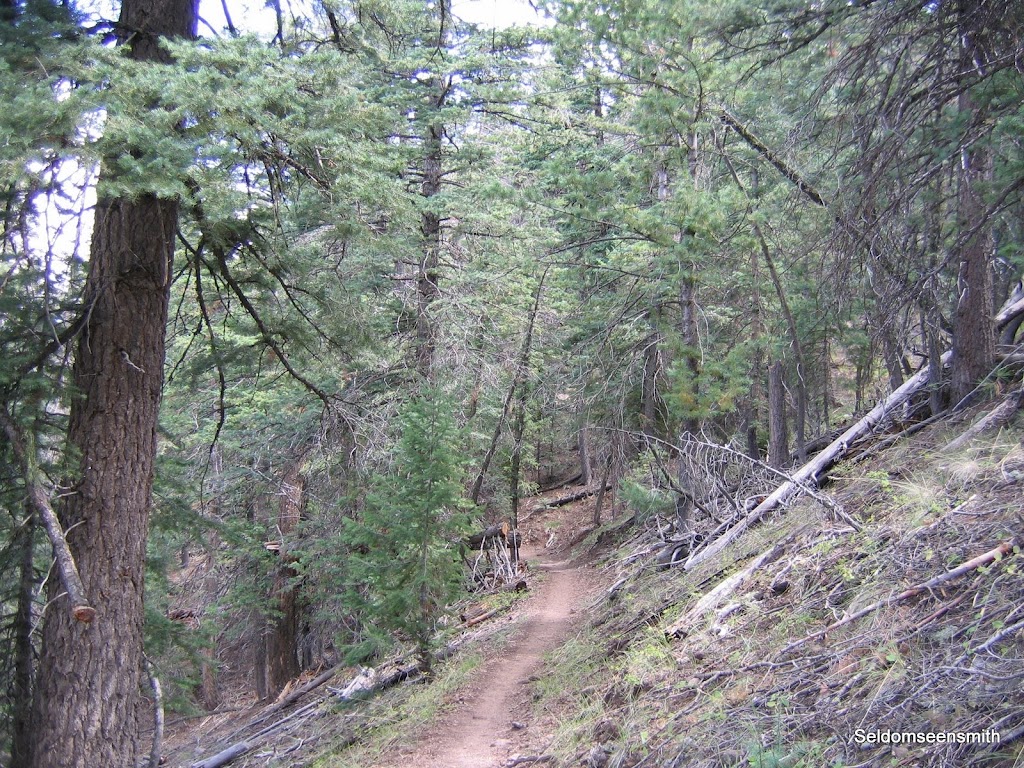
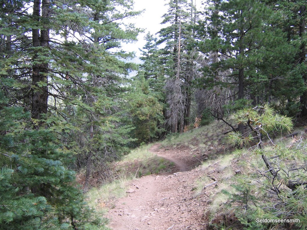
Once the trail stops climbing it begins a gentle traverse around the north side of the hills. Cooler, wetter micro-climate dynamics influence vegetation here, and fir, aspen, and spruce dominate the plant community. Here also the trail tread is less rocky, with gentle undulations that generally hover at the same elevation - about 8400 feet.


There are also great views along the trail to the north, looking over Schultz Pass and the San Francisco Peaks.


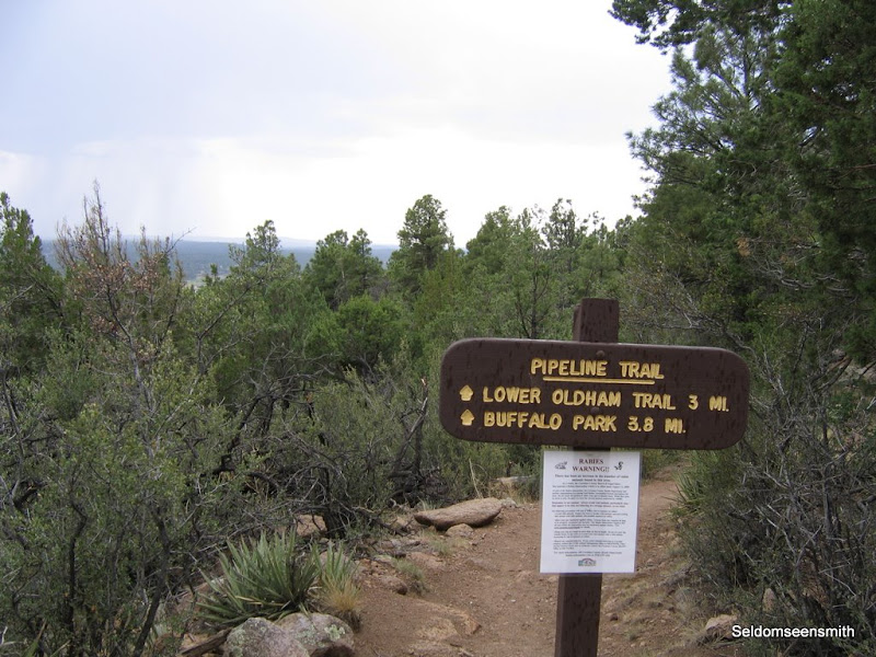
As Brookbank meanders to the east and its junction with the Sunset trail, several small meadows appear on the saddle between hills before the trail crosses over to the south side, where it again traverses just below the crest. At Sunset, hikers can elect to turn back west towards Schultz Tank, continue on east to Upper Oldham for a loop hike, or use a car shuttle to descend Mt. Elden. The many possibilities are what makes the Dry Lake Hills trails system so enjoyable.

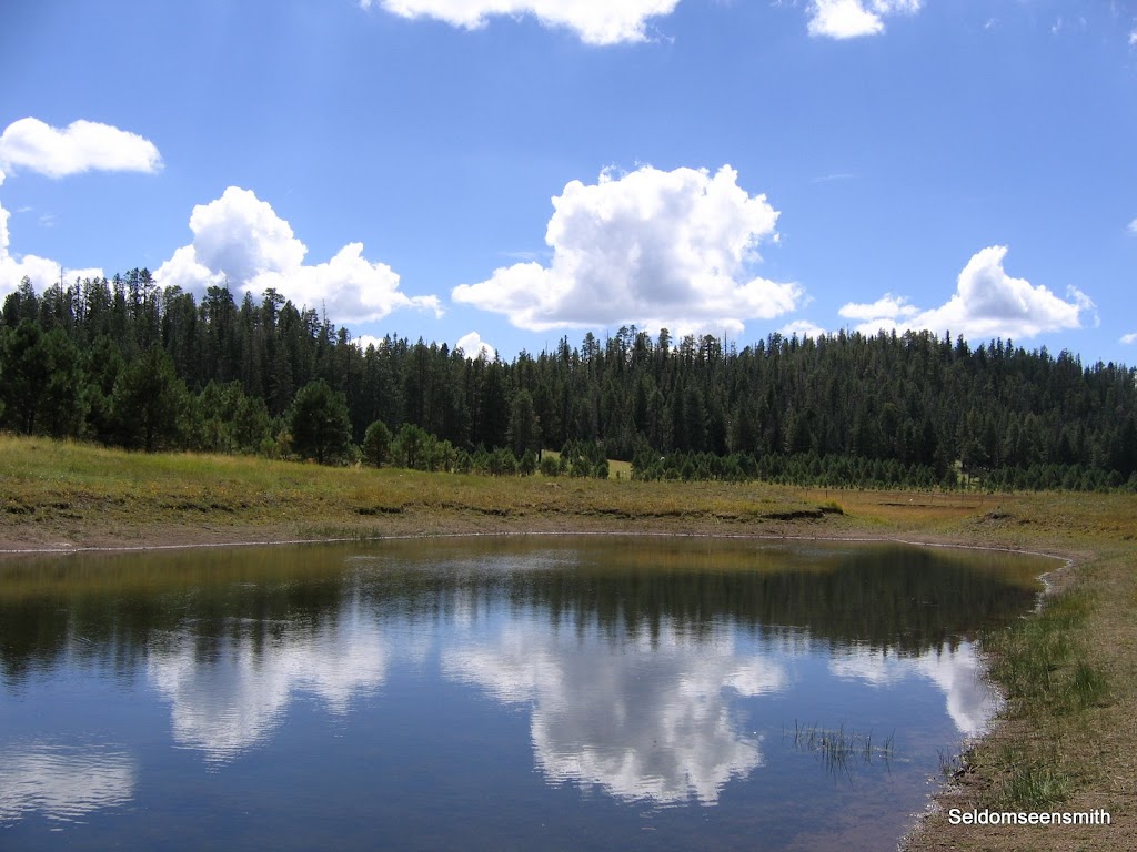
Just above where the two trails diverge, a large open meadow holds the only surface water for miles, making it a favorite place for wildlife. Mule deer, elk, coyote, bobcat, black bear and mountain lion are the larger game animals found here, as well as many species of smaller mammals like skunk, fox, raccoon, and squirrel.


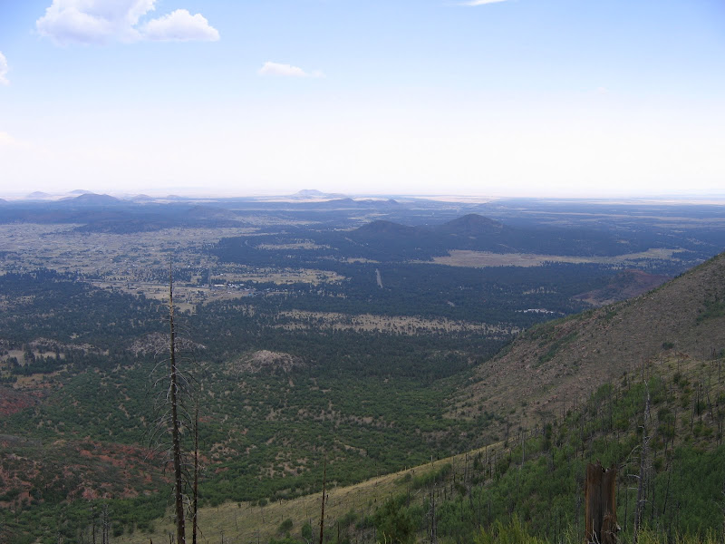
An unmarked trail in the meadow branches to the south, and leads for nearly a mile through grasses and native flowers to an overlook of Flagstaff.


After soaking up the peaceful serenity of the overlook, it's time to head back down. As I leave the meadow and begin the descent, bracken fern line the trail. A few plants are already turning brown, heralding the end of another summer in the high country. Fall is around the corner, and the cooler air, clear blue skies, and colorful foliage provide even more excuses to get out and enjoy the landscape.

Saturday, September 5, 2009

On Foot Part II - Mt. Elden Lookout Trail

All dressed up and nowhere to go - at least not on a road trip. Since my next outing won't be for another couple of weeks, I'll share more of the recreation here in Flagstaff.

Elden Lookout Trail

Of all the trails found in the Dry Lake Hills system, none is more challenging than the Elden Lookout trail. Though it is relatively short in length at 2.5 miles each way, it more than compensates by being unrelentingly steep. Gaining over 2400 feet primarily in the last 1.5 miles, this rocky path climbs up at a steady grade to the summit of Mt. Elden. Hikers looking to prepare for the Grand Canyon will find similar trail conditions here, from the loose rocks of the trail bed to the large boulders and cribbed steps that negotiate the many switchbacks.

This trail is very easy to reach - the trailhead is located right off U.S. Highway 89 at the east end of town. It begins innocently enough about .5 of a mile from the base of the mountain, climbing very gently through a forest of mixed ponderosa, juniper, and scrub oak. From here there are several options for those wanting a less strenuous outing, such as a 2.2 mile round-trip on the Fat Man's Loop, or a longer hike to the west on the Pipeline trail to Buffalo Park. The truly ambitious can arrange a car shuttle for a hike up and over Mt. Elden to the Brookbank, Oldham, or Sunset trails found to the north.


Soon after reaching the basaltic pillars of volcanic rock that form the foundation of the mountain the trail begins a no-nonsense climb up the side. At first the trail ascends a broad talus slope fronting the hill, but as it works its way higher the angle becomes more acute and the switchbacks more frequent.


At nearly a mile in, you reach the junction with the Mt. Elden trail. The Fat Man's Loop continues on along the flank of the mountain for a bit before descending and rejoining the main trail below. The truly committed turn left (north) here.


Because of the southern orientation, the slopes here host vegetation that can endure constant exposure to the southwestern sun. Although rain and snow fall more abundantly here than at lower elevations the geology is porous, and water does not remain on the surface for long. Agave, wax leaf currant, chaparral, and juniper dominate the environment. It is not uncommon to see many small species of reptiles, including the endangered horned lizard.

The trail is rocky to put it mildly. While some energy and effort was made in the construction of the path, in most cases the rock is simply incorporated into the trail. Cribbing is used to form steps in a lot of areas, but even so giant steps are what you'll take coming or going.


As you climb higher and higher, your view of the city below expands to include vistas to the south and east. One notable feature is the Nestle Purina Dog Food Processing Plant. If the wind blows from the south you'll experience the unmistakable aroma of roasting pet food - an acquired taste I can assure you.


At around the 8000 foot elevation mark, ponderosa and fir trees become the primary plant life. The trail itself grinds up and up, with a rare mostly level section on occasion, with even rarer areas of rock-free trail bed.


Finally the trail makes one long switchback to the east, and approaches the edge of the mountain. This long sloping ridge holds a few more twists and turns upwards before finally making the approach to the lookout. The views have gotten steadily better, and the spur looking east opens the panorama up further.


By this time only the sight of the tower ahead is keeping my legs in motion. The upper trail is no less steep for nearing the top, and determination and dried fruit power the final push.


Near the ridge top aspen trees form a welcome green corridor. There is ample evidence of burned trees from the 1977 Radio Fire, and the white barked aspen is often the first generation of life to replenish the once well forested landscape.


Finally the trail tops out on the rocky ridge, revealing open views to the north and the San Francisco Peaks. The lookout tower is a further .2 miles from this point, but I did not continue on this outing as active thunderstorms were still rumbling overhead, and the view is really no better there than from this point.


The ridge also marks the junction with the Sunset trail, which leads over the Dry Lake Hills to many other trails and explorations. For me however, I am content to savor the conquest of this challenging yet rewarding excursion. After all, I need to save some hiking for the next time.

Wednesday, September 2, 2009

On Foot Part I - Upper Oldham Trail

When I'm not rolling down the highway towards some isolated natural wonder, I'm spending time in my own backyard. I am fortunate to live in an area that offers an incredible variety of hiking trails within a few minutes drive, and I get outside to enjoy the fresh air and scenery as much as possible.

The San Francisco Peaks and surrounding features provide ample hiking opportunities ranging from moderate traverses to steep slogs. The elevations range from 7000 feet above sea level to 12,633 on Mt. Humphrey, so hikers can enjoy a wide diversity of environments. My favorite trails in the area are found in the Dry Lake Hills trail system just north of Flagstaff. This blog entry is an introduction to one of those trails - I'll add more as time allows.

The Dry Lake Hills trails are part of the Peaks Ranger District of the Coconino National Forest - take a look at their recreation website and you'll see just how many different hiking and biking opportunities exist in the area. Anyone who wants to spend time enjoying the great outdoors in a forested mountain setting will have lots to explore.

The Upper Oldham Trail #1

The Oldham Trail actually begins in town at Buffalo Park, a forested regional park at the base of Mt. Elden. Here you can make connections east, west, and south on one of the many trails of the Flagstaff Urban Trail System (FUTS). This outstanding network of trails is a work in progress. It links most of the city and surrounding areas for hikers, joggers, and cyclists and is eventually destined to encompass over 130 miles (currently 49 miles of improved trail exist).

Oldham trail is divided into two sections - the upper and lower. I prefer to hike the upper section, and to get there I need to drive a short distance north on Elden Lookout Road. This rough and rocky dirt road is accessed off U.S. Highway 180 just before it reaches the city limits of Flagstaff on the northwest. The first couple of miles are paved, but the remaining two miles require a high clearance vehicle.


The trailhead is on the right side of the road - the sign in the picture above marks the Lower Oldham and Rocky Ridge trails which also begin here. The trail parallels Elden Lookout Road for the first mile or so, following the course of a normally dry stream bed at the base of rocky cliffs. In about .2 of a mile you reach the beginning of yet another trail in this area, the Brookbank Trail. This fun little track crosses the road and climbs up the hills on the opposite side, leading to even more hiking options.


Continue on the right, following the creek as it steadily climbs up. Here on the north side of the hill, temperatures are cooler as sun exposure is more limited, and the large boulders wear a coat of moss and lichen. Wax Leaf Currant, Bracken Fern, and Red Monkeyflower as well as aspen and fir soften the rocky terrain and provide welcome shade.

Soon the trail reaches the junction with Upper Oldham proper. The direction turns southward up a small canyon. Upper Oldham was once a road leading to the top of Mt. Elden, but it was abandoned long ago in favor of the current approach. The trail is rocky but wide, and shows evidence of runoff from the slopes above after heavy rains.


This section takes a direct approach up the drainage. There are no switchbacks, just a steady climb towards the head of the canyon. Again because of the northern aspect, the vegetation here is a classic example of how microclimates work. Just on the other (south) side of Mt. Elden where sun and terrain work to produce a hotter and drier climate, drought tolerant ponderosa pines dominate the area. On this side however, the relatively protected and slightly wetter canyon shelters fir, spruce, and aspen trees, and in some ways is reminiscent of a northwestern forest.


Near the head of the canyon the trail finally begins a series of switchbacks up the ridge. At times the grade is steep, but overall the ascent is moderate. For the first time you begin to catch glimpses of the surrounding hills, but views are still limited because of tree cover.
After traversing upwards for a while the trail reaches Oldham Park, a grassy meadow. The top and our destination is very near.
After passing the short distance through the meadow, the trail crosses the road. The skyline looms just ahead, and after climbing a short hill the views you've come for are in sight. Here also is the junction with the Sunset Trail, which links to Mt. Elden to the south, and the Brookbank and Schultz Creek trails north and west. There are many loop possibilities for those interested in a longer hike, or if you have a car shuttle you can take in the rugged and steep Mt. Elden trail among others.


Here on the ridge the views to the northeast and east can stretch 100 miles or more on a clear day. Below on the flanks of the mountain you can see evidence of the 1977 Radio Fire, which burned as a result of a careless campfire. Some areas are experiencing a regrowth of aspen, while others remain mostly bare except for shrubs and grasses. The refreshing breeze up here is a welcome sensation after a good workout climbing up. My "do-everything" watch tells me the elevation is 8830 feet, but I know it's just over 8900. Either way it's a great day in the neighborhood.