
When I first started this blog in May, my intention was to provide a firsthand look at the incredible array of diverse landscapes here on the Colorado Plateau. I began with the area immediately surrounding my home in Flagstaff. As I covered the cardinal points of the compass in that introduction, I mentioned that in almost all cases my primary direction of travel is north.
There are worthwhile and interesting features to be seen in central and southern Arizona, and eventually I may get around to showcasing them. My preference however runs to the canyons, plateaus, and deserts to the north, especially those of southern Utah.
The geography of this wildly varied area is visually stunning, and the combination of challenging terrain and harsh environment effectively limits exploration to those are are determined and prepared. The few highways that do exist serve as conduits for travelers to pass through on the way to more developed and accessible areas, while primitive dirt roads penetrate the very heart of this wild and remote country, enticing the adventurous soul to experience unparalleled beauty and solitude.
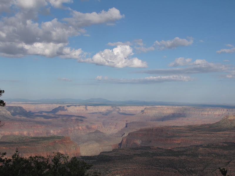 When I head north from Flagstaff, the options are pretty straightforward. The enormous size of Grand Canyon occupying much of the northern third of Arizona effectively determines the way - northeasterly on U.S. Highway 89.
As it leaves the cool forested heights near the San Francisco Peaks, the road drops in elevation to the high deserts of the Navajo Indian Reservation. This immense stretch of mesas, sprawling canyons, open badlands, and rugged mountains covers nearly all of northeastern Arizona as well portions of New Mexico, Utah, and Colorado, and all roads north lead through it.
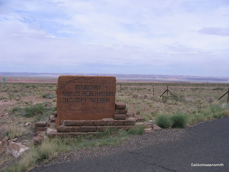
Few large communities exist on the reservation, or "Rez" as it is referred to locally. Most Navajo (or Dine') live in small family groups on land passed down through generations according to clan association. Countless unimproved dirt roads lead from the main highway to clusters of dwellings that often mix old and new - traditional hogans stand side by side with mobile homes or small single family houses. In many cases the people live without basic utilities, such as electricity, water, and phone service. The size of the reservation and the scattered, random nature of these settlements make providing services difficult at best.
About 67 miles north of Flagstaff, the option of continuing on 89 or heading east towards Colorado presents itself at the junction of U.S. Highway 160. Again geography plays a role in determining which choice the traveler must make. Lake Powell, created by the impoundment of the Colorado River at Glen Canyon Dam divides the region much the way Grand Canyon does downstream, effectively eliminating the idea that the shortest distance between two points is a straight line.
 |  |
Those travelers electing to stay on 89 will cross the river either at Navajo Bridge over Marble Canyon or the dam itself near Page. Either way that road will take you to Kanab, Utah and the southcentral part of the state. Anyone choosing Highway 160 that leads north and east into Utah or Colorado will find the next available crossing of the river occurs 140 miles away as the crow flies. That fact alone says much about the rugged topography of the region.
On this journey I choose Highway 160 as my goal is the corner of southeastern Utah. After the junction the highway climbs modestly onto Moenkopi Mesa, and soon arrives at one of the few developed towns in the area - Tuba City. The whimsical sounding name has nothing to do with brass musical instruments, rather it is a Anglo corruption of the proper Hopi name Tuuvi. Tuba City highlights cultural differences between Navajo and non-native society in that the primary purpose of the community is not to congregate the population into neighborhoods, but to concentrate services such as schools, markets, and medical care in a central location.
Beyond Tuba City the vast open space of undeveloped land stretches to the horizon. In the north the flat tableland of White Mesa looms on the horizon, while to the south the western edge of Black Mesa begins to rise gradually over the countryside. About 56 miles beyond Tuba City and Moenkopi railroad tracks appear to the north, running parallel to the road. This electric train transports coal directly to the Navajo Generating Station near Page from the mines on Black Mesa.
Not long afterwards the coal loading chute appears overhead, descending from the heights of Black Mesa. As the road begins a scenic passage through a deep valley formed by the Shonto Plateau on the north and Black Mesa on the south, the junction of Arizona 563 appears leading to Shonto and the beautiful but infrequently visited Navajo National Monument.
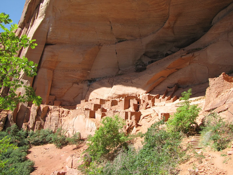 Canyons cut into the plateau are home to the well preserved cliff dwellings of Betatakin and Keet Seel. Read more about the Monument and Betatakin in my previous post HERE
Continuing on the road offers intriguing glimpses north into Tsegi Canyon, where sheer walls of Navajo sandstone tower over the valley. The small roadside development known as Tsegi has a motel and restaurant for weary travelers at the mouth of the canyon, while the road drops into a broad basin below. In a few more miles, another relatively large community has grown up around the junction of 160 and U.S. Highway 163 - Kayenta
This crossroads town is the last "large" development until Cortez, Colorado and it serves a widely scattered population in the region. Like Tuba City, the town is not a large population center as much as it is a focal point for goods and services. Likewise for travelers headed north, Kayenta is a good place to stock up on groceries and sundries before venturing into the relatively unpopulated region ahead.
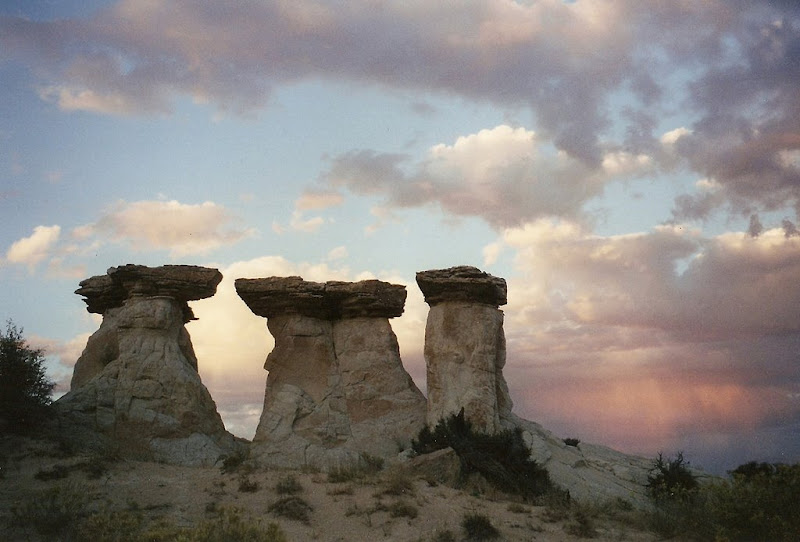
Heading north on U.S. Highway 163, the town quickly disappears in the rear view mirror. Scattered houses at the end of two track dirt roads appear randomly across the landscape, and towering cliffs and mesas begin to dominate the horizon. This is the way into the land of the giants, and the first towering monolith to appear is both striking and imposing, if somewhat different from those ahead - Agathla Peak

This jagged spire of rock once formed the throat of an ancient volcano. When the lava cooled and hardened a plug of erosion resistant rock remained in place to be buried in sediments over millions of years, only to reemerge when forces of wind and water stripped the softer overlying sandstone away. Unlike the linear shape of the buttes, mesas, and canyons found in the region, Agathla reminds visitors that fire as well as wind and water forged the outstanding beauty of the area.
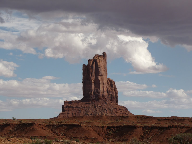
Just around the corner from Agathla Peak is the entrance to one of the Wests' most photographed landscapes - Monument Valley. Monument Valley has served as a backdrop for countless movies, television series, and commercials, and the iconic images of these sandstone sentinels are recognized throughout the world.
Monument Valley is not a valley in the classic sense. No single river or stream carved the land, leaving these isolated formations to rise above the surrounding desert. This deservedly famous and scenic area is a result of the relentless action of water that penetrates small cracks, fissures, and faults in the overlying sandstone of the Monument Upwarp, an uplifted region of stratified sediments. The water repeatedly freezes and thaws, chiseling away the rock along angular lines, leaving behind the classic butte and mesas that have graced many a western film.
 | 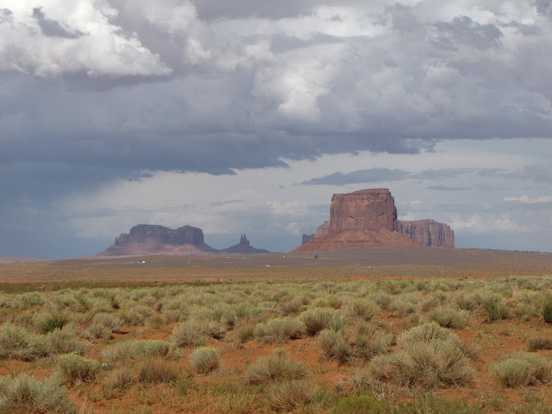 |  |
For many Monument Valley can be experienced just by driving through on the highway, stopping at one of many pullouts along the road to marvel and take pictures. If that does not satisfy the truly curious however, be aware that this is still the Navajo reservation, and off road travel is restricted. To get up close and personal with the rock formations, you will need a guide, which can be arranged through the Navajo Nation Tribal Parks Department.
The state line between Arizona and Utah bisects the Valley, and the border is easy to miss with all the scenic distractions. From here the heart of canyon country is just over the horizon.
No comments:
Post a Comment